Camp Hale Memorial Campground
Campground
Campground · 4.1 mi from the trail
 Photo: Jeffrey Beall, CC BY 4.0 (via Wikimedia Commons)
Cooper Creek is a cross-country ski route in Colorado's White River National Forest, within the Holy Cross Ranger District. The Forest Service manages the land, and the trail is short, about 0.37 miles, with a moderate climb of 142 feet from a starting elevation of about 10,533 feet to a high point of about 10,550 feet. The steepest stretch comes early, at about 0.08 miles in, with a 17% grade. Winter is the natural season for this route. Typical averages from the nearby Climax weather station show January and February highs around 27 to 29°F with lows near 3°F and about 15 snow days a month. By June, snow days drop to about two, and July highs reach about 67°F, though the station sits roughly 800 feet lower than the trail. Cooper Loop, another cross-country ski route, lies about 0.1 mile away, and The Woods, a mountain biking area, is just as close. Camp Hale Memorial Campground and Camp Hale East Fork Group Campground are both about 4 miles off, and the East Fork Arkansas River offers paddling at a similar distance.
Camp Hale Memorial Campground
Campground
Hot Heads Chicken
Fast food
 If it rainsPlazak, CC BY 3.0 · Wikimedia Commons
Matchless Mine
Attraction
Places © OpenStreetMap contributors · Photos: Plazak, CC BY 3.0 (commons)
More in LeadvilleNot on Roamze yet. Their page has how to reach them.
Cooper LoopCross-country skiingPhoto: Jeffrey Beall, CC BY 4.0 (via Wikimedia Commons)0.1 mi The WoodsMountain bikingPhoto: Jeffrey Beall, CC BY 4.0 (via Wikimedia Commons)0.1 mi
 Tennessee CreekCanoeingPhoto: Jeffrey Beall, CC BY 3.0 (via Wikimedia Commons)4.1 mi
 East Fork Arkansas RiverCanoeingPhoto: Jeffrey Beall, CC BY 3.0 (via Wikimedia Commons)4.6 mi
Source: Roamze catalog (indexable pages within 10 miles, PostGIS distance)
Cooper Loop RoadCross-country skiing · Next doorPhoto: Jeffrey Beall, CC BY 4.0 (via Wikimedia Commons) 10Th Mountain DivideCross-country skiing · Next doorPhoto: Jeffrey Beall, CC BY 4.0 (via Wikimedia Commons)
 Lung BurnCross-country skiing · ~1 min drivePhoto: Bruce Fingerhood from Springfield, Oregon, US, CC BY 2.0 (via Wikimedia Commons)CooperCross-country skiing · ~2 min drivePhoto: Jeffrey Beall, CC BY 4.0 (via Wikimedia Commons)
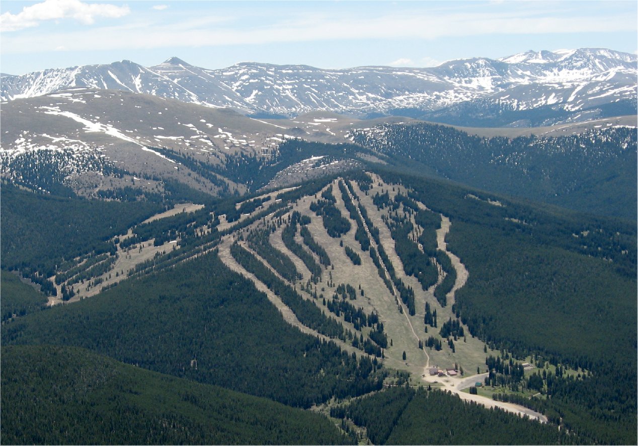 Ski CooperDownhill skiing · ~2 min drivePhoto: The original uploader was Sculptorjones at English Wikipedia., Public domain (via Wikimedia Commons)
 Mount Of The Holy Cross #2009Ski touring · ~21 min drivePhoto: Lionello DelPiccolo liodp, CC0 (via Wikimedia Commons)Larry'S LoopCross-country skiing · Next doorPhoto: Bruce Fingerhood from Springfield, Oregon, US, CC BY 2.0 (via Wikimedia Commons)The WoodsCross-country skiing · Next doorPhoto: Bruce Fingerhood from Springfield, Oregon, US, CC BY 2.0 (via Wikimedia Commons)GrizCross-country skiing · ~2 min drivePhoto: Bruce Fingerhood from Springfield, Oregon, US, CC BY 2.0 (via Wikimedia Commons)Treeline Loop Ski TrailCross-country skiing · ~2 min drivePhoto: Jeffrey Beall, CC BY 4.0 (via Wikimedia Commons)
No month here meets our mild-weather rule. Best months have typical highs of 55–85 °F, lows of 30 °F or warmer (32 °F where the station doesn't record snow), at most one snowy day and no more than 12 wet days.
Jan
27° / 3°
15 wet · 15 snow
Feb
29° / 3°
15 wet · 15 snow
Mar
35° / 8°
14 wet · 14 snow
Apr
40° / 15°
13 wet · 13 snow
May
49° / 25°
10 wet · 8 snow
Jun
61° / 34°
8 wet · 2 snow
Jul
67° / 40°
13 wet
Aug
64° / 39°
15 wet
Sep
58° / 32°
11 wet · 2 snow
Oct
47° / 21°
9 wet · 7 snow
Nov
35° / 11°
12 wet · 12 snow
Dec
27° / 3°
15 wet · 15 snow
Typical high / low (°F) and days with rain or snow, 1991–2020. Measured at Climax, CO, 6.1 mi away at 11,344 ft. The station sits about 800 ft higher than this place, so expect it a little warmer here. Source: NOAA NCEI U.S. Climate Normals 1991–2020.
Map and trail data © OpenStreetMap contributors

