Sugar Loafin'
Campground
Campground · 3.6 mi from the trail
 Photo: Bruce Fingerhood from Springfield, Oregon, US, CC BY 2.0 (via Wikimedia Commons)
Closure in the area
There's a closure order in Leadville Ranger District. It doesn't name Griz, so check the source for the area it covers.
Willow Fire Area Closure
Agency closure covering Leadville Ranger District · Order 02-12-01-26-39 · USFS · Leadville Ranger District
FSR 286, Radical Hill, is closed due to washouts and unsafe conditions
Agency alert covering Pike and San Isabel National Forests · USFS · Pike and San Isabel National Forests
Interlaken Hotel and Annex Area closure
Agency alert covering Leadville Ranger District · Order 02-12-01-26-19 · USFS · Leadville Ranger District
Interlaken Hotel Tree Hazards
Agency alert covering Pike and San Isabel National Forests · USFS · Pike and San Isabel National Forests
Sharpe Fire Update
Agency alert covering Pike and San Isabel National Forests · USFS · Pike and San Isabel National Forests
As of · Source: USFS · Leadville Ranger District. Agencies don't list every closure — check before you go.
Griz is a cross-country skiing route in Colorado's Pike and San Isabel National Forests, within the Leadville Ranger District. The Forest Service manages the land, and the route runs about 0.8 miles with a total elevation gain of 426 feet, from a low point of 10,266 feet to a high of 10,709 feet. The climb is rated hard. The steepest part comes at about 0.4 miles in, with a 17% grade, and the route also has a total loss of 433 feet, so it works well as a short, steep out-and-back. The most comfortable months for a ski outing are June and July, when typical averages from the nearby Climax weather station run from a high of 61°F in June to 67°F in July. Snow is common from November through April, with about 15 snow days a month in December and January. Two other ski routes, Fritz's Freeway and Willa's Way, sit about 0.1 miles away. Tennessee Creek and the East Fork Arkansas River offer paddling roughly 3 to 4 miles off.
Sugar Loafin'
Campground
Hot Heads Chicken
Fast food
 If it rainsPlazak, CC BY 3.0 · Wikimedia Commons
Matchless Mine
Attraction
Places © OpenStreetMap contributors · Photos: Plazak, CC BY 3.0 (commons)
More in LeadvilleNot on Roamze yet. Their page has how to reach them.
No month here meets our mild-weather rule. Best months have typical highs of 55–85 °F, lows of 30 °F or warmer (32 °F where the station doesn't record snow), at most one snowy day and no more than 12 wet days.
Jan
27° / 3°
15 wet · 15 snow
Feb
29° / 3°
15 wet · 15 snow
Mar
35° / 8°
14 wet · 14 snow
Apr
40° / 15°
13 wet · 13 snow
May
49° / 25°
10 wet · 8 snow
Jun
61° / 34°
8 wet · 2 snow
Jul
67° / 40°
13 wet
Aug
64° / 39°
15 wet
Sep
58° / 32°
11 wet · 2 snow
Oct
47° / 21°
9 wet · 7 snow
Nov
35° / 11°
12 wet · 12 snow
Dec
27° / 3°
15 wet · 15 snow
Typical high / low (°F) and days with rain or snow, 1991–2020. Measured at Climax, CO, 6.2 mi away at 11,344 ft. The station sits about 600 ft higher than this place, so expect it a little warmer here. Source: NOAA NCEI U.S. Climate Normals 1991–2020.
 Photo: Jeffrey Beall, CC BY 4.0 (via Wikimedia Commons)
Cooper
Next door
Cooper is a 0.24-mile ski trail in Colorado with 10 feet of elevation gain.
Photo: Bruce Fingerhood from Springfield, Oregon, US, CC BY 2.0 (via Wikimedia Commons)Lung Burn
~1 min drive
0.49-mile trail in Colorado with 186 ft of elevation gain.
Photo: Bruce Fingerhood from Springfield, Oregon, US, CC BY 2.0 (via Wikimedia Commons)Larry'S Loop
~1 min drive
Larry'S Loop is a short 0.86-mile loop in Colorado with 256 feet of elevation gain.
Photo: Bruce Fingerhood from Springfield, Oregon, US, CC BY 2.0 (via Wikimedia Commons)The Woods
~1 min drive
0.48-mile trail in Colorado with 58 ft of elevation gain.
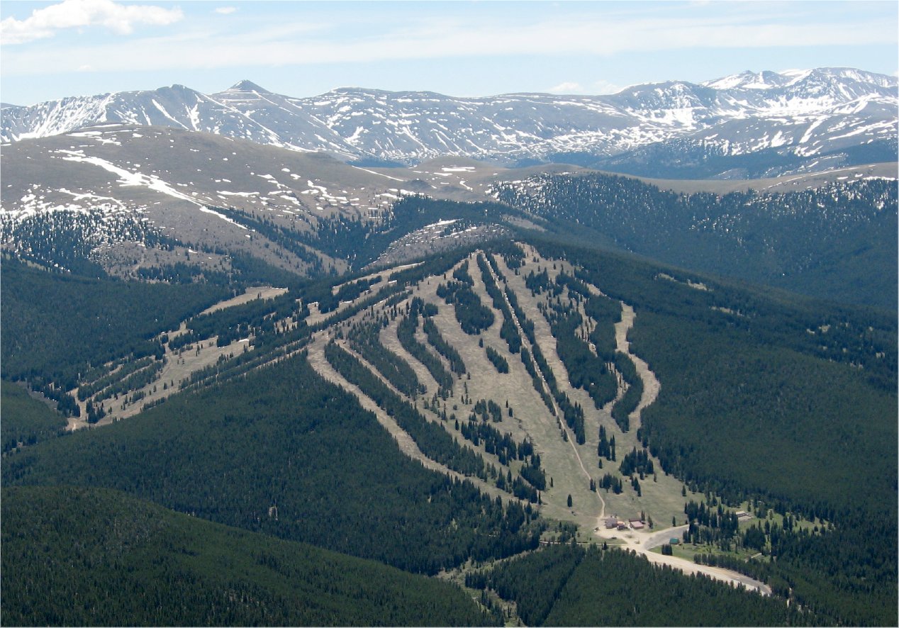 Photo: The original uploader was Sculptorjones at English Wikipedia., Public domain (via Wikimedia Commons)
Ski Cooper
~2 min drive
Ski Cooper in Colorado has 5 lifts and 47 runs (12 easy, 16 intermediate, 18 advanced) with 1,161 ft of vertical.
 Photo: Jeffrey Beall, CC BY 4.0 (via Wikimedia Commons)
Treeline Loop Ski Trail
~3 min drive
1.60-mile loop in Tennessee Pass, Colorado with 466 ft elevation gain.
SKI
West Tennessee Lakes
~6 min drive
13.35-mile cross-country ski trail in Colorado with 1,257 ft of elevation gain.
Photo: Jeffrey Beall, CC BY 4.0 (via Wikimedia Commons)Cooper Loop Road
~2 min drive
Cooper Loop Road is a 0.83-mile route in Colorado with 326 feet of elevation gain.
Photo: Bruce Fingerhood from Springfield, Oregon, US, CC BY 2.0 (via Wikimedia Commons)Fish Flats
~2 min drive
3.85-mile cross-country ski trail in Colorado with 137 ft of elevation gain.
 Photo: Jarrod Doll from United States of America, CC BY 2.0 (via Wikimedia Commons)
Copper Mountain
~20 min drive
Copper Mountain is a ski area in Colorado with 147 runs and 23 lifts.
Map and trail data © OpenStreetMap contributors

