Duster
- 1.2 mi
- distance
- 265 ft
- climb
- Jun–Sep
- best months
Is Duster open right now?
Closure in the area
There's a closure order in Hahns Peak-Bears Ears Ranger District. It doesn't name Duster, so check the source for the area it covers.
Area Closure for the Fishhook Fire - Routt National Forest
Agency closure covering Hahns Peak-Bears Ears Ranger District · Order 02-06-03-26-222 · USFS · Hahns Peak-Bears Ears Ranger District
Access Impact: Big Creek Lakes Dam Project
Agency alert covering Medicine Bow-Routt National Forest · USFS · Medicine Bow-Routt National Forest
Trail & Access Impact: Stillwater Reservoir Project
Agency alert covering Medicine Bow-Routt National Forest · USFS · Medicine Bow-Routt National Forest
Snowy Range - 2026 Active Vegetation Operations
Agency alert covering Medicine Bow-Routt National Forest · USFS · Medicine Bow-Routt National Forest
As of · Source: USFS · Hahns Peak-Bears Ears Ranger District. Agencies don't list every closure — check before you go.
Duster is a mountain biking route in the Hahns Peak-Bears Ears Ranger District of the Medicine Bow-Routt National Forest in Colorado, about 4.6 miles from Steamboat Springs. The Forest Service manages the land. The route is 1.2 miles long, with a one-way climb of 265 feet from a low point of 9,052 feet to a high of 9,326 feet. The steepest stretch comes at about 0.27 miles in, with a 14% grade. Summer is the most comfortable time to ride. Typical averages from a nearby weather station in Spicer put July highs around 77°F with lows near 42°F, and the station sits roughly 900 feet lower than the route, so temperatures on the climb run cooler. The Sunshine and Moonlight trails are both within half a mile. Walton Creek, a canoeing spot, and Blob Rock, a climbing area, are each about 2.9 miles away.
Local outfitters
- Rancho Del Rio39 mi away
Not on Roamze yet. Their page has how to reach them.
- SunshineMountain biking0.2 mi
- MoonlightMountain biking0.4 mi
- Walton CreekCanoeing2.9 mi
- Blob RockRock climbing2.9 mi
- Butcher KnifeRock climbing4.4 mi
- Granite CampgroundCamping5 mi
- Meadows CampgroundCamping5.3 mi
- Soda CreekCanoeing6.3 mi
Source: Roamze catalog (indexable pages within 10 miles, PostGIS distance)
- SunshineMountain biking · Next door
- MoonlightMountain biking · Next door
- ElkheadMountain biking · Next door
- Spur RunMountain biking · ~1 min drive
- Vista Nature TrailMountain biking · ~1 min drive
- Storm Peak ChallengeMountain biking · ~1 min drive
- Pete's Wicked TrailMountain biking · ~1 min drive
- Mountain ViewMountain biking · ~1 min drive
- Rustler's Ridge Upper TrailMountain biking · ~2 min drive
- Valley ViewMountain biking · ~2 min drive
Also worth it near here
 Steamboat Ski ResortDownhill skiing · ~1 min drivePhoto: CarTick at English Wikipedia, CC BY-SA 3.0 (via Wikimedia Commons)
 Mount WernerSummit · ~2 min drivePhoto: Jeffrey Beall, CC BY 4.0 (via Wikimedia Commons)
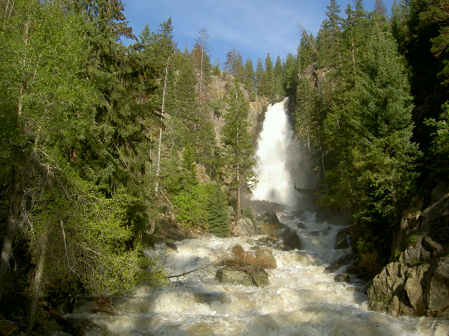 Fish Creek FallsWaterfall · ~4 min drivePhoto: Roy Brumback, CC BY-SA 3.0 (via Wikimedia Commons)
Best time to visit Duster
Best months: June–September. Best months have typical highs of 55–85 °F, lows of 30 °F or warmer (32 °F where the station doesn't record snow), at most one snowy day and no more than 12 wet days.
Jan
28° / 7°
8 wet
Feb
31° / 9°
8 wet
Mar
40° / 15°
8 wet
Apr
49° / 23°
9 wet
May
59° / 30°
10 wet
Jun
71° / 36°
8 wet
Jul
77° / 42°
9 wet
Aug
76° / 40°
11 wet
Sep
68° / 34°
8 wet
Oct
55° / 25°
7 wet
Nov
39° / 16°
8 wet
Dec
29° / 9°
8 wet
Typical high / low (°F) and days with rain or snow, 1991–2020. Measured at Spicer, CO, 16.6 mi away at 8,385 ft. The station sits about 900 ft lower than this place, so expect it a little cooler here. This station doesn't record snowfall. Source: NOAA NCEI U.S. Climate Normals 1991–2020.
Map and trail data © OpenStreetMap contributors
