HM1
Campground
Campground · 4.1 mi from the trail
Power Line Trail is a mountain biking route in Bobcat Ridge Natural Area, a city-managed natural area in Colorado, about 1.6 miles long. It runs from a starting elevation of roughly 5,730 feet to a high point of about 6,617 feet, with a total climb of 881 feet. The steepest stretch comes around the 0.75-mile mark, where the grade reaches about 24 percent. Summer is the most comfortable time to ride. Typical averages from a nearby weather station show July highs around 79°F with lows near 56°F, while the station sits about 780 feet higher than the trail's high point, so temperatures on the trail run warmer. Several other mountain biking trails start close by. The D. R. Trail is about 0.1 mile away and the Elk Meadow Trail about 0.3 mile. The Ginny Trail is roughly 0.9 mile off. For paddling, the Cache la Poudre River lies about 1.1 miles away.
HM1
Campground
Almost East Gemstone Peak
Viewpoint
Places © OpenStreetMap contributors
More in Estes Park Cache la Poudre RiverCanoeingPhoto: Wusel007, CC BY-SA 3.0 (via Wikimedia Commons)1.1 mi
 Horsetooth MountainRock climbingPhoto: Jamesmartin111, CC0 (via Wikimedia Commons)4.3 miHorsetooth Rock - West FaceRock climbingPhoto: Jamesmartin111, CC0 (via Wikimedia Commons)4.3 mi
 Sign Crack AreaRock climbingPhoto: jamieotterbein, CC BY-SA 2.0 (via Flickr)4.4 mi
 Big Thompson RiverCanoeingPhoto: Wusel007, CC BY-SA 3.0 (via Wikimedia Commons)8 mi
Source: Roamze catalog (indexable pages within 10 miles, PostGIS distance)
Also worth it near here
Cache la Poudre RiverCanoeing · ~2 min drivePhoto: Wusel007, CC BY-SA 3.0 (via Wikimedia Commons) Horsetooth Falls TrailHiking · ~7 min drivePhoto: Timothy Sipkens, CC0 (via Wikimedia Commons)
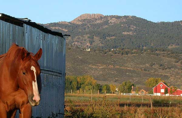 Horsetooth MountainSummit · ~7 min drivePhoto: Matthew Trump (talk) (Uploads)
Uploaded by Decumanus at en.wikipedia, CC BY-SA 3.0 (via Wikimedia Commons)
Best months: May–October. Best months have typical highs of 55–85 °F, lows of 30 °F or warmer (32 °F where the station doesn't record snow), at most one snowy day and no more than 12 wet days.
Jan
40° / 21°
5 wet
Feb
40° / 20°
6 wet
Mar
47° / 26°
8 wet
Apr
51° / 30°
10 wet
May
60° / 39°
12 wet
Jun
72° / 49°
11 wet
Jul
79° / 56°
11 wet
Aug
78° / 55°
11 wet
Sep
70° / 47°
8 wet
Oct
57° / 36°
7 wet
Nov
47° / 28°
6 wet
Dec
40° / 20°
6 wet
Typical high / low (°F) and days with rain or snow, 1991–2020. Measured at Buckhorn Mtn 1 E, CO, 9.4 mi away at 7,400 ft. The station sits about 800 ft higher than this place, so expect it a little warmer here. This station doesn't record snowfall. Source: NOAA NCEI U.S. Climate Normals 1991–2020.
Map and trail data © OpenStreetMap contributors
