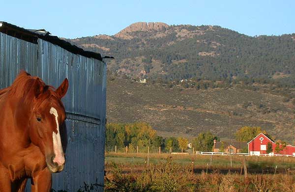
Horsetooth Mountain
Horsetooth Mountain in Colorado has 5 climbing routes with mixed and trad styles.
 Photo: Jamesmartin111, CC0 (via Wikimedia Commons)
- 5 routes
- 5.4 – 5.13
- Trad · Mixed
Is Horsetooth Mountain open right now?
Alert in the area
The Forest Service lists 4 alerts for Canyon Lakes Ranger District.
Salt Cabin Prescribed (RX) Fire Closure
Agency alert covering Canyon Lakes Ranger District · Order 02-10-05-26-10 · USFS · Canyon Lakes Ranger District
Fire Restrictions
Agency alert covering Arapaho and Roosevelt National Forests · USFS · Arapaho and Roosevelt National Forests
West Crystal A - Mechanical Fuelbreak Area and Road Closure
Agency alert covering Canyon Lakes Ranger District · Order 02-10-05-26-04 · USFS · Canyon Lakes Ranger District
Cameron Peak Fire Road Closures
Agency alert covering Canyon Lakes Ranger District · Order 02-10-05-26-01 · USFS · Canyon Lakes Ranger District
As of · Source: USFS · Canyon Lakes Ranger District. Agencies don't list every closure — check before you go.
Best time to visit Horsetooth Mountain
Best months: May–October. Best months have typical highs of 55–85 °F, lows of 30 °F or warmer (32 °F where the station doesn't record snow), at most one snowy day and no more than 12 wet days.
Jan
40° / 21°
5 wet
Feb
40° / 20°
6 wet
Mar
47° / 26°
8 wet
Apr
51° / 30°
10 wet
May
60° / 39°
12 wet
Jun
72° / 49°
11 wet
Jul
79° / 56°
11 wet
Aug
78° / 55°
11 wet
Sep
70° / 47°
8 wet
Oct
57° / 36°
7 wet
Nov
47° / 28°
6 wet
Dec
40° / 20°
6 wet
Typical high / low (°F) and days with rain or snow, 1991–2020. Measured at Buckhorn Mtn 1 E, CO, 7.4 mi away at 7,400 ft. The station sits about 500 ft higher than this place, so expect it a little warmer here. This station doesn't record snowfall. Source: NOAA NCEI U.S. Climate Normals 1991–2020.
Horsetooth Mountain is a climbing area on county land in the Canyon Lakes Ranger District of the Arapaho and Roosevelt National Forests in Colorado. It sits within its own named unit, Horsetooth Mountain, and the surrounding land is managed by county authorities rather than the Forest Service. Summer is the most comfortable time to visit. Typical averages from a nearby weather station show July highs around 79°F with lows near 56°F, while winter highs stay around 40°F with lows in the low 20s. The Horsetooth Rock - West Face climbing area is just 0.1 mile away, and the Westridge Trail and Wathan Trail are both within a third of a mile. The Cache la Poudre River, about 3.3 miles off, offers paddling.
Routes (5)
Horsetooth Rock - East Face(3)
Outer Space Wall(2)
Keep exploring — more climbs worth the drive
 Photo: Runner1928, CC BY-SA 4.0 (via Wikimedia Commons)
Talent Scout
~5 min drive
Talent Scout is a bouldering area in Colorado with 7 routes.
Photo: Runner1928, CC BY-SA 4.0 (via Wikimedia Commons)Rotary Park
~5 min drive
Rotary Park in Colorado has 11 bouldering routes across 9 difficulty grades.
 Photo: KimonBerlin, CC BY-SA 2.0 (via Flickr)
Eltuck Bay
~5 min drive
Eltuck Bay in Colorado has 4 bouldering routes with 3 difficulty grades.
Photo: Runner1928, CC BY-SA 4.0 (via Wikimedia Commons)Horsetooth Reservoir
~5 min drive
Horsetooth Reservoir in Colorado has 8 climbing routes with 6 difficulty grades.
Photo: KimonBerlin, CC BY-SA 2.0 (via Flickr)The Black Wall
~5 min drive
Black Wall, The is a bouldering area in Colorado with 12 routes.
 Photo: KimonBerlin, CC BY-SA 2.0 (via Flickr)
Lory State Park
~6 min drive
Lory State Park in Colorado has 4 bouldering routes across 3 difficulty grades.
Photo: Jamesmartin111, CC0 (via Wikimedia Commons)Horsetooth Rock - West Face
~0 min drive
6 routes on Horsetooth Rock's west face in Colorado, 5 grades, sport and trad.
Mill Creek Wall
~3 min drive
Mill Creek Wall in Colorado has 6 bouldering routes.
The Fog That Surrounds Boulder
~3 min drive
Fog That Surrounds Boulder is a 9-route climbing area in Colorado with bouldering pads and 6 difficulty grades.
Main Area
~3 min drive
Main Area in Colorado has 20 bouldering routes across 12 difficulty grades.