West Beaver Trail 447
- 5.0 mi
- round trip
- 3,017 ft
- climb
- 8,983 ft
- high point
- Out and back
- route
- Jun–Sep
- best months
Caution at last check
Weather is marginal · OpenWeather · checked 14 h ago
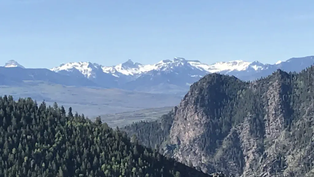
West Beaver Trail 447 is a hard out-and-back hike on Bureau of Land Management land in Colorado's Gunnison Field Office. The route starts at about 8,115 feet and climbs to 8,983 feet, with a total gain of 3,017 feet over 10 miles. The steepest stretch comes at about 2.2 miles in, where the grade reaches 19 percent. That makes it a challenging day on foot, and the trail's high point sits well above the nearby Gunnison weather station, so expect cooler temperatures up top. Summer is the most comfortable time to go. Typical averages from a nearby weather station show July highs around 80°F with lows near 44°F, while winter brings highs in the mid-20s and lows below zero. The trip takes about five hours. For more time on foot, Sun Creek is about 3 miles away and Black Gulch Trail about 3.5 miles. Campers can stay at Mesa RV Resort, roughly 4.6 miles out, and climbers will find The Other Side about 5.8 miles away.
Local outfitters
- Taylor Park Trading Post33 mi away
- Maroon Bells Guide and Outfitters43 mi away
Not on Roamze yet. Their page has how to reach them.
- Sun CreekHiking3.1 mi
- Black Gulch TrailHiking3.5 mi
- Neversink TrailHiking3.8 mi
- Mesa RV ResortCamping4.6 mi
 Stevens Creek CampgroundCampingPhoto: Recreation.gov (RIDB) / public domain5.3 mi
- The Other SideRock climbing5.8 mi
- The StashRock climbing6.1 mi
- Ohio CreekCanoeing9.4 mi
Source: Roamze catalog (indexable pages within 10 miles, PostGIS distance)
 Beaver Creek TrailHiking · ~8 min drivePhoto: flamouroux, CC BY-SA 2.0 (via Flickr)
 RidgelineHiking · ~13 min drivePhoto: Ken Lund from Reno, Nevada, USA, CC BY-SA 2.0 (via Wikimedia Commons)
 South Rim TrailHiking · ~20 min drivePhoto: Ken Lund from Reno, Nevada, USA, CC BY-SA 2.0 (via Wikimedia Commons)
- Sun Park TrailHiking · ~10 min drive
- Van Tuyl TrailHiking · ~11 min drivePhoto: Ken Lund from Reno, Nevada, USA, CC BY-SA 2.0 (via Wikimedia Commons)
 Dillon Pinnacles TrailHiking · ~21 min drivePhoto: AndreyZharkikh, CC BY 2.0 (via Flickr)
- April GulchHiking · ~8 min drive
 The RidgeHiking · ~11 min drivePhoto: Matt Lavin, CC BY-SA 2.0 (via Flickr)
- SUN CREEKHiking · ~6 min drive
- Little Mill Trail 455Hiking · ~14 min drive
Best time to visit West Beaver Trail 447
Best months: June–September. Best months have typical highs of 55–85 °F, lows of 30 °F or warmer (32 °F where the station doesn't record snow), at most one snowy day and no more than 12 wet days.
Jan
26° / -6°
7 wet
Feb
30° / 1°
6 wet
Mar
44° / 14°
5 wet
Apr
56° / 23°
5 wet
May
66° / 30°
6 wet
Jun
76° / 36°
6 wet
Jul
80° / 44°
10 wet
Aug
77° / 43°
11 wet
Sep
70° / 34°
9 wet
Oct
60° / 22°
6 wet
Nov
44° / 11°
5 wet
Dec
28° / -3°
7 wet
Typical high / low (°F) and days with rain or snow, 1991–2020. Measured at Gunnison 3sw, CO, 5.5 mi away at 7,622 ft. The station sits about 1,400 ft lower than this place, so expect it a little cooler here. This station doesn't record snowfall. Source: NOAA NCEI U.S. Climate Normals 1991–2020.
Map and trail data © OpenStreetMap contributors
