Mill Creek Basin Backcountry Camp
Campground
Campground · 3.0 mi from the trail
Closure in the area
There's a closure order in Grand Mesa, Uncompahgre and Gunnison National Forests. It doesn't name Sheridan Crosscut, so check the source for the area it covers (2 listed).
Gold Mountain Wildfire Roads and Trails Closure Order v 4.0
Agency closure covering Grand Mesa, Uncompahgre and Gunnison National Forests · USFS · Grand Mesa, Uncompahgre and Gunnison National Forests
Ophir Pass Road Closure
Agency closure covering Grand Mesa, Uncompahgre and Gunnison National Forests · USFS · Grand Mesa, Uncompahgre and Gunnison National Forests
Potter Basin Road Closure Order
Agency alert covering Grand Mesa, Uncompahgre and Gunnison National Forests · USFS · Grand Mesa, Uncompahgre and Gunnison National Forests
Beaver Park Road Closure Order
Agency alert covering Grand Mesa, Uncompahgre and Gunnison National Forests · USFS · Grand Mesa, Uncompahgre and Gunnison National Forests
TERMINATION OF ORDER - FIRE RESTRICTIONS
Agency alert covering Grand Mesa, Uncompahgre and Gunnison National Forests · USFS · Grand Mesa, Uncompahgre and Gunnison National Forests
As of · Source: USFS · Grand Mesa, Uncompahgre and Gunnison National Forests. Agencies don't list every closure — check before you go.
Sheridan Crosscut is a hard hike in Colorado's Norwood Ranger District, part of the Grand Mesa, Uncompahgre and Gunnison National Forests. The trail is an out-and-back that climbs from about 9,800 feet to about 11,880 feet, a total gain of 2,089 feet over roughly 3.8 miles. The Forest Service manages the land, and the route is on natural surface with no horses or bikes allowed. The trail is open year-round, so it works for a visit in any season. Plan for a full day, and expect the climb to be the main challenge. The route is rated hard, and the high point sits well above the starting elevation. Several other outings lie close by. The Jud Wiebe Memorial Loop and Liberty Bell hikes are each within a mile, Telluride Edge offers climbing about a mile away, and Mill Creek Basin Backcountry Camp is about 3 miles off for an overnight stay.
Mill Creek Basin Backcountry Camp
Campground
Wood Ear
Restaurant
MiXX
Gallery
Places © OpenStreetMap contributors
More in TellurideNot on Roamze yet. Their page has how to reach them.
 The Mine BoulderRock climbingPhoto: Ken Lund, CC BY-SA 2.0 (via Flickr)1.2 mi
Source: Roamze catalog (indexable pages within 10 miles, PostGIS distance)
 Bridal Veil CreekHiking · ~3 min drivePhoto: Daniel Weber, Public Domain Dedication (CC0) (via Flickr)
 Ridge TrailHiking · ~4 min drivePhoto: sf-dvs, CC BY 2.0 (via Wikimedia Commons)
 Mount EmmaHiking · ~6 min drivePhoto: QKC, CC BY-SA 3.0 (via Wikimedia Commons)
 Prospect LoopHiking · ~6 min drivePhoto: Moo.The.Cow, CC BY 2.0 (via Flickr)Silver LakeHiking · ~4 min drivePhoto: Daniel Weber, Public Domain Dedication (CC0) (via Flickr)
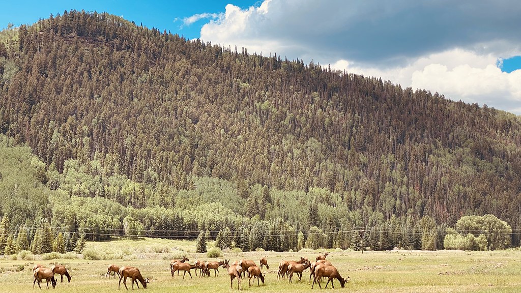 Eider TrailHiking · ~5 min drivePhoto: lamblukas, CC BY 2.0 (via Flickr)Skunk CreekHiking · ~7 min drivePhoto: Moo.The.Cow, CC BY 2.0 (via Flickr)Chicago PeakHiking · ~4 min drivePhoto: QKC, CC BY-SA 3.0 (via Wikimedia Commons)
Also worth it near here
 Jud Wiebe Memorial TrailMountain biking · ~2 min drivePhoto: dmtilley, CC BY 3.0 (via Wikimedia Commons)The Mine BoulderRock climbing · ~2 min drivePhoto: Ken Lund, CC BY-SA 2.0 (via Flickr)
 Bridal Veil FallsWaterfall · ~3 min drivePhoto: Terry Foote (talk), CC BY-SA 3.0 (via Wikimedia Commons)
