West Fork Campground
Campground
Campground · 1.4 mi from the trail
 Photo: Dicklyon, CC BY-SA 4.0 (via Wikimedia Commons)
Blocked at last check
A road serving this area is closed; agency alerts are in effect for this area; weather is good · USFS, State DOT 511, OpenWeather · checked 20 h ago
Road closed
US 160: road closure is listed as closed by CDOT 511.
US 160: road closure
Closed · ~0.1 km from Overlook · CDOT 511
Travel is not advised to the San Juan NF
Agency closure covering San Juan National Forest · USFS · San Juan National Forest
Closures and dangerous conditions on roads, bridges, and trails from flooding
Agency closure covering San Juan National Forest · USFS · San Juan National Forest
Multiple roads and trails damaged by flooding on SJNF
Agency closure covering San Juan National Forest · USFS · San Juan National Forest
Bear Activity High Across San Juan National Forest
Agency alert covering San Juan National Forest · USFS · San Juan National Forest
As of · Source: CDOT 511. Agencies don't list every closure — check before you go.
Overlook is an easy hike in the Pagosa Ranger District of San Juan National Forest in Colorado, on Forest Service land. The route is just 0.04 miles long, with no elevation gain, and it sits at a high point of about 8,218 feet. The trail is short enough to fit into a quick stop, and it's easy to pair with other outings in the area. The trail is natural-surfaced and allows bikes, so it works for hikers and riders alike. The closest trailhead is the Treasure Falls Trailhead, which also serves as the parking for this route. Summer is the most comfortable time to visit. Typical averages from a nearby weather station at a similar elevation show July highs around 79°F with lows near 40°F, while winter highs there stay in the low 30s. The trail is open from about May 15 through October 31. Treasure Falls is just 0.1 mile away, and West Fork Winter, a cross-country skiing route, is about 0.7 mile off. West Fork Campground lies roughly 1.4 miles away, and The Pillars climbing area is about 2.8 miles out.
West Fork Campground
Campground
Ramon's Mexican Restaurant
Restaurant
Places © OpenStreetMap contributors
More in South ForkNot on Roamze yet. Their page has how to reach them.
Treasure FallsHikingPhoto: Dicklyon, CC BY-SA 4.0 (via Wikimedia Commons)0.1 mi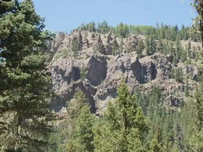 West Fork CampgroundCampingPhoto: Recreation.gov (RIDB) / public domain1.4 mi
 Primitive CampingCampingPhoto: Kevin Stroup, CC BY 3.0 (via Wikimedia Commons)3.9 mi
 East Fork San Juan RiverCanoeingPhoto: Dicklyon, CC BY-SA 4.0 (via Wikimedia Commons)4.8 mi
 West Fork San Juan RiverCanoeingPhoto: Jeffrey Beall, CC BY 4.0 (via Wikimedia Commons)4.8 mi
Source: Roamze catalog (indexable pages within 10 miles, PostGIS distance)
Treasure FallsHiking · Next doorPhoto: Dicklyon, CC BY-SA 4.0 (via Wikimedia Commons) ArchuletaHiking · ~11 min drivePhoto: JustTooLazy, CC BY 2.0 (via Flickr)
 LoboHiking · ~9 min drivePhoto: Corey Leopold, CC BY 2.0 (via Flickr)
 HighlineHiking · ~21 min drivePhoto: cogdogblog, Public Domain Dedication (CC0) (via Flickr)
 Big Meadows LoopHiking · ~14 min drivePhoto: JustTooLazy, CC BY 2.0 (via Flickr)Windy PassHiking · ~1 min drivePhoto: Dicklyon, CC BY-SA 4.0 (via Wikimedia Commons)
 Hunters LakeHiking · ~21 min drivePhoto: cogdogblog, Public Domain Dedication (CC0) (via Flickr)
Best months: June–September. Best months have typical highs of 55–85 °F, lows of 30 °F or warmer (32 °F where the station doesn't record snow), at most one snowy day and no more than 12 wet days.
Jan
33° / -10°
Feb
38° / -4°
Mar
46° / 10°
Apr
54° / 21°
May
63° / 27°
Jun
75° / 32°
Jul
79° / 40°
Aug
75° / 40°
Sep
70° / 32°
Oct
61° / 20°
Nov
46° / 8°
Dec
33° / -8°
Typical high / low (°F) and days with rain or snow, 1991–2020. Measured at Creede Wtp, CO, 26.5 mi away at 8,624 ft. This station doesn't record snowfall. Source: NOAA NCEI U.S. Climate Normals 1991–2020.
