Rockslide
Campground
Campground · 2.8 mi from the trail
 Photo: inkknife_2000 (7.5 million views +), CC BY-SA 2.0 (via Wikimedia Commons)
Road closed
US 34: Milner Pass is listed as closed by CDOT 511 (2 listed).
US 34: Milner Pass
Closed · ~0.2 km from Old Ute Trail · CDOT 511
US 34: road closure
Closed · ~0.2 km from Old Ute Trail · CDOT 511
Trail Ridge Road is Closed to Through Travel for the Season
Park closure covering Rocky Mountain National Park · NPS · Rocky Mountain National Park
As of · Source: CDOT 511. Agencies don't list every closure — check before you go.
Old Ute Trail is a short, easy hike in Rocky Mountain National Park, within the Rocky Mountain National Park Wilderness. The National Park Service manages the land, and the trail starts at about 10,805 feet, rising to about 11,092 feet over its 0.56-mile length. The climb is gentle overall, with a total gain of 502 feet, though the steepest stretch comes at about 0.4 miles in, where the grade reaches 15%. Summer is the most comfortable time to go. Typical averages from a nearby weather station show July highs around 74°F with lows near 43°F, while winter highs stay around 31°F. That station sits well below the trail, so temperatures on the route run cooler. Milner Pass and the Mount Ida Trail both lie about 0.1 mile away. Grandview Campground is about 5 miles off, and La Poudre Pass Creek offers canoeing about 6 miles away.
Rockslide
Campground
Trail Ridge Cafe
Restaurant
Images of Rocky Mountain National Park
Gallery
Places © OpenStreetMap contributors
More in Estes ParkNot on Roamze yet. Their page has how to reach them.
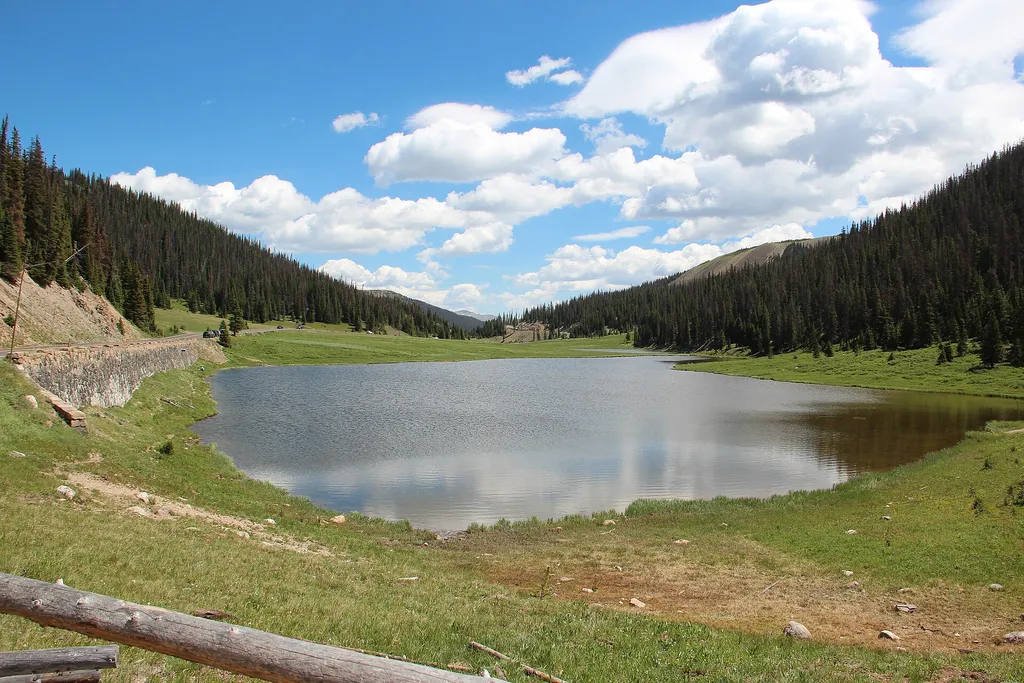 Milner PassHikingPhoto: Thomson M — Wikimedia Commons (CC BY 3.0)0.1 miMount Ida TrailHikingPhoto: inkknife_2000 (7.5 million views +), CC BY-SA 2.0 (via Wikimedia Commons)0.1 mi
 NotchtopRock climbingPhoto: AER Wilmington DE, CC BY 2.0 (via Flickr)9.3 mi
Source: Roamze catalog (indexable pages within 10 miles, PostGIS distance)
Mount Ida TrailHiking · Next doorPhoto: inkknife_2000 (7.5 million views +), CC BY-SA 2.0 (via Wikimedia Commons) Crater TrailHiking · Next doorPhoto: Frans-Banja Mulder, CC BY 3.0 (via Wikimedia Commons)
 Colorado River TrailHiking · ~4 min drivePhoto: inkknife_2000 (7.5 million views +), CC BY-SA 2.0 (via Wikimedia Commons)
 Timber Lake TrailHiking · ~4 min drivePhoto: Dariusz Kowalczyk, CC BY-SA 3.0 (via Wikimedia Commons)
 Ute TrailHiking · ~1 min drivePhoto: inkknife_2000 (14 million views), CC BY-SA 2.0 (via Flickr)
 Red Mountain TrailHiking · ~4 min drivePhoto: inkknife_2000 (7.5 million views +), CC BY-SA 2.0 (via Wikimedia Commons)
 Ditch RoadHiking · ~7 min drivePhoto: inkknife_2000 (7.5 million views +), CC BY-SA 2.0 (via Wikimedia Commons)
Best months: June and September. Best months have typical highs of 55–85 °F, lows of 30 °F or warmer (32 °F where the station doesn't record snow), at most one snowy day and no more than 12 wet days.
Jan
31° / 11°
9 wet
Feb
33° / 10°
9 wet
Mar
40° / 15°
10 wet
Apr
45° / 20°
10 wet
May
55° / 28°
10 wet
Jun
68° / 36°
10 wet
Jul
74° / 43°
13 wet
Aug
72° / 41°
14 wet
Sep
65° / 34°
10 wet
Oct
51° / 25°
8 wet
Nov
39° / 18°
9 wet
Dec
31° / 11°
9 wet
Typical high / low (°F) and days with rain or snow, 1991–2020. Measured at Hourglass Rsvr, CO, 14.7 mi away at 9,520 ft. The station sits about 1,600 ft lower than this place, so expect it a little cooler here. This station doesn't record snowfall. Source: NOAA NCEI U.S. Climate Normals 1991–2020.
US 34: Milner Pass closed
closed Nov 17, 2026, no reopening recorded · State DOT
US 34: Milner Pass closed
closed Nov 11, 2026 → reopened Nov 17, 2026 · State DOT
US 34: Milner Pass closed
closed Nov 10, 2026 → reopened Nov 11, 2026 · State DOT
US 34: Milner Pass closed
closed Nov 8, 2026 → reopened Nov 10, 2026 · State DOT
US 34: Milner Pass closed
closed Nov 8, 2026 → reopened Nov 8, 2026 · State DOT
US 34: Milner Pass closed
closed Nov 7, 2026 → reopened Nov 8, 2026 · State DOT
Map and trail data © OpenStreetMap contributors

