Rockslide
Campground
Campground · 2.7 mi from the trail
 Photo: inkknife_2000 (7.5 million views +), CC BY-SA 2.0 (via Wikimedia Commons)
Road closed
US 34: Milner Pass is listed as closed by CDOT 511 (2 listed).
US 34: Milner Pass
Closed · ~0.5 km from Mount Ida Trail · CDOT 511
US 34: road closure
Closed · ~0.4 km from Mount Ida Trail · CDOT 511
Trail Ridge Road is Closed to Through Travel for the Season
Park closure covering Rocky Mountain National Park · NPS · Rocky Mountain National Park
As of · Source: CDOT 511. Agencies don't list every closure — check before you go.
Mount Ida Trail is a 4.1-mile hike in Rocky Mountain National Park, Colorado, within the Rocky Mountain National Park Wilderness. The National Park Service manages the land, and the trail rises about 2,400 feet to a high point of 12,880 feet. The route is rated easy, and the climb is spread across the full length of the trail. The trail's proximity to other routes makes it a natural link in a longer day. Old Ute Trail starts just 0.1 mile away, and Milner Pass is about 0.2 mile off. For an overnight base, Grandview Campground sits about 5 miles away, and Long Draw Campground is about 7 miles out. Climbers can head to Ypsilon Mountain, roughly 7 miles away.
Rockslide
Campground
Trail Ridge Cafe
Restaurant
Images of Rocky Mountain National Park
Gallery
Places © OpenStreetMap contributors
More in Estes ParkNot on Roamze yet. Their page has how to reach them.
Daily highs and lows, wind and the chance of precipitation at the summit and route start for the next 7 days, from the Open-Meteo model.
Old Ute TrailHikingPhoto: inkknife_2000 (7.5 million views +), CC BY-SA 2.0 (via Wikimedia Commons)0.1 mi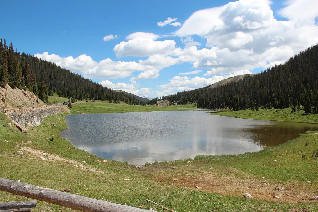 Milner PassHikingPhoto: Thomson M — Wikimedia Commons (CC BY 3.0)0.2 mi
 NotchtopRock climbingPhoto: AER Wilmington DE, CC BY 2.0 (via Flickr)9.1 mi
Source: Roamze catalog (indexable pages within 10 miles, PostGIS distance)
Old Ute TrailHiking · Next doorPhoto: inkknife_2000 (7.5 million views +), CC BY-SA 2.0 (via Wikimedia Commons) Colorado River TrailHiking · ~4 min drivePhoto: inkknife_2000 (7.5 million views +), CC BY-SA 2.0 (via Wikimedia Commons)
 Timber Lake TrailHiking · ~4 min drivePhoto: Dariusz Kowalczyk, CC BY-SA 3.0 (via Wikimedia Commons)
 Crater TrailHiking · Next doorPhoto: Frans-Banja Mulder, CC BY 3.0 (via Wikimedia Commons)
 Red Mountain TrailHiking · ~4 min drivePhoto: inkknife_2000 (7.5 million views +), CC BY-SA 2.0 (via Wikimedia Commons)
 Ditch RoadHiking · ~7 min drivePhoto: inkknife_2000 (7.5 million views +), CC BY-SA 2.0 (via Wikimedia Commons)
 Ute TrailHiking · ~1 min drivePhoto: inkknife_2000 (14 million views), CC BY-SA 2.0 (via Flickr)
Season: Summer, fall.
Snow typically lingers until late June/early July; afternoon thunderstorms common in summer; early fall offers crisp conditions and potential wildlife viewing.
About 4.1 mi.
About 2,400 ft of climbing round trip.
It is rated hard.
About 4 hours round trip.
Summer, fall.
Map and trail data © OpenStreetMap contributors

