Mccurdy Park
- 14.5 mi
- round trip
- 2,305 ft
- climb
- 10,892 ft
- high point
- Out and back
- route
Is Mccurdy Park open right now?
Alert in the area
The Forest Service lists 8 alerts for Pike and San Isabel National Forests.
FSR 286, Radical Hill, is closed due to washouts and unsafe conditions
Agency alert covering Pike and San Isabel National Forests · USFS · Pike and San Isabel National Forests
Interlaken Hotel Tree Hazards
Agency alert covering Pike and San Isabel National Forests · USFS · Pike and San Isabel National Forests
Sharpe Fire Update
Agency alert covering Pike and San Isabel National Forests · USFS · Pike and San Isabel National Forests
Turquoise Lake Road (County Road 4) Closure
Agency alert covering Pike and San Isabel National Forests · USFS · Pike and San Isabel National Forests
Downed and weakened trees on South Platte Ranger District
Agency alert covering South Platte Ranger District · USFS · South Platte Ranger District
As of · Source: USFS · Pike and San Isabel National Forests. Agencies don't list every closure — check before you go.
McCurdy Park is a 14.5-mile out-and-back hike in Colorado's Lost Creek Wilderness, within the South Platte Ranger District of the Pike and San Isabel National Forests. The trail climbs from about 8,862 feet to about 10,892 feet, a total gain of 2,305 feet, and is rated hard. The route is on natural surface, and horses are allowed. Bikes are not. The Forest Service manages the land, and the trail is open year-round. Nearby, the Lost Creek paddling route is about 2 miles away, and the Brookside-McCurdy hike is about 2.7 miles off. Climbers can head to Wigwam Creek/Lost Creek Wilderness, about 2.8 miles away, and Twin Eagles Campground is about 4.8 miles away.
Go with a guide
- Mineral Belt Trail Guided WalkRoamze · $25 per person · 45 mi away
- Lostfork Basecamp20 mi away
- Lost CreekCanoeing2 mi
- Brookside-MccurdyHiking2.7 mi
- Wigwam Creek/Lost Creek WildernessRock climbing2.8 mi
- Lake Park TrailHiking3.8 mi
- Inventions in NatureRock climbing4.1 mi
- Twin Eagles CampgroundCamping4.8 mi
- Lost Park CampgroundCamping5.6 mi
- Craig CreekCanoeing9.3 mi
Source: Roamze catalog (indexable pages within 10 miles, PostGIS distance)
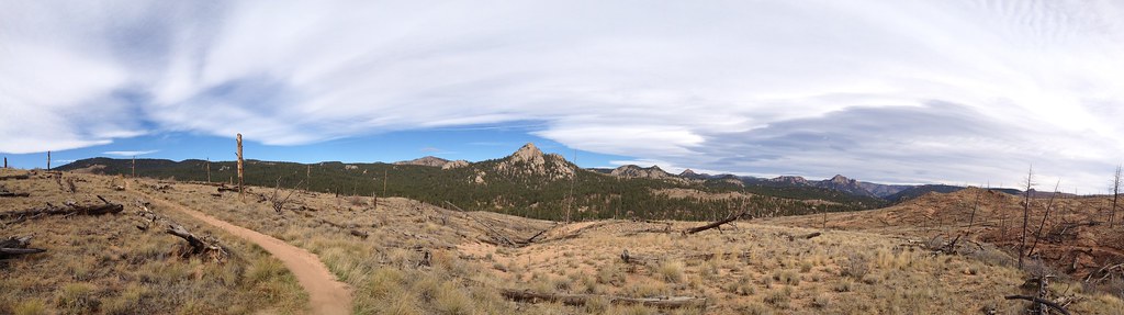 Morrison CreekHiking · ~21 min drivePhoto: rb06, CC BY 2.0 (via Flickr)
- BaldyHiking · ~21 min drivePhoto: rb06, CC BY 2.0 (via Flickr)
- Brookside-MccurdyHiking · ~5 min drive
- Lizard RockHiking · ~10 min drive
- TramwayHiking · ~20 min drivePhoto: rb06, CC BY 2.0 (via Flickr)
- Goose CreekHiking · ~8 min drive
- Forest Trail 204Hiking · ~12 min drive
- Lake Park TrailHiking · ~6 min drive
- Ute CreekHiking · ~9 min drive
- MouacheHiking · ~18 min drive

