Kebler Wagon Trail
- 12.8 mi
- round trip
- 648 ft
- climb
- 10,026 ft
- high point
- Out and back
- route
- Jun–Aug
- best months
Is Kebler Wagon Trail open right now?
Road closed
Gunnison County Road 12: road closure is listed as closed by CDOT 511.
Gunnison County Road 12: road closure
Closed · ~0.0 km from Kebler Wagon Trail · CDOT 511
Gold Mountain Wildfire Roads and Trails Closure Order v 4.0
Agency closure covering Grand Mesa, Uncompahgre and Gunnison National Forests · USFS · Grand Mesa, Uncompahgre and Gunnison National Forests
Ophir Pass Road Closure
Agency closure covering Grand Mesa, Uncompahgre and Gunnison National Forests · USFS · Grand Mesa, Uncompahgre and Gunnison National Forests
Potter Basin Road Closure Order
Agency alert covering Grand Mesa, Uncompahgre and Gunnison National Forests · USFS · Grand Mesa, Uncompahgre and Gunnison National Forests
Beaver Park Road Closure Order
Agency alert covering Grand Mesa, Uncompahgre and Gunnison National Forests · USFS · Grand Mesa, Uncompahgre and Gunnison National Forests
As of · Source: CDOT 511. Agencies don't list every closure — check before you go.
Kebler Wagon Trail is a 6.4-mile out-and-back route in the Paonia Ranger District of the Grand Mesa, Uncompahgre and Gunnison National Forests in Colorado, managed by the Forest Service. The trail follows a historic wagon road that once linked settlements and mining operations across the backcountry, and its wagon road origins give it a distinctive character compared to purpose-built hiking paths. The trail is rated hard, with a one-way climb of about 650 feet from a low point of roughly 9,400 feet to a high of about 10,000 feet. The out-and-back format makes it easy to turn back at any point, and the route works well for a half-day outing or as part of a broader exploration of Colorado's historic routes. Summer is the most comfortable time to go. Typical averages from a nearby weather station in Crested Butte show July highs around 76°F with lows near 40°F, while winter highs stay in the mid-20s. Bikes and horses are both allowed on the trail. Lake Irwin Loop Snowmobile/ski and Dyke Mountain Bike are both about a mile away, and Lake Irwin and Kebler Pass Camping Area are within about 1.6 miles.
Local outfitters
- Maroon Bells Guide and Outfitters25 mi away
- Taylor Park Trading Post30 mi away
Not on Roamze yet. Their page has how to reach them.
- Lake Irwin Loop Snowmobile/skiMountain biking1 mi
- Dyke Mountain BikeMountain biking1.1 mi
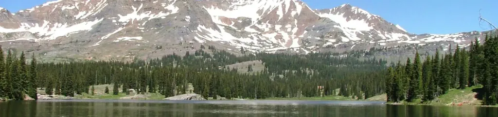 Lake IrwinCampingPhoto: Recreation.gov (RIDB) / public domain1.4 mi
- Kebler Pass Camping AreaCamping1.6 mi
- Ruby Anthracite CreekCanoeing3.2 mi
 Slate RiverCanoeingPhoto: Jeffrey Beall, CC BY 3.0 (via Wikimedia Commons)6.9 mi
- Skyland BouldersRock climbing8.7 mi
- The Hone StoneRock climbing8.9 mi
Source: Roamze catalog (indexable pages within 10 miles, PostGIS distance)
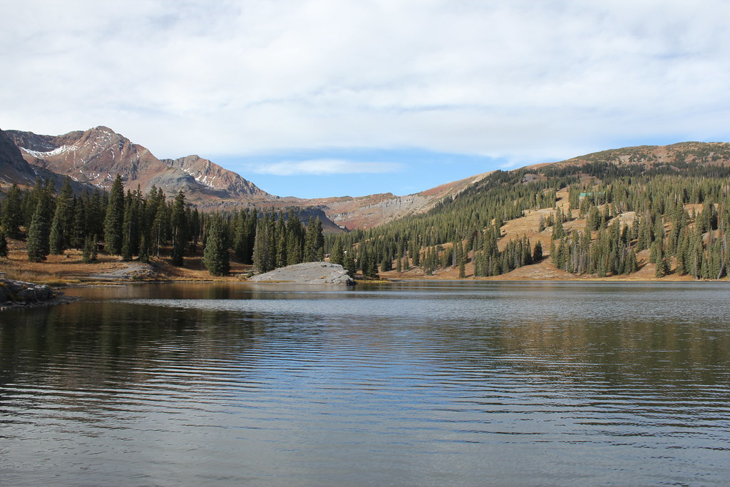 Irwin Lake TrailHiking · ~3 min drivePhoto: Jeffrey Beall, CC BY-SA 2.0 (via Flickr)
- Ridge 70Hiking · ~3 min drivePhoto: Jeffrey Beall, CC BY-SA 2.0 (via Flickr)
 Cliff CreekHiking · ~7 min drivePhoto: indigoprime, CC BY 2.0 (via Flickr)
 West Elk PeakHiking · ~8 min drivePhoto: John Sowell, CC BY-SA 4.0 (via Wikimedia Commons)
 Upper Peeler LakesHiking · ~6 min drivePhoto: Kyle Watson Photography, CC BY-SA 2.0 (via Flickr)
- ScarpHiking · ~4 min drivePhoto: Jeffrey Beall, CC BY-SA 2.0 (via Flickr)
- Beckwith BenchHiking · ~7 min drivePhoto: indigoprime, CC BY 2.0 (via Flickr)
- Carbon Trail 436Hiking · ~12 min drive
 Daisy Pass Blue LakeHiking · ~6 min drivePhoto: Kyle Watson Photography, CC BY-SA 2.0 (via Flickr)
 Budd TrailHiking · ~11 min drivePhoto: pixellaphoto, Public Domain Dedication (CC0) (via Flickr)
Also worth it near here
 Kebler Wagon TrailMountain biking · Next doorPhoto: John Sowell, CC BY-SA 4.0 (via Wikimedia Commons)
- Lake IrwinCamping · ~2 min drive
 Lily Lake Trail #639Cross-country skiing · ~4 min drivePhoto: John Sowell, CC BY-SA 4.0 (via Wikimedia Commons)
 Mount OwenSummit · ~5 min drivePhoto: John Sowell, CC BY-SA 4.0 (via Wikimedia Commons)
Best time to visit Kebler Wagon Trail
Best months: June–August. Best months have typical highs of 55–85 °F, lows of 30 °F or warmer (32 °F where the station doesn't record snow), at most one snowy day and no more than 12 wet days.
Jan
26° / -7°
12 wet
Feb
29° / -2°
11 wet
Mar
38° / 7°
10 wet
Apr
47° / 19°
9 wet
May
58° / 28°
8 wet
Jun
70° / 34°
7 wet
Jul
76° / 40°
10 wet
Aug
74° / 38°
12 wet
Sep
66° / 31°
9 wet
Oct
54° / 22°
8 wet
Nov
39° / 9°
9 wet
Dec
27° / -4°
11 wet
Typical high / low (°F) and days with rain or snow, 1991–2020. Measured at Crested Butte, CO, 7.7 mi away at 8,867 ft. The station sits about 1,200 ft lower than this place, so expect it a little cooler here. This station doesn't record snowfall. Source: NOAA NCEI U.S. Climate Normals 1991–2020.
Map and trail data © OpenStreetMap contributors
