West Elk Peak
 Photo: John Sowell, CC BY-SA 4.0 (via Wikimedia Commons)
- 22.4 mi
- round trip
- 5,873 ft
- climb
- 13,041 ft
- high point
- Out and back
- route
Is West Elk Peak open right now?
Closure in the area
There's a closure order in Grand Mesa, Uncompahgre and Gunnison National Forests. It doesn't name West Elk Peak, so check the source for the area it covers (2 listed).
Gold Mountain Wildfire Roads and Trails Closure Order v 4.0
Agency closure covering Grand Mesa, Uncompahgre and Gunnison National Forests · USFS · Grand Mesa, Uncompahgre and Gunnison National Forests
Ophir Pass Road Closure
Agency closure covering Grand Mesa, Uncompahgre and Gunnison National Forests · USFS · Grand Mesa, Uncompahgre and Gunnison National Forests
Potter Basin Road Closure Order
Agency alert covering Grand Mesa, Uncompahgre and Gunnison National Forests · USFS · Grand Mesa, Uncompahgre and Gunnison National Forests
Beaver Park Road Closure Order
Agency alert covering Grand Mesa, Uncompahgre and Gunnison National Forests · USFS · Grand Mesa, Uncompahgre and Gunnison National Forests
TERMINATION OF ORDER - FIRE RESTRICTIONS
Agency alert covering Grand Mesa, Uncompahgre and Gunnison National Forests · USFS · Grand Mesa, Uncompahgre and Gunnison National Forests
As of · Source: USFS · Grand Mesa, Uncompahgre and Gunnison National Forests. Agencies don't list every closure — check before you go.
West Elk Peak is a high, steep out-and-back hike in Colorado's Gunnison Ranger District, part of the Grand Mesa, Uncompahgre and Gunnison National Forests. The route rises to 13,041 feet, with a total elevation gain of 5,873 feet over a round trip of about 22.4 miles. The climb is rated expert, and the Forest Service manages the land. The peak sits in the high country of western Colorado, and the trip is a long one. Plan on about 10.5 hours for the round trip. The closest trail is the Railroad Ski mountain biking route, just 0.2 miles away, and the Braun Bypass hike is 0.7 miles off. For an overnight base, Kebler Pass Camping Area and Splains Gulch Camping Area are both within about 4 miles.
Local outfitters
- Maroon Bells Guide and Outfitters28 mi away
- Taylor Park Trading Post29 mi away
Not on Roamze yet. Their page has how to reach them.
Conditions and forecast on West Elk Peak
Daily highs and lows, wind and the chance of precipitation at the summit and route start for the next 7 days, from the Open-Meteo model.
 Railroad SkiMountain bikingPhoto: Mshuang2, CC0 (via Wikimedia Commons)0.2 mi
- Braun BypassHiking0.7 mi
- Kebler Pass Camping AreaCamping3.7 mi
- Splains Gulch Camping AreaCamping3.8 mi
- Ruby Anthracite CreekCanoeing7.5 mi
 Slate RiverCanoeingPhoto: Jeffrey Beall, CC BY 3.0 (via Wikimedia Commons)7.9 mi
- The Hone StoneRock climbing8.7 mi
- The Joint BoulderRock climbing8.7 mi
Source: Roamze catalog (indexable pages within 10 miles, PostGIS distance)
- Beaver PondsHiking · ~1 min drivePhoto: John Sowell, CC BY-SA 4.0 (via Wikimedia Commons)
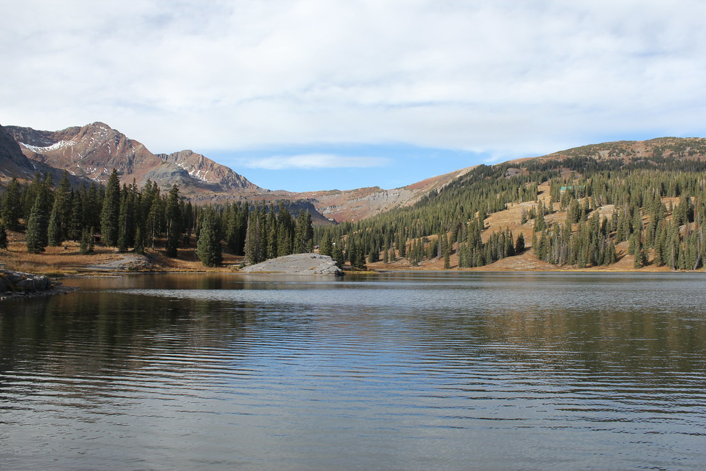 Ridge 70Hiking · ~10 min drivePhoto: Jeffrey Beall, CC BY-SA 2.0 (via Flickr)
 Cliff CreekHiking · ~10 min drivePhoto: indigoprime, CC BY 2.0 (via Flickr)
- Carbon Trail 436Hiking · ~8 min drive
- Irwin Lake TrailHiking · ~9 min drivePhoto: Jeffrey Beall, CC BY-SA 2.0 (via Flickr)
- ScarpHiking · ~11 min drivePhoto: Jeffrey Beall, CC BY-SA 2.0 (via Flickr)
- Beckwith BenchHiking · ~10 min drivePhoto: indigoprime, CC BY 2.0 (via Flickr)
 Upper Peeler LakesHiking · ~12 min drivePhoto: Kyle Watson Photography, CC BY-SA 2.0 (via Flickr)
 Budd TrailHiking · ~13 min drivePhoto: pixellaphoto, Public Domain Dedication (CC0) (via Flickr)
 Oh-Be-JoyfulHiking · ~14 min drivePhoto: supercraigtalbert, CC BY 2.0 (via Flickr)

Route details
- Distance
- 22.4 mi round trip
- Climbing
- About 5,873 ft
- Starts at
- Swampy Pass Trailhead
- Summit
- 13,039 ft
- Difficulty
- Expert
Questions about this route
How long is the West Elk Peak on West Elk Peak?
About 22.4 mi round trip from Swampy Pass Trailhead.
How much elevation gain is on the West Elk Peak?
About 5,873 ft of climbing round trip.
How hard is the West Elk Peak?
It is rated expert.
Where does the West Elk Peak start?
Swampy Pass Trailhead.
© openrouteservice.org by HeiGIT | Map data © OpenStreetMap contributors
