Scarp
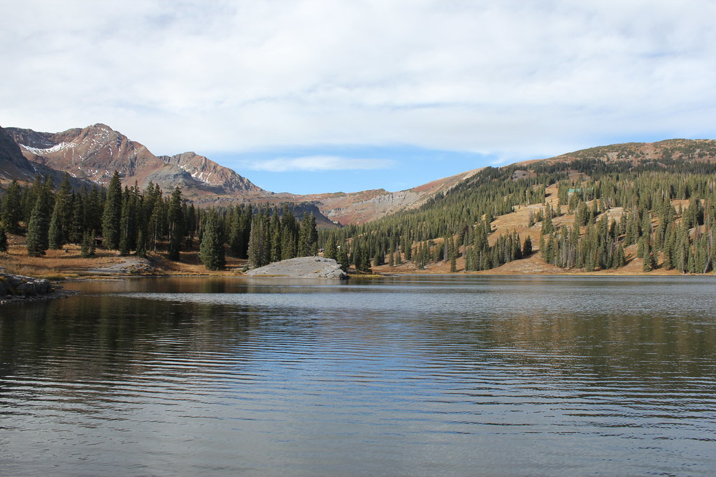 Photo: Jeffrey Beall, CC BY-SA 2.0 (via Flickr)
- 4.2 mi
- round trip
- 1,214 ft
- climb
- 12,208 ft
- high point
- Out and back
- route
Is Scarp open right now?
Closure in the area
There's a closure order in Grand Mesa, Uncompahgre and Gunnison National Forests. It doesn't name Scarp, so check the source for the area it covers (2 listed).
Gold Mountain Wildfire Roads and Trails Closure Order v 4.0
Agency closure covering Grand Mesa, Uncompahgre and Gunnison National Forests · USFS · Grand Mesa, Uncompahgre and Gunnison National Forests
Ophir Pass Road Closure
Agency closure covering Grand Mesa, Uncompahgre and Gunnison National Forests · USFS · Grand Mesa, Uncompahgre and Gunnison National Forests
TERMINATION OF ORDER - FIRE RESTRICTIONS
Agency alert covering Grand Mesa, Uncompahgre and Gunnison National Forests · USFS · Grand Mesa, Uncompahgre and Gunnison National Forests
Dallas Area Closure order
Agency alert covering Grand Mesa, Uncompahgre and Gunnison National Forests · USFS · Grand Mesa, Uncompahgre and Gunnison National Forests
Island Lake Road Closure
Agency alert covering Grand Mesa, Uncompahgre and Gunnison National Forests · USFS · Grand Mesa, Uncompahgre and Gunnison National Forests
As of · Source: USFS · Grand Mesa, Uncompahgre and Gunnison National Forests. Agencies don't list every closure — check before you go.
Scarp is a moderate hike of about 4.2 miles in the Gunnison Ranger District of the Grand Mesa, Uncompahgre and Gunnison National Forests in Colorado, managed by the Forest Service. The nearest town is Irwin, about 1.2 miles away. The trail is an out-and-back with a one-way climb of about 1,214 feet, from a low point of roughly 10,993 feet to a high of about 12,208 feet. The route is on natural surface, and horses are allowed. Bikes are not. Ridge 70 is a hike just 0.3 miles away, and the Irwin Lake Spur mountain biking trail is about 0.6 miles off. Lake Irwin campground sits about 0.7 miles away, and Kebler Pass Camping Area is about 2.5 miles away.
Local outfitters
- Maroon Bells Guide and Outfitters22 mi away
- Taylor Park Trading Post30 mi away
Not on Roamze yet. Their page has how to reach them.
Keep exploring — more trails worth the drive
Photo: Jeffrey Beall, CC BY-SA 2.0 (via Flickr)Ridge 70
Next door
3.13-mile out-and-back trail in Colorado with 1,334 ft of elevation gain
Photo: Jeffrey Beall, CC BY-SA 2.0 (via Flickr)Irwin Lake Trail
~2 min drive
0.62-mile out-and-back hike to Irwin Lake in Colorado at 10,631 ft.
 Photo: supercraigtalbert, CC BY 2.0 (via Flickr)
Oh-Be-Joyful
~6 min drive
9.17-mile out-and-back trail in Colorado with 1,258 ft elevation gain.
 Photo: John Sowell, CC BY-SA 4.0 (via Wikimedia Commons)
West Elk Peak
~11 min drive
Route to the summit of West Elk Peak (13,041 ft) from Swampy Pass Trailhead.
 Photo: pixellaphoto, Public Domain Dedication (CC0) (via Flickr)
Budd Trail
~9 min drive
2.58-mile out-and-back trail in Colorado with 1,924 ft elevation gain and loss.
 Photo: Kyle Watson Photography, CC BY-SA 2.0 (via Flickr)
Upper Peeler Lakes
~2 min drive
1.36-mile out-and-back trail to Upper Peeler Lakes in Colorado.
 Photo: indigoprime, CC BY 2.0 (via Flickr)
Cliff Creek
~10 min drive
21.40-mile out-and-back trail in Colorado with 1,750 ft elevation gain.
HIKE
Carbon Trail 436
~12 min drive
19.08-mile out-and-back trail in Colorado with 4,487 ft elevation gain/loss.
HIKE
GB Loop
~7 min drive
1.22-mile loop in Colorado with 478 ft gain and 600 ft loss.
Photo: supercraigtalbert, CC BY 2.0 (via Flickr)Coal Train Trail
~7 min drive
0.96-mile out-and-back hike in Colorado with 273 ft elevation gain.
Also worth it near here
 Photo: Sheila Sund from Salem, United States, CC BY 2.0 (via Wikimedia Commons)
Irwin Lake Spur
~1 min drive
SEE
Lake Irwin Fishing Site
~1 min drive
 Photo: John Sowell, CC BY-SA 4.0 (via Wikimedia Commons)
Mount Owen
~3 min drive
 Photo: John Sowell, CC BY-SA 4.0 (via Wikimedia Commons)
Lily Lake Trail #639
~6 min drive
