K & K Connection Trail
- 0.4 mi
- round trip
- 352 ft
- climb
- 10,364 ft
- high point
- Out and back
- route
- Jun, Sep
- best months
Is K & K Connection Trail open right now?
Alert in the area
The Forest Service lists 3 alerts for Arapaho and Roosevelt National Forests.
Fire Restrictions
Agency alert covering Arapaho and Roosevelt National Forests · USFS · Arapaho and Roosevelt National Forests
Fire Restrictions
Agency alert covering Sulphur Ranger District · USFS · Sulphur Ranger District
Permanent Recreational Shooting Order
Agency alert covering Sulphur Ranger District · Order 02-10-00-25-02 · USFS · Sulphur Ranger District
As of · Source: USFS · Arapaho and Roosevelt National Forests. Agencies don't list every closure — check before you go.
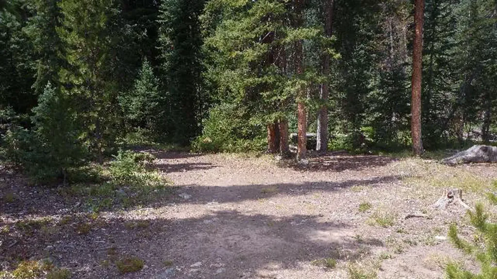
The K & K Connection Trail is a short, easy out-and-back hike in Colorado's Arapaho and Roosevelt National Forests, within the Sulphur Ranger District. The Forest Service manages the land, and the trail is about 0.4 miles long, with a total elevation gain of 352 feet over the round trip. The high point is 10,364 feet, and the route starts at that elevation, so the climb is back-loaded, with the steepest stretch at about 0.14 miles in. Summer is the most comfortable time to go. Typical averages from the nearby Cabin Creek weather station, which sits a few hundred feet lower, show July highs around 69°F with lows near 46°F, while winter highs stay around freezing. The hike takes about half an hour. Kinney Creek Trail lies just 0.1 mile away, and Keyser Ridge Loop is about 1.2 miles off. For paddling, Williams Fork is roughly 2.5 miles away, and South Fork Campground is about 4.2 miles away.
Go with a guide
- Mineral Belt Trail Guided WalkNexPM AI · $25 per person · 44 mi away
- Camp Always Choose Adventures25 mi away
- Kinney Creek TrailHiking0.1 mi
- KINNEY CREEKHiking0.9 mi
- KEYSER RIDGE LOOPHiking1.2 mi
 Williams ForkCanoeingPhoto: US Geological Survey, Public domain (via Wikimedia Commons)2.5 mi
- Equinox GardensRock climbing3.7 mi
- South Fork CampgroundCamping4.2 mi
 South Fork Group Site - Arapaho NF (CO)CampingPhoto: Recreation.gov (RIDB) / public domain4.3 mi
 Saint Louis CreekCanoeingPhoto: Jeffrey Beall, CC BY 4.0 (via Wikimedia Commons)8.1 mi
Source: Roamze catalog (indexable pages within 10 miles, PostGIS distance)
 KINNEY CREEKHiking · ~4 min drivePhoto: jtsmmm, CC BY 3.0 (via Wikimedia Commons)
 Darling CreekHiking · ~7 min drivePhoto: jtsmmm, CC BY 3.0 (via Wikimedia Commons)
- KINNEY CREEKHiking · ~2 min drive
- Williams Fork BoardwalkHiking · ~7 min drivePhoto: jtsmmm, CC BY 3.0 (via Wikimedia Commons)
- Mount NystromHiking · ~15 min drive
- KEYSER RIDGEHiking · ~2 min drive
 Waterfall TrailHiking · ~15 min drivePhoto: denverkid, CC BY 2.0 (via Flickr)
- Ute PeakHiking · ~5 min drive
- No-See-Um TrailHiking · ~7 min drive
- Keyser Ridge TrailHiking · ~6 min drive
Best time to visit K & K Connection Trail
Best months: June and September. Best months have typical highs of 55–85 °F, lows of 30 °F or warmer (32 °F where the station doesn't record snow), at most one snowy day and no more than 12 wet days.
Jan
32° / 12°
8 wet
Feb
31° / 11°
8 wet
Mar
38° / 17°
9 wet
Apr
43° / 23°
10 wet
May
53° / 31°
9 wet
Jun
64° / 40°
9 wet
Jul
69° / 46°
13 wet
Aug
67° / 44°
14 wet
Sep
61° / 38°
10 wet
Oct
50° / 29°
7 wet
Nov
39° / 19°
7 wet
Dec
32° / 12°
8 wet
Typical high / low (°F) and days with rain or snow, 1991–2020. Measured at Cabin Creek, CO, 22.2 mi away at 10,020 ft. This station doesn't record snowfall. Source: NOAA NCEI U.S. Climate Normals 1991–2020.
Map and trail data © OpenStreetMap contributors
