Poverty Gulch Camping Area
- Jun–Aug
- best months
Is Poverty Gulch Camping Area open right now?
Closure in the area
There's a closure order in Grand Mesa, Uncompahgre and Gunnison National Forests. It doesn't name Poverty Gulch Camping Area, so check the source for the area it covers (2 listed).
Gold Mountain Wildfire Roads and Trails Closure Order v 4.0
Agency closure covering Grand Mesa, Uncompahgre and Gunnison National Forests · USFS · Grand Mesa, Uncompahgre and Gunnison National Forests
Ophir Pass Road Closure
Agency closure covering Grand Mesa, Uncompahgre and Gunnison National Forests · USFS · Grand Mesa, Uncompahgre and Gunnison National Forests
Potter Basin and Beaver Park Roads Emergency Closures
Agency alert covering Grand Mesa, Uncompahgre and Gunnison National Forests · USFS · Grand Mesa, Uncompahgre and Gunnison National Forests
TERMINATION OF ORDER - FIRE RESTRICTIONS
Agency alert covering Grand Mesa, Uncompahgre and Gunnison National Forests · USFS · Grand Mesa, Uncompahgre and Gunnison National Forests
Dallas Area Closure order
Agency alert covering Grand Mesa, Uncompahgre and Gunnison National Forests · USFS · Grand Mesa, Uncompahgre and Gunnison National Forests
As of · Source: USFS · Grand Mesa, Uncompahgre and Gunnison National Forests. Agencies don't list every closure — check before you go.
- At 9,555 ftHigh camp: expect cold nights, even in summer
- Gunnison Ranger DistrictGrand Mesa, Uncompahgre and Gunnison National Forests
Poverty Gulch Camping Area is a Forest Service campground in the Gunnison Ranger District of the Grand Mesa, Uncompahgre and Gunnison National Forests in Colorado. No fees are required to use the site. Summer is the most comfortable time to visit. Typical averages from the nearby Crested Butte weather station, which sits about 700 feet lower than the camp, show July highs around 76°F with lows near 40°F, while winter highs stay in the mid-20s and lows drop to around -7°F in January. The Daisy Pass 404 Trail starts about half a mile away, and Slate River Camping Area is roughly a mile off. Washington Gulch is about 2 miles away, and the Crested Butte climbing area is about 4 miles away.
Local outfitters
- Marble RV Park and Campground10 mi away
- Mountain Time RV Park and Cabins27 mi away
Not on Roamze yet. Their page has how to reach them.
- Daisy Pass 404 TrailHiking0.6 mi
- Slate River Camping AreaCamping1 mi
- Campsite SR 18Camping1.5 mi
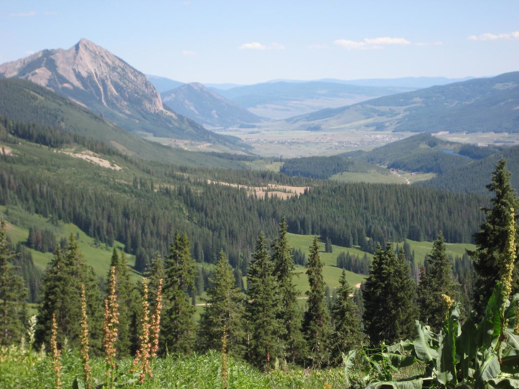 Washington GulchHikingPhoto: GSEC, CC BY 2.0 (via Flickr)2 mi
- Crested ButteRock climbing4 mi
 Slate RiverCanoeingPhoto: Jeffrey Beall, CC BY 3.0 (via Wikimedia Commons)6.4 mi
- Ruby Anthracite CreekCanoeing6.7 mi
- Skyland BouldersRock climbing8.1 mi
Source: Roamze catalog (indexable pages within 10 miles, PostGIS distance)
 Campsite WG 46Camping · ~5 min drivePhoto: Sheila Sund from Salem, United States, CC BY 2.0 (via Wikimedia Commons)
 Campsite WG 45Camping · ~5 min drivePhoto: Sheila Sund from Salem, United States, CC BY 2.0 (via Wikimedia Commons)
- Campsite WG 38Camping · ~5 min drivePhoto: Sheila Sund from Salem, United States, CC BY 2.0 (via Wikimedia Commons)
- Campsites WG 42Camping · ~5 min drivePhoto: Sheila Sund from Salem, United States, CC BY 2.0 (via Wikimedia Commons)
- Campsite WG 11Camping · ~7 min drivePhoto: Sheila Sund from Salem, United States, CC BY 2.0 (via Wikimedia Commons)
 Campsites GC 13Camping · ~7 min drivePhoto: James St. John, CC BY 2.0 (via Wikimedia Commons)
- Campsites GC 4-8Camping · ~7 min drivePhoto: James St. John, CC BY 2.0 (via Wikimedia Commons)
- Lake IrwinCamping · ~9 min drive
- Campsite SR 19Camping · ~3 min drive
- Campsite WG 48Camping · ~3 min drive
Also worth it near here
- Washington GulchHiking · ~3 min drivePhoto: GSEC, CC BY 2.0 (via Flickr)
 Purple MountainSummit · ~5 min drivePhoto: Jonathan Fox, CC BY-SA 2.0 (via Wikimedia Commons)
 Daisy Pass Blue LakeMountain biking · ~6 min drivePhoto: Sheila Sund from Salem, United States, CC BY 2.0 (via Wikimedia Commons)
- Oh-Be-Joyful RoadCross-country skiing · ~6 min drivePhoto: Sheila Sund from Salem, United States, CC BY 2.0 (via Wikimedia Commons)
Best time to visit Poverty Gulch Camping Area
Best months: June–August. Best months have typical highs of 55–85 °F, lows of 30 °F or warmer (32 °F where the station doesn't record snow), at most one snowy day and no more than 12 wet days.
Jan
26° / -7°
12 wet
Feb
29° / -2°
11 wet
Mar
38° / 7°
10 wet
Apr
47° / 19°
9 wet
May
58° / 28°
8 wet
Jun
70° / 34°
7 wet
Jul
76° / 40°
10 wet
Aug
74° / 38°
12 wet
Sep
66° / 31°
9 wet
Oct
54° / 22°
8 wet
Nov
39° / 9°
9 wet
Dec
27° / -4°
11 wet
Typical high / low (°F) and days with rain or snow, 1991–2020. Measured at Crested Butte, CO, 7.9 mi away at 8,867 ft. The station sits about 700 ft lower than this place, so expect it a little cooler here. This station doesn't record snowfall. Source: NOAA NCEI U.S. Climate Normals 1991–2020.
