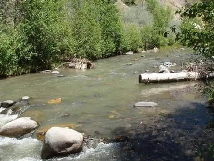
Blanco River
 Photo: Dicklyon, CC BY-SA 4.0 (via Wikimedia Commons)
- May–Jun, Sep
- best months
Is Blanco River open right now?
Closure in the area
There's a closure order in San Juan National Forest. It doesn't name Blanco River, so check the source for the area it covers (3 listed).
Travel is not advised to the San Juan NF
Agency closure covering San Juan National Forest · USFS · San Juan National Forest
Closures and dangerous conditions on roads, bridges, and trails from flooding
Agency closure covering San Juan National Forest · USFS · San Juan National Forest
Multiple roads and trails damaged by flooding on SJNF
Agency closure covering San Juan National Forest · USFS · San Juan National Forest
Bear Activity High Across San Juan National Forest
Agency alert covering San Juan National Forest · USFS · San Juan National Forest
West Fork Road and Bridge Closure Order
Agency alert covering Pagosa Ranger District · Order 02-13-06-25-19 · USFS · Pagosa Ranger District
As of · Source: USFS · San Juan National Forest. Agencies don't list every closure — check before you go.
- At 6,983 ft
- Pagosa Ranger DistrictSan Juan National Forest
The Blanco River is a camping destination in the Pagosa Ranger District of the San Juan National Forest in Colorado. It sits within the forest's boundaries, and Blanco River Group Campground lies about 3.6 miles away. The most comfortable stretch for a visit runs from late spring through early fall. Typical averages from a nearby weather station in Dulce, New Mexico, show May highs around 74°F and September highs near 79°F, with July and August warming into the upper 80s and bringing the most wet days of the year. Winters are cold, with January lows averaging about 10°F. Several other outings sit within a short drive. The Blue Creek hike is about 4 miles off, the Rio Blanco paddling route is about 6 miles away, and the Trujillo climbing area and Rito Blanco paddling route are both about 6.5 miles out.
Local outfitters
- Wolf Creek Run Resort9 mi away
- Pagosa Riverside Campground9 mi away
Not on Roamze yet. Their page has how to reach them.
 Blanco River Group CampgroundCampingPhoto: Recreation.gov (RIDB) / public domain3.6 mi
 BLUE CREEK WINTERHikingPhoto: Dicklyon, CC BY-SA 4.0 (via Wikimedia Commons)4 mi
 Rio BlancoCanoeingPhoto: Dicklyon, CC BY-SA 4.0 (via Wikimedia Commons)6 mi
- Blue CreekHiking6.1 mi
- TrujilloRock climbing6.4 mi
- Rito BlancoCanoeing6.5 mi
- Cast Iron CragRock climbing8.5 mi
- Wolf Creek Run Motor Coach ResortCamping8.5 mi
Source: Roamze catalog (indexable pages within 10 miles, PostGIS distance)
- Blanco River Group CampgroundCamping · ~6 min drive
- West Fork CampgroundCamping · ~34 min drive
 Lower Piedra Campground Camping · ~40 min drivePhoto: Dicklyon, CC BY-SA 4.0 (via Wikimedia Commons)
 Primitive Campsite, Pagosa Ranger District (San Juan National Forest)Camping · ~40 min drivePhoto: Kevin Stroup, CC BY 3.0 (via Wikimedia Commons)
 Crazy Horse OutfittersCamping · ~42 min drivePhoto: Jeffrey Beall, CC BY 4.0 (via Wikimedia Commons)
 Dispersed Camping near Coal Creek (San Juan National Forest)Camping · ~29 min drivePhoto: Dicklyon, CC BY-SA 4.0 (via Wikimedia Commons)
- Dispersed Camping near East Fork San Juan River (San Juan National Forest)Camping · ~30 min drivePhoto: Dicklyon, CC BY-SA 4.0 (via Wikimedia Commons)
- Buckles Dispersed CampgroundCamping · ~13 min drive
- Wolf Creek Run Motor Coach ResortCamping · ~15 min drive
- Pagosa Riverside CampgroundCamping · ~15 min drive
Best time to visit Blanco River
Best months: May–June and September. Best months have typical highs of 55–85 °F, lows of 30 °F or warmer (32 °F where the station doesn't record snow), at most one snowy day and no more than 12 wet days.
Jan
44° / 10°
7 wet
Feb
48° / 16°
8 wet
Mar
57° / 22°
8 wet
Apr
64° / 27°
7 wet
May
74° / 34°
7 wet
Jun
84° / 41°
6 wet
Jul
88° / 50°
11 wet
Aug
85° / 49°
13 wet
Sep
79° / 41°
9 wet
Oct
68° / 29°
7 wet
Nov
54° / 20°
6 wet
Dec
44° / 12°
8 wet
Typical high / low (°F) and days with rain or snow, 1991–2020. Measured at Dulce, NM, 15.6 mi away at 6,793 ft. This station doesn't record snowfall. Source: NOAA NCEI U.S. Climate Normals 1991–2020.
Map and trail data © OpenStreetMap contributors
