Base Camp
Campground
Campground · 1.5 mi from the trail
 Photo: Justin, CC BY 2.0 (via Wikimedia Commons)
Alert in the area
The Forest Service lists 2 alerts for Eldorado National Forest.
Help Halt Golden Mussel Invasion
Agency alert covering Eldorado National Forest · USFS · Eldorado National Forest
Deer Valley Trail (19E01) & Meadow Lake Road (09N01)
Agency alert covering Eldorado National Forest · Order 03-24-05 · USFS · Eldorado National Forest
As of · Source: USFS · Eldorado National Forest. Agencies don't list every closure — check before you go.
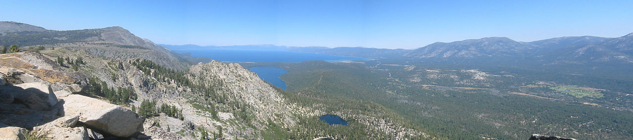
Thunder Mountain is a summit of 9,406 feet in the Amador Ranger District of Eldorado National Forest in California, about 2 miles from the town of Kirkwood. The Forest Service manages the land. The closest neighbors are the East Silver Lake hike and the Basement climbing area, both about a mile away. Silver Lake Campground sits about 1.6 miles off, and Caples Lake Resort is roughly 3 miles away.
Base Camp
Campground
The Cornice
Restaurant
Alpine County Museum
Museum
Places © OpenStreetMap contributors
More in Bear ValleyDaily highs and lows, wind and the chance of precipitation at the summit and route start for the next 7 days, from the Open-Meteo model.
Elevation from USGS 3D Elevation Program terrain data (about 10 m resolution).
9,406 ft (2,867 m).
One: Thunder Mountain.
Year-round.

 The BasementRock climbingPhoto: sarahstierch, CC0 (via Flickr)1.1 mi
 East Silver LakeHikingPhoto: sarahstierch, Public Domain Dedication (CC0) (via Flickr)1.1 miThe FreaksRock climbingPhoto: sarahstierch, CC0 (via Flickr)1.2 mi
 Silver Lake-Horse Canyon TrailHikingPhoto: RuggyBearLA, CC BY 2.0 (via Flickr)1.4 mi
 Silver Lake CgCampingPhoto: Ken Lund — CC BY-SA 2.0 (via Flickr)1.6 mi
Source: Roamze catalog (indexable pages within 10 miles, PostGIS distance)
 Deadwood PeakSummit · ~11 min drivePhoto: Tom Hilton, CC BY 2.0 (via Wikimedia Commons)Ralston PeakSummit · ~19 min drivePhoto: Jonathan Fox, CC BY-SA 2.0 (via Wikimedia Commons)
 Pyramid PeakSummit · ~21 min drivePhoto: Phreakdigital at English Wikipedia, Public domain (via Wikimedia Commons)Echo PeakSummit · ~22 min drivePhoto: Peter, CC BY-SA 2.0 (via Wikimedia Commons)
 Mount PriceSummit · ~24 min drivePhoto: Jonathan Fox, CC BY-SA 2.0 (via Wikimedia Commons)
 Mount TallacSummit · ~27 min drivePhoto: Rabit 115 at English Wikipedia, Public domain (via Wikimedia Commons)
 Jobs SisterSummit · ~29 min drivePhoto: Tim Berger, CC BY 2.0 (via Wikimedia Commons)
 Jobs PeakSummit · ~30 min drivePhoto: beth woodrum from Kingman, Arizona, USA, CC BY 2.0 (via Wikimedia Commons)
 Maggies PeaksSummit · ~30 min drivePhoto: Phreakdigital (talk · contribs), Public domain (via Wikimedia Commons)
 McConnell PeakSummit · ~35 min drivePhoto: photo by Travis Higdon, Public domain (via Wikimedia Commons)
Also worth it near here
 Thunder MountainHiking · Next doorPhoto: schvin, CC BY 2.0 (via Flickr)
 Silver Lake-Horse Canyon TrailMountain biking · ~1 min drivePhoto: Miguel Vieira from Redwood City, CA, USA, CC BY 2.0 (via Wikimedia Commons)The FreaksRock climbing · ~2 min drivePhoto: sarahstierch, CC0 (via Flickr)
