Lookout Point
- 7,256 ft
- summit
- May–Oct
- best months
Is Lookout Point open right now?
Closure in the area
There's a closure order in Stanislaus National Forest. It doesn't name Lookout Point, so check the source for the area it covers (2 listed).
Stanislaus National Forest extends seasonal MVUM closure for two high elevation roads
Agency closure covering Stanislaus National Forest · USFS · Stanislaus National Forest
Extension of Seasonal Road Closures
Agency closure covering Stanislaus National Forest · USFS · Stanislaus National Forest
As of · Source: USFS · Stanislaus National Forest. Agencies don't list every closure — check before you go.
Lookout Point is a summit of 7,256 feet in the Emigrant Wilderness, within the Groveland Ranger District of Stanislaus National Forest in California. The nearest town is Cold Springs, about 12 miles away. Summer is the most comfortable time to visit. Typical averages from a nearby weather station show July and August highs around 75°F with lows near 60°F and only about one wet day a month, while winter highs stay in the low to mid 40s. The Kibbie Ridge Trail lies about 2 miles away and the Kibbie Lake Trail about 2.3 miles away. Cherry Valley campground is roughly 5.4 miles off, and paddlers can find Cherry Creek about 4 miles away.
Conditions and forecast
Daily highs and lows, wind and the chance of precipitation at the summit for the next 7 days, from the Open-Meteo model.
- Summit elevation
- 7,256 ft
Elevation from USGS 3D Elevation Program terrain data (about 10 m resolution).
We don't know of a mapped trail or route to the summit of Lookout Point. Plan the approach with local maps, a guidebook or a local guide, and check conditions before you go.
Questions about Lookout Point
How tall is Lookout Point?
7,256 ft (2,212 m).
Is there a trail to the top of Lookout Point?
We don't know of a mapped trail or route to the summit. Plan the approach with local maps, a guidebook or a local guide.
- Burst Rock9,154 ft · California1 route10 mi away
- North Mountain5,758 ft · California3 routes11 mi away
- Thompson Peak5,293 ft · California1 route11 mi away
- Smith Peak7,747 ft · California1 route12 mi away
 Mount Hoffmann10,845 ft · California1 route25 mi awayPhoto: David McCracken, CC BY 2.0 (via Wikimedia Commons)
 El Capitan7,779 ft · California1 route25 mi awayPhoto: Fernando Guachiak, CC BY-SA 4.0 (via Wikimedia Commons)
- Kibbie Ridge TrailHiking2.1 mi
- Kibbie Lake TrailHiking2.3 mi
- Cherry CreekCanoeing4 mi
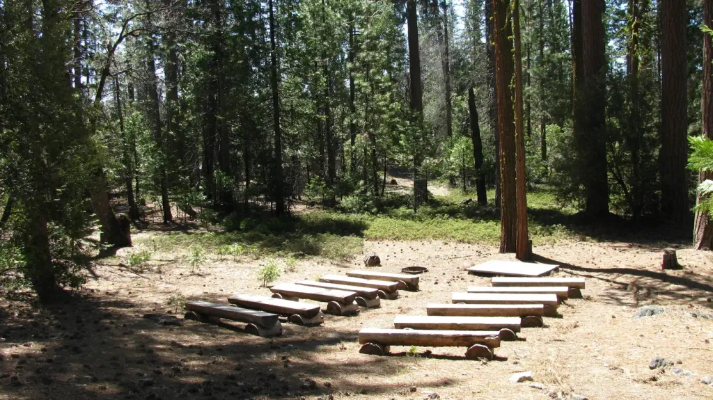 Cherry ValleyCampingPhoto: Recreation.gov (RIDB) / public domain5.4 mi
- West Fork Cherry CreekCanoeing6 mi
- Sonora Pass Highway (108)Rock climbing7.9 mi
- Hull CreekCamping9.5 mi
- Hetch HetchyRock climbing9.6 mi
Source: Roamze catalog (indexable pages within 10 miles, PostGIS distance)
 Hetch Hetchy DomeSummit · ~16 min drivePhoto: Richard Wood, CC BY-SA 3.0 (via Wikimedia Commons)
 Kolana RockSummit · ~16 min drivePhoto: Crimoid, CC BY 3.0 (via Wikimedia Commons)
 Tower PeakSummit · ~32 min drivePhoto: Tom Hilton, CC BY 2.0 (via Wikimedia Commons)
 Leavitt PeakSummit · ~34 min drivePhoto: Miguel.v, Public domain (via Wikimedia Commons)
 Night Cap PeakSummit · ~34 min drivePhoto: Tom Hilton, CC BY 2.0 (via Wikimedia Commons)
 Crown PointSummit · ~40 min drivePhoto: Jonathan Fox, CC BY-SA 2.0 (via Wikimedia Commons)
 Sonora PeakSummit · ~42 min drivePhoto: H. S. Magnuski (talk · contribs), CC BY-SA 3.0 (via Wikimedia Commons)
- Mount HoffmannSummit · ~42 min drivePhoto: David McCracken, CC BY 2.0 (via Wikimedia Commons)
 Tuolumne PeakSummit · ~42 min drivePhoto: au_ears, CC BY-SA 2.0 (via Wikimedia Commons)
 Kettle PeakSummit · ~42 min drivePhoto: Kurt Minard, CC BY-SA 3.0 (via Wikimedia Commons)
Also worth it near here
Best time to visit Lookout Point
Best months: May–October. Best months have typical highs of 55–85 °F, lows of 30 °F or warmer (32 °F where the station doesn't record snow), at most one snowy day and no more than 12 wet days.
Jan
44° / 32°
10 wet
Feb
42° / 31°
9 wet
Mar
45° / 32°
10 wet
Apr
49° / 36°
8 wet
May
58° / 43°
7 wet
Jun
67° / 52°
3 wet
Jul
75° / 60°
1 wet
Aug
75° / 59°
1 wet
Sep
70° / 54°
2 wet
Oct
60° / 46°
4 wet
Nov
49° / 37°
7 wet
Dec
43° / 32°
9 wet
Typical high / low (°F) and days with rain or snow, 1991–2020. Measured at Yosemite Village 12 W, CA, 20.7 mi away at 6,620 ft. The station sits about 600 ft lower than this place, so expect it a little cooler here. This station doesn't record snowfall. Source: NOAA NCEI U.S. Climate Normals 1991–2020.


