Little Butte
- 5,630 ft
- summit
- 1
- way up
Is Little Butte open right now?
Alert in the area
The Forest Service lists 20 alerts for Mendocino National Forest.
Prescribed burning in Upper Lake Ranger District
Agency alert covering Mendocino National Forest · USFS · Mendocino National Forest
Pile burning on M5 Road in western Colusa County
Agency alert covering Mendocino National Forest · USFS · Mendocino National Forest
Heavy equipment in Three Prong Campground
Agency alert covering Mendocino National Forest · USFS · Mendocino National Forest
Chico Seed Orchard Public Use and Access Closure
Agency alert covering Mendocino National Forest · Order 08-26-02 · USFS · Mendocino National Forest
M10 Road Status - closure in place Mondays-Fridays
Agency alert covering Mendocino National Forest · USFS · Mendocino National Forest
As of · Source: USFS · Mendocino National Forest. Agencies don't list every closure — check before you go.
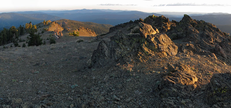
Little Butte is a summit of 5,630 feet in the Yolla Bolly-Middle Eel Wilderness, part of the Covelo Ranger District of Mendocino National Forest in California. The nearest town is Covelo, about 18 miles away. The peak sits within designated wilderness, so plan on a trip into the backcountry. Several trails start close by, including Willow Creek, Morrison Creek and Boundary Trail, each about 0.4 miles from the summit. Paddlers can find the North Fork Middle Fork Eel River about 3.4 miles away, and Casoose Creek and Red Mountain Creek are each about 4.6 miles off.
Conditions and forecast
Daily highs and lows, wind and the chance of precipitation at the summit and route start for the next 7 days, from the Open-Meteo model.
- Summit elevation
- 5,630 ft
Elevation from USGS 3D Elevation Program terrain data (about 10 m resolution).
Map © Mapbox © OpenStreetMap contributors Questions about Little Butte
How tall is Little Butte?
5,630 ft (1,716 m).
How many routes go to the summit of Little Butte?
One: Morrison Creek Trail.
- Horsehead Mountain5,867 ft · California1 route6.0 mi away
- Red Rock6,049 ft · California1 route8.8 mi away
- Windy Mountain7,080 ft · California2 routes8.9 mi away
- North Kelsey Peak5,175 ft · California1 route10 mi away
- Sugarloaf Mountain7,370 ft · California1 route11 mi away
- Solomon Peak7,582 ft · California2 routes12 mi away
- WILLOW CREEKHiking0.4 mi
- Morrison Creek TrailHiking0.4 mi
- Boundary TrailHiking0.4 mi
- Willow Creek TrailHiking1.3 mi
- North Fork Middle Fork Eel RiverCanoeing3.4 mi
- Casoose CreekCanoeing4.6 mi
- Red Mountain CreekCanoeing4.6 mi
- Balm of Gilead CreekCanoeing7.4 mi
Source: Roamze catalog (indexable pages within 10 miles, PostGIS distance)
 Mount LinnSummit · ~29 min drivePhoto: Mkauffmann, CC BY 3.0 (via Wikimedia Commons)
 Anthony PeakSummit · ~31 min drivePhoto: USFS Region 5, CC BY 2.0 (via Wikimedia Commons)
 Hayfork BallySummit · ~1h 11m drivePhoto: Region 5 Photography, CC BY 2.0 (via Wikimedia Commons)
 Saint John MountainSummit · ~1h 26m drivePhoto: Cheers. Trance addict - Armin van Buuren - Oceanlab, CC BY-SA 3.0 (via Wikimedia Commons)
- Red MountainSummit · ~7 min drive
- Horsehead MountainSummit · ~10 min drive
- Blue SlideSummit · ~11 min drive
- Red RockSummit · ~15 min drive
- Windy MountainSummit · ~15 min drive
- North Kelsey PeakSummit · ~18 min drive
Also worth it near here
- Morrison CampCamping · ~3 min drive
 Middle Fork Eel RiverCanoeing · ~13 min drivePhoto: humboldthead, CC BY 2.0 (via Wikimedia Commons)
- Mad River Ranger DistrictRiver fishing · ~14 min drive
- Yolla Bolly-Middle Eel WildernessSaltwater fishing · ~17 min drive
 Brooks Ridge TrailHiking · ~18 min drivePhoto: Pacific Southwest Region 5, Public domain (via Wikimedia Commons)
