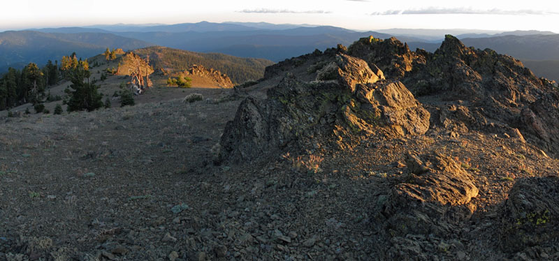
Anthony Peak
 Photo: USFS Region 5, CC BY 2.0 (via Wikimedia Commons)
- 6,956 ft
- summit
- 1
- way up
- Forest Service
- managed by
Is Anthony Peak open right now?
Alert in the area
The Forest Service lists 20 alerts for Mendocino National Forest.
Prescribed burning in Upper Lake Ranger District
Agency alert covering Mendocino National Forest · USFS · Mendocino National Forest
Pile burning on M5 Road in western Colusa County
Agency alert covering Mendocino National Forest · USFS · Mendocino National Forest
Heavy equipment in Three Prong Campground
Agency alert covering Mendocino National Forest · USFS · Mendocino National Forest
Chico Seed Orchard Public Use and Access Closure
Agency alert covering Mendocino National Forest · Order 08-26-02 · USFS · Mendocino National Forest
M10 Road Status - closure in place Mondays-Fridays
Agency alert covering Mendocino National Forest · USFS · Mendocino National Forest
As of · Source: USFS · Mendocino National Forest. Agencies don't list every closure — check before you go.
Anthony Peak is a summit of about 6,956 feet in Mendocino County, California, within the Covelo Ranger District of Mendocino National Forest. The nearest town is Covelo, about 16 miles away, and the Forest Service manages the surrounding land. Wells Cabin sits about a mile away, and Howard Meadows and Sugar Springs are both within 3 miles. The Anthony Ridge Trail is about 4 miles off.
Conditions and forecast
Daily highs and lows, wind and the chance of precipitation at the summit and route start for the next 7 days, from the Open-Meteo model.
- Summit elevation
- 6,956 ft
- Land manager
- Forest Service
Elevation from USGS 3D Elevation Program terrain data (about 10 m resolution).
Map © Mapbox © OpenStreetMap contributors Questions about Anthony Peak
How tall is Anthony Peak?
6,956 ft (2,120 m).
How many routes go to the summit of Anthony Peak?
One: Anthony Ridge Trail.
- Black Butte7,446 ft · California1 route9.6 mi away
- Red Rock6,049 ft · California1 route10 mi away
- Hammerhorn Mountain7,560 ft · California2 routes11 mi away
- Solomon Peak7,582 ft · California2 routes12 mi away
- Sugarloaf Mountain7,370 ft · California1 route14 mi away
- Windy Mountain7,080 ft · California2 routes16 mi away
- Wells CabinCamping1 mi
- Howard MeadowsCamping2.7 mi
- Sugar SpringsCamping2.8 mi
- Jumpoff CreekCanoeing3 mi
- Anthony Ridge TrailHiking3.7 mi
- Little Doe TrailHiking3.8 mi
- Board CreekCanoeing3.9 mi
- HELL HOLE CANYONHiking4.3 mi
Source: Roamze catalog (indexable pages within 10 miles, PostGIS distance)
 Mount LinnSummit · ~25 min drivePhoto: Mkauffmann, CC BY 3.0 (via Wikimedia Commons)
 Saint John MountainSummit · ~55 min drivePhoto: Cheers. Trance addict - Armin van Buuren - Oceanlab, CC BY-SA 3.0 (via Wikimedia Commons)
- Black ButteSummit · ~16 min drive
- Red RockSummit · ~18 min drive
- Hammerhorn MountainSummit · ~18 min drive
- Solomon PeakSummit · ~21 min drive
- Sugarloaf MountainSummit · ~24 min drive
- Windy MountainSummit · ~28 min drive
- Little ButteSummit · ~31 min drive
- Lazyman ButteSummit · ~31 min drive


