Blue Slide
- 5,615 ft
- summit
Is Blue Slide open right now?
Alert in the area
The Forest Service lists 20 alerts for Mendocino National Forest.
Prescribed burning in Upper Lake Ranger District
Agency alert covering Mendocino National Forest · USFS · Mendocino National Forest
Pile burning on M5 Road in western Colusa County
Agency alert covering Mendocino National Forest · USFS · Mendocino National Forest
Heavy equipment in Three Prong Campground
Agency alert covering Mendocino National Forest · USFS · Mendocino National Forest
Chico Seed Orchard Public Use and Access Closure
Agency alert covering Mendocino National Forest · Order 08-26-02 · USFS · Mendocino National Forest
M10 Road Status - closure in place Mondays-Fridays
Agency alert covering Mendocino National Forest · USFS · Mendocino National Forest
As of · Source: USFS · Mendocino National Forest. Agencies don't list every closure — check before you go.
Blue Slide is a summit of 5,615 feet in the Yolla Bolly-Middle Eel Wilderness, part of the Covelo Ranger District of Mendocino National Forest in California. The nearest town is Ruth, about 17 miles away. The closest trails are Dead Puppy Ridge Trail, about 1.7 miles away, and Blossom Cabin Trail, about 2.3 miles away. Shell Mountain Creek, a canoeing spot, is about 2.6 miles off, and White Rock Camp offers camping about 8.9 miles away.
Conditions and forecast
Daily highs and lows, wind and the chance of precipitation at the summit for the next 7 days, from the Open-Meteo model.
- Summit elevation
- 5,615 ft
Elevation from USGS 3D Elevation Program terrain data (about 10 m resolution).
We don't know of a mapped trail or route to the summit of Blue Slide. Plan the approach with local maps, a guidebook or a local guide, and check conditions before you go.
Questions about Blue Slide
How tall is Blue Slide?
5,615 ft (1,711 m).
Is there a trail to the top of Blue Slide?
We don't know of a mapped trail or route to the summit. Plan the approach with local maps, a guidebook or a local guide.
- Horsehead Mountain5,867 ft · California1 route1.4 mi away
- North Kelsey Peak5,175 ft · California1 route6.2 mi away
- Little Butte5,630 ft · California1 route6.6 mi away
- Windy Mountain7,080 ft · California2 routes6.6 mi away
- Black Rock Mountain7,763 ft · California1 route6.6 mi away
- Lazyman Butte6,537 ft · California1 route9.1 mi away
- Dead Puppy Ridge TrailHiking1.7 mi
- Blossom Cabin TrailHiking2.3 mi
- Buck Ridge TrailHiking2.4 mi
- DEAD PUPPY RIDGEHiking2.5 mi
- Shell Mountain CreekCanoeing2.6 mi
- North Fork Middle Fork Eel RiverCanoeing3.5 mi
- Mad River Ranger DistrictRiver fishing5.3 mi
- White Rock CampCamping8.9 mi
Source: Roamze catalog (indexable pages within 10 miles, PostGIS distance)
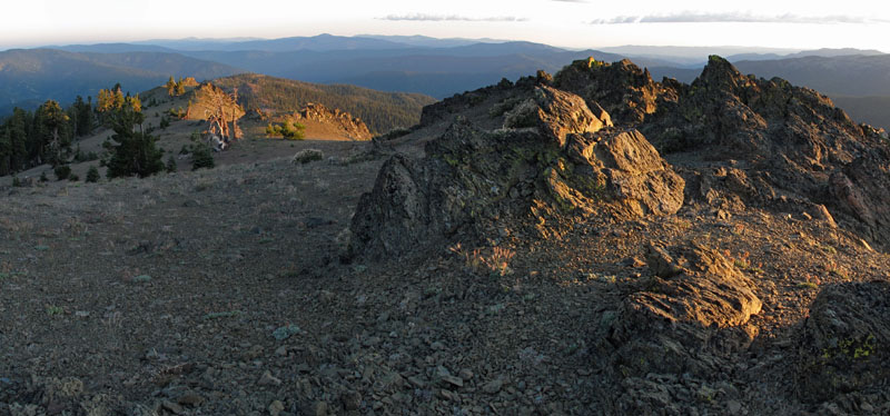 Mount LinnSummit · ~25 min drivePhoto: Mkauffmann, CC BY 3.0 (via Wikimedia Commons)
 Hayfork BallySummit · ~1h 3m drivePhoto: Region 5 Photography, CC BY 2.0 (via Wikimedia Commons)
 Anthony PeakSummit · ~37 min drivePhoto: USFS Region 5, CC BY 2.0 (via Wikimedia Commons)
- Horsehead MountainSummit · ~2 min drive
- North Kelsey PeakSummit · ~11 min drive
- Little ButteSummit · ~11 min drive
- Windy MountainSummit · ~11 min drive
- Black Rock MountainSummit · ~11 min drive
- Red MountainSummit · ~14 min drive
- Lazyman ButteSummit · ~16 min drive

