Yolla Bolly-Middle Eel Wilderness
Caution today
Agency alerts are in effect for this area; weather is good · USFS, OpenWeather · checked 6 h ago
Is Yolla Bolly-Middle Eel Wilderness open right now?
Alert in the area
The Forest Service lists 20 alerts for Mendocino National Forest.
Prescribed burning in Upper Lake Ranger District
Agency alert covering Mendocino National Forest · USFS · Mendocino National Forest
Pile burning on M5 Road in western Colusa County
Agency alert covering Mendocino National Forest · USFS · Mendocino National Forest
Heavy equipment in Three Prong Campground
Agency alert covering Mendocino National Forest · USFS · Mendocino National Forest
Chico Seed Orchard Public Use and Access Closure
Agency alert covering Mendocino National Forest · Order 08-26-02 · USFS · Mendocino National Forest
M10 Road Status - closure in place Mondays-Fridays
Agency alert covering Mendocino National Forest · USFS · Mendocino National Forest
As of · Source: USFS · Mendocino National Forest. Agencies don't list every closure — check before you go.
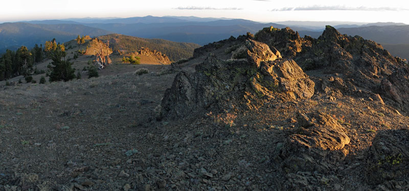
In the Wintun Indian language, "Yo-la" means "snow covered", and "Bo-li" means "high peak." The second part of this Wilderness' name refers to the headwaters of the Middle Fork Eel River, which originates in this remote and rugged land. This area was first protected in 1931 when it was classified as a primitive area. Further protection was given when this area became part of the National Wilderness Preservation System, created by the passage of the Wilderness Act of 1964. The Wilderness Act of 1984 added another 2,000 acres to the Yolla Bolly-Middle Eel Wilderness, for a total of about 151,626 acres.The Wilderness is roughly oval in shape, being about 19 miles long in the north-south direction and 24 miles wide in the east-west direction. The majority of the Wilderness lies in two districts of the Mendocino National Forest (Covelo and Grindstone Ranger Districts). The far northern portion of the Wilderness is in the Yolla Bolly Ranger District of the Shasta-Trinity National Forest. To the far west, a part of the Wilderness is in the Mad River Ranger District of the Six Rivers National Forest, and the Bureau of Land Management has a small portion of the Wilderness (also on the western edge).The lowest point of the Wilderness is along Cottonwood Creek (2,600' elevation). This is just four and a half miles from the highest point, Mount Linn, at an elevation of 8,092 feet. Several other peaks push their way above 7,000 feet and provide fine views (weather and smoke permitting) of Mount Lassen, Mount Shasta, the Trinity Alps, the Kings Range and sometimes the Pacific Ocean.
Local outfitters
- Headwaters Adventure Co49 mi away
Not on Roamze yet. Their page has how to reach them.
- Minnie Lake TrailHiking1.3 mi
- Salmon Peak CutoffHiking1.3 mi
- French Cove TrailHiking1.4 mi
- Balm of Gilead CreekCanoeing2.7 mi
- Rattlesnake CreekCanoeing3.6 mi
 Middle Fork Eel RiverCanoeingPhoto: humboldthead, CC BY 2.0 (via Wikimedia Commons)4.6 mi
- Green Springs CampgroundCamping5.4 mi
- Hammerhorn LakeCamping6.4 mi
Source: Roamze catalog (indexable pages within 10 miles, PostGIS distance)
- Sheep Camp Primitive CampgroundSaltwater fishing · ~1h 15m drive
- Peltier Bridge Primitive CampgroundSaltwater fishing · ~1h 15m drive
- Masterson Group CampgroundSaltwater fishing · ~38 min drive
- E A Wright Dam ReservoirLake fishing · ~1h 5m drive
- Lewiston LakeLake fishing · ~1h 23m drive
- Mad River Ranger DistrictRiver fishing · ~24 min drive
- Lake PillsburyLake fishing · ~1h 13m drive