Black Rock Mountain
- 7,763 ft
- summit
- 1
- way up
Is Black Rock Mountain open right now?
Closure in the area
There's a closure order in Shasta-Trinity National Forest. It doesn't name Black Rock Mountain, so check the source for the area it covers (2 listed).
Mud and Ash Creek Area and Road Closure
Agency closure covering Shasta-Trinity National Forest · Order 14-26-13 · USFS · Shasta-Trinity National Forest
Road Closure on Wild Mad Road
Agency closure covering Shasta-Trinity National Forest · Order 14-25-09 · USFS · Shasta-Trinity National Forest
Trout Creek Bridge Closure Order
Agency alert covering Shasta-Trinity National Forest · Order 14-26-02 · USFS · Shasta-Trinity National Forest
South Fork Suspension Bridge Closure
Agency alert covering Shasta-Trinity National Forest · Order 14-25-30 · USFS · Shasta-Trinity National Forest
Ah-Di-Na Area Closure
Agency alert covering Shasta-Trinity National Forest · Order 14-25-10 · USFS · Shasta-Trinity National Forest
As of · Source: USFS · Shasta-Trinity National Forest. Agencies don't list every closure — check before you go.
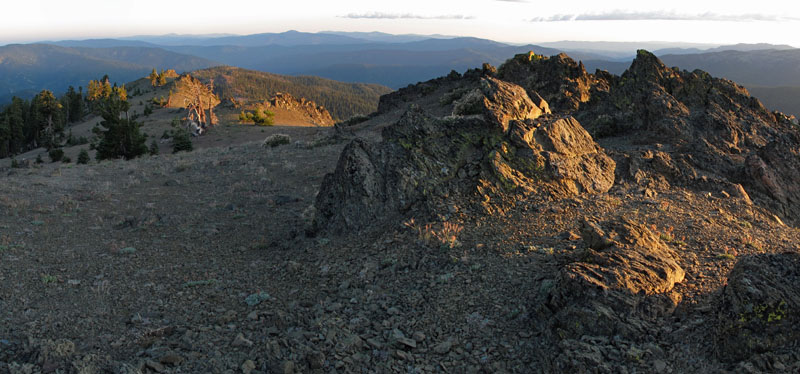
Black Rock Mountain is a summit in California's Yolla Bolly-Middle Eel Wilderness, part of the Yolla Bolla Ranger District of Shasta-Trinity National Forest. The nearest town is Platina, about 12 miles away. The summit sits inside designated wilderness, so plan for a backcountry outing. Several other destinations lie close by. Black Rock Lake is about 1.3 miles away, and North Yolla Bolly is about 1.4 miles away. For an overnight base, White Rock Camp is about 3.4 miles off, and the Rat Trap Gap trailhead is about 4.2 miles away.
Conditions and forecast
Daily highs and lows, wind and the chance of precipitation at the summit and route start for the next 7 days, from the Open-Meteo model.
- Summit elevation
- 7,763 ft
Elevation from USGS 3D Elevation Program terrain data (about 10 m resolution).
Map © Mapbox © OpenStreetMap contributors Questions about Black Rock Mountain
How tall is Black Rock Mountain?
7,763 ft (2,366 m).
How many routes go to the summit of Black Rock Mountain?
One: Black Rock Mtn.
When is the best time to climb Black Rock Mountain?
Year-round.
- Horsehead Mountain5,867 ft · California1 route7.7 mi away
- Lazyman Butte6,537 ft · California1 route7.8 mi away
- North Kelsey Peak5,175 ft · California1 route8.5 mi away
- Wells Creek Peak4,813 ft · California1 route8.6 mi away
- Windy Mountain7,080 ft · California2 routes8.8 mi away
- Sugarloaf Mountain7,370 ft · California1 route11 mi away
 Black Rock LakeHikingPhoto: John Game, CC BY 2.0 (via Flickr)1.3 mi
- Black Rock MtnHikingPhoto: John Game, CC BY 2.0 (via Flickr)1.4 mi
- North Yolla BollyHikingPhoto: John Game, CC BY 2.0 (via Flickr)1.4 mi
- East Fork South Fork Trinity RiverCanoeing2.8 mi
- White Rock CampCamping3.4 mi
- Rat Trap Gap (trailhead)Camping4.2 mi
- South Fork Beegum CreekCanoeing5.1 mi
- Post Creek Guard StationCamping5.3 mi
Source: Roamze catalog (indexable pages within 10 miles, PostGIS distance)
 Mount LinnSummit · ~24 min drivePhoto: Mkauffmann, CC BY 3.0 (via Wikimedia Commons)
 Anthony PeakSummit · ~43 min drivePhoto: USFS Region 5, CC BY 2.0 (via Wikimedia Commons)
 Hayfork BallySummit · ~57 min drivePhoto: Region 5 Photography, CC BY 2.0 (via Wikimedia Commons)
- Blue SlideSummit · ~11 min drive
- Horsehead MountainSummit · ~13 min drive
- Lazyman ButteSummit · ~13 min drive
- North Kelsey PeakSummit · ~15 min drive
- Wells Creek PeakSummit · ~15 min drive
- Windy MountainSummit · ~15 min drive
- Sugarloaf MountainSummit · ~19 min drive
