Big Pine Camp
Campground
Campground · 0.3 mi from the trail
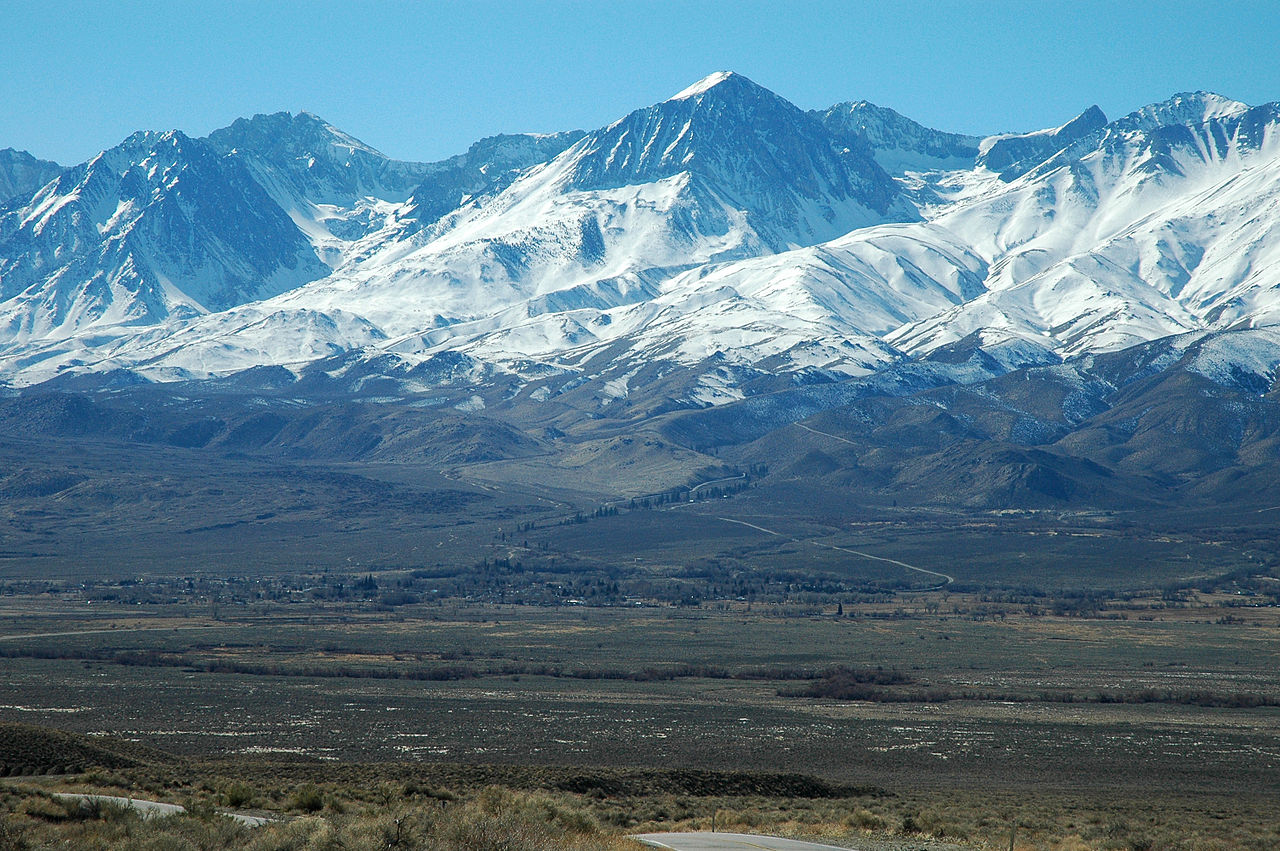 Photo: Clinton Steeds from Los Angeles, USA, CC BY 2.0 (via Wikimedia Commons)
Alert in the area
The Forest Service lists 3 alerts for Los Padres National Forest.
Los Padres Fire Use and Firearm Restrictions
Agency alert covering Los Padres National Forest · Order 05-07-00-26-05 · USFS · Los Padres National Forest
Santa Barbara Front Country Fire Use Restrictions
Agency alert covering Los Padres National Forest · Order 05-07-5406-01 · USFS · Los Padres National Forest
West Cuesta Fire Use Restrictions
Agency alert covering Santa Lucia Ranger District · Order 05-07-53-24-19 · USFS · Santa Lucia Ranger District
As of · Source: USFS · Los Padres National Forest. Agencies don't list every closure — check before you go.
Big Pine Mountain is a summit of about 6,819 feet in Santa Barbara County, California, inside the Dick Smith Wilderness. The peak lies within the Santa Lucia Ranger District of Los Padres National Forest, which the Forest Service manages, and the nearest town is Cuyama, about 16 miles away. The closest trail is Mission Pine Trail, about half a mile away. Alamar, Grapevine and Madulce all lie within about 2 miles.
Big Pine Camp
Campground
 If it rainsMike Boucher, CC BY 2.0 · Wikimedia Commons
Places © OpenStreetMap contributors, Places © Overture Maps Foundation · Photos: Mike Boucher, CC BY 2.0 (commons)
More in CarpinteriaDaily highs and lows, wind and the chance of precipitation at the summit for the next 7 days, from the Open-Meteo model.
Elevation from USGS 3D Elevation Program terrain data (about 10 m resolution).
We don't know of a mapped trail or route to the summit of Big Pine Mountain. Plan the approach with local maps, a guidebook or a local guide, and check conditions before you go.
6,819 ft (2,078 m).
We don't know of a mapped trail or route to the summit. Plan the approach with local maps, a guidebook or a local guide.

Source: Roamze catalog (indexable pages within 10 miles, PostGIS distance)
Madulce PeakSummit · ~6 min drivePhoto: U.S. Forest Service-Los Padres National Forest, Public domain (via Wikimedia Commons) Little Pine MountainSummit · ~14 min drivePhoto: Ymblanter, CC BY-SA 3.0 (via Wikimedia Commons)
 Figueroa MountainSummit · ~33 min drivePhoto: Doc Searls from Santa Barbara, USA, CC BY 2.0 (via Wikimedia Commons)
 Caliente MountainSummit · ~41 min drivePhoto: Antandrus at English Wikipedia, CC BY-SA 3.0 (via Wikimedia Commons)
 Sawmill MountainSummit · ~50 min drivePhoto: Cygnus (talk), CC BY 3.0 (via Wikimedia Commons)
 Hines PeakSummit · ~1h 1m drivePhoto: Chevy111, CC BY-SA 4.0 (via Wikimedia Commons)
 Frazier MountainSummit · ~1h 8m drivePhoto: Elbonian, CC BY-SA 4.0 (via Wikimedia Commons)
 South MountainSummit · ~1h 15m drivePhoto: Antandrus at English Wikipedia, CC BY-SA 3.0 (via Wikimedia Commons)
 Grapevine PeakSummit · ~1h 17m drivePhoto: Visitor7, CC BY-SA 3.0 (via Wikimedia Commons)
 Dome MountainSummit · ~1h 24m drivePhoto: Mikejp211, CC BY-SA 4.0 (via Wikimedia Commons)

