Pyramid Lake - Los Alamos Campground
Campground
Campground · 2.5 mi from the trail
 Photo: Mikejp211, CC BY-SA 4.0 (via Wikimedia Commons)
Alert in the area
The Forest Service lists 2 alerts for Los Padres National Forest.
Los Padres Fire Use and Firearm Restrictions
Agency alert covering Los Padres National Forest · Order 05-07-00-26-05 · USFS · Los Padres National Forest
Santa Barbara Front Country Fire Use Restrictions
Agency alert covering Los Padres National Forest · Order 05-07-5406-01 · USFS · Los Padres National Forest
As of · Source: USFS · Los Padres National Forest. Agencies don't list every closure — check before you go.
Dome Mountain is a summit of 4,948 feet in the Sespe Wilderness, part of the Mt. Pinos Ranger District of Los Padres National Forest in California. The Forest Service manages the land, and the nearest town is Hasley Canyon, about 13 miles away. Spring and fall are the most comfortable times to go. Typical averages from a nearby weather station at a similar elevation show May highs around 70°F and October highs around 71°F, while July and August average highs near 88°F. Beartrail Trail lies about 1.4 miles away and Slide Mountain Trail about 1.9 miles away. Pyramid Lake - Los Alamos Campground is about 2.5 miles off, and the Conglomerate Boulders (Templin boulders) climbing area is about 3 miles away.
Pyramid Lake - Los Alamos Campground
Campground
 If it rainsNorris M. Knaus, Public domain · Wikimedia Commons
Places © OpenStreetMap contributors · Photos: Norris M. Knaus, Public domain (commons)
More in MoorparkDaily highs and lows, wind and the chance of precipitation at the summit for the next 7 days, from the Open-Meteo model.
Elevation from USGS 3D Elevation Program terrain data (about 10 m resolution).
We don't know of a mapped trail or route to the summit of Dome Mountain. Plan the approach with local maps, a guidebook or a local guide, and check conditions before you go.
4,948 ft (1,508 m).
We don't know of a mapped trail or route to the summit. Plan the approach with local maps, a guidebook or a local guide.

 Beartrail TrailHikingPhoto: Clotee Pridgen Alloc…, CC BY-SA 3.0 (via Wikimedia Commons)1.4 mi
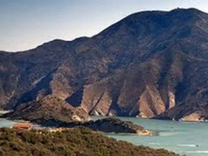 Pyramid Lake - Los Alamos CampgroundCampingPhoto: Recreation.gov (RIDB) / public domain2.5 mi
 Castaic CreekCanoeingPhoto: Albaum at English Wikipedia, Public domain (via Wikimedia Commons)7.8 mi
Source: Roamze catalog (indexable pages within 10 miles, PostGIS distance)
 Burnt PeakSummit · ~23 min drivePhoto: Chevy111, CC BY-SA 3.0 (via Wikimedia Commons)
 Frazier MountainSummit · ~24 min drivePhoto: Elbonian, CC BY-SA 4.0 (via Wikimedia Commons)Hines PeakSummit · ~30 min drivePhoto: Chevy111, CC BY-SA 4.0 (via Wikimedia Commons)
 Grapevine PeakSummit · ~34 min drivePhoto: Visitor7, CC BY-SA 3.0 (via Wikimedia Commons)
 South MountainSummit · ~41 min drivePhoto: Antandrus at English Wikipedia, CC BY-SA 3.0 (via Wikimedia Commons)
 Fairmont ButteSummit · ~41 min drivePhoto: Rennett Stowe from USA, CC BY 2.0 (via Wikimedia Commons)
 Mission PointSummit · ~46 min drivePhoto: User:Jordan Brown, Public domain (via Wikimedia Commons)
 Double MountainSummit · ~57 min drivePhoto: RangerX, CC BY 3.0 (via Wikimedia Commons)
 Sandstone PeakSummit · ~1h 1m drivePhoto: Wasquewhat, CC BY-SA 4.0 (via Wikimedia Commons)
 Boney PeakSummit · ~1h 2m drivePhoto: Justin Johnsen (Justin.Johnsen), CC BY-SA 3.0 (via Wikimedia Commons)
Also worth it near here
Beartrail TrailHiking · ~2 min drivePhoto: Clotee Pridgen Alloc…, CC BY-SA 3.0 (via Wikimedia Commons)Best months: March–June and September–November. Best months have typical highs of 55–85 °F, lows of 30 °F or warmer (32 °F where the station doesn't record snow), at most one snowy day and no more than 12 wet days.
Jan
52° / 39°
7 wet
Feb
53° / 38°
8 wet
Mar
57° / 41°
7 wet
Apr
62° / 43°
5 wet
May
70° / 49°
3 wet
Jun
80° / 58°
1 wet
Jul
88° / 65°
1 wet
Aug
88° / 65°
1 wet
Sep
83° / 61°
1 wet
Oct
71° / 52°
2 wet
Nov
60° / 44°
4 wet
Dec
52° / 38°
6 wet
Typical high / low (°F) and days with rain or snow, 1991–2020. Measured at Sandberg, CA, 9.1 mi away at 4,510 ft. This station doesn't record snowfall. Source: NOAA NCEI U.S. Climate Normals 1991–2020.
