The Roaches Boulder
Roaches Boulder, The in California has 7 bouldering routes on rock faces with 6 difficulty grades.
 Photo: DieselDemon, CC BY 2.0 (via Flickr)
- 7 routes
- V0 – V7
- Bouldering
Is Roaches Boulder, The open right now?
Alert in the area
The Forest Service lists 2 alerts for Los Padres National Forest.
Los Padres Fire Use and Firearm Restrictions
Agency alert covering Los Padres National Forest · Order 05-07-00-26-05 · USFS · Los Padres National Forest
Santa Barbara Front Country Fire Use Restrictions
Agency alert covering Los Padres National Forest · Order 05-07-5406-01 · USFS · Los Padres National Forest
As of · Source: USFS · Los Padres National Forest. Agencies don't list every closure — check before you go.
Best time to visit The Roaches Boulder
Best months: October–May. Best months have typical highs of 55–85 °F, lows of 30 °F or warmer (32 °F where the station doesn't record snow), at most one snowy day and no more than 12 wet days.
Jan
66° / 36°
8 wet
Feb
67° / 36°
9 wet
Mar
70° / 38°
7 wet
Apr
76° / 41°
4 wet
May
80° / 46°
2 wet
Jun
88° / 49°
0 wet
Jul
94° / 55°
0 wet
Aug
96° / 54°
0 wet
Sep
91° / 51°
1 wet
Oct
83° / 45°
2 wet
Nov
73° / 40°
3 wet
Dec
64° / 34°
6 wet
Typical high / low (°F) and days with rain or snow, 1991–2020. Measured at Gibraltar Dam #2, CA, 10.4 mi away at 1,558 ft. The station sits about 1,200 ft lower than this place, so expect it a little cooler here. This station doesn't record snowfall. Source: NOAA NCEI U.S. Climate Normals 1991–2020.
The Roaches Boulder is a bouldering area in the Santa Barbara Ranger District of Los Padres National Forest in California, managed by the Forest Service. It sits among a cluster of climbing spots, with Jah Hole and Dancing Outlaw Boulder each about 0.1 mile away. The area has seven bouldering routes, all rated on the V scale from V0 to V7. The easiest is Spiders at V0, and the hardest is Unknown at V7. The median grade is V3, so climbers can find problems across a range of difficulties. Spring and fall are the most comfortable times to visit. Typical averages from a nearby weather station show May highs around 80°F and October highs around 83°F, while July and August average in the mid-90s. That station sits about 1,200 feet lower than the boulders, so temperatures up high run cooler. Nearby, Fremont Campground offers saltwater fishing about 4 miles away, and Paradise Campground and the Rattlesnake Trail are both about 4 miles off.
Keep exploring — more climbs worth the drive
 Photo: Doc Searls from Santa Barbara, CA,USA, CC BY-SA 2.0 (via Wikimedia Commons)
The Brickyard
~0 min drive
Brickyard in California has 10 bouldering routes across 7 grades.
Photo: DieselDemon, CC BY 2.0 (via Flickr)Rat Boulder
~0 min drive
Rat Boulder in California has 5 bouldering routes with pads.
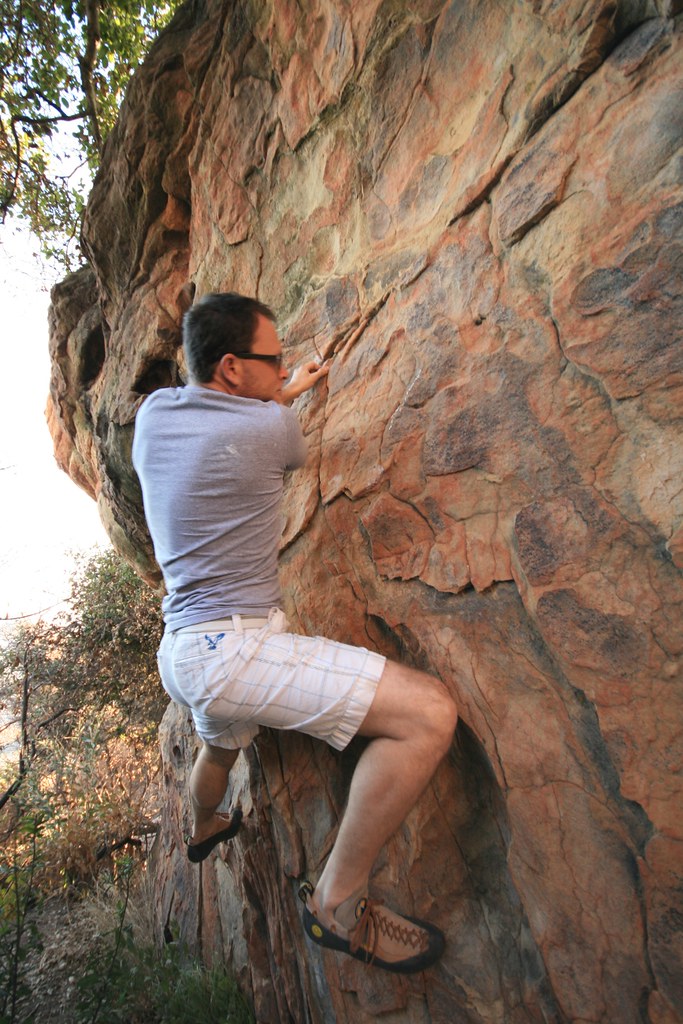 Photo: DieselDemon, CC BY 2.0 (via Flickr)
The Owl Farm
~0 min drive
Owl Farm, California has 7 climbing routes with bouldering pads.
 Photo: DieselDemon, CC BY 2.0 (via Flickr)
Charlotte's Web Area
~0 min drive
Charlotte's Web Area in California has 10 bouldering routes across 9 difficulty grades.
Photo: DieselDemon, CC BY 2.0 (via Flickr)Yeti Boulder
~0 min drive
Yeti Boulder is a 5-route bouldering crag in California with routes spanning 4 difficulty grades.
Photo: DieselDemon, CC BY 2.0 (via Flickr)The Belafonte
~0 min drive
Belafonte, The is a 7-route bouldering crag in California with 6 distinct difficulty grades.
 Photo: DieselDemon, CC BY 2.0 (via Flickr)
Meilee Area
~1 min drive
Meilee Area in California has 13 climbing routes on bouldering pads.
Photo: Doc Searls from Santa Barbara, CA,USA, CC BY-SA 2.0 (via Wikimedia Commons)Femme Fatale Area
~1 min drive
Femme Fatale Area is a bouldering crag in California with 19 routes and 14 difficulty grades.
 Photo: DieselDemon, CC BY 2.0 (via Flickr)
The Big Heat
~1 min drive
Big Heat, The in California has 6 bouldering routes across 4 difficulty grades.
 Photo: DieselDemon, CC BY 2.0 (via Flickr)
Breakfast at Tiffany's
~1 min drive
Breakfast at Tiffany's in California has 8 bouldering routes across 5 grades.
