The Owl Farm
Owl Farm, California has 7 climbing routes with bouldering pads.
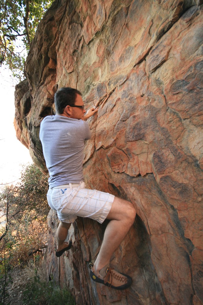 Photo: DieselDemon, CC BY 2.0 (via Flickr)
- 7 routes
- V0 – V6+
- Bouldering
Is Owl Farm, The open right now?
Alert in the area
The Forest Service lists 2 alerts for Los Padres National Forest.
Los Padres Fire Use and Firearm Restrictions
Agency alert covering Los Padres National Forest · Order 05-07-00-26-05 · USFS · Los Padres National Forest
Santa Barbara Front Country Fire Use Restrictions
Agency alert covering Los Padres National Forest · Order 05-07-5406-01 · USFS · Los Padres National Forest
As of · Source: USFS · Los Padres National Forest. Agencies don't list every closure — check before you go.
Best time to visit The Owl Farm
Best months: October–May. Best months have typical highs of 55–85 °F, lows of 30 °F or warmer (32 °F where the station doesn't record snow), at most one snowy day and no more than 12 wet days.
Jan
66° / 36°
8 wet
Feb
67° / 36°
9 wet
Mar
70° / 38°
7 wet
Apr
76° / 41°
4 wet
May
80° / 46°
2 wet
Jun
88° / 49°
0 wet
Jul
94° / 55°
0 wet
Aug
96° / 54°
0 wet
Sep
91° / 51°
1 wet
Oct
83° / 45°
2 wet
Nov
73° / 40°
3 wet
Dec
64° / 34°
6 wet
Typical high / low (°F) and days with rain or snow, 1991–2020. Measured at Gibraltar Dam #2, CA, 10.4 mi away at 1,558 ft. The station sits about 1,200 ft lower than this place, so expect it a little cooler here. This station doesn't record snowfall. Source: NOAA NCEI U.S. Climate Normals 1991–2020.
The Owl Farm is a bouldering area in California's Los Padres National Forest, within the Santa Barbara Ranger District. The Forest Service manages the land, and the climbing sits close to two other boulders, Rat Boulder and Ant Boulder, each about 0.1 mile away. The area is all bouldering, with seven routes in total, and the grades range from V0 to V6+. The easiest are Sidewalk and Street Side at V0, and the hardest is Grin and Bear It at V6+. South Street is a V4-. Spring and fall are the most comfortable times to go. Typical averages from a nearby weather station show April highs around 76°F and October highs around 83°F, while July and August average in the low 90s. That station sits about 1,200 feet lower than the boulders, so temperatures up high run cooler. Paradise Campground and Fremont Campground are both about 4 miles away, and the Rattlesnake Trail is a similar distance.
Keep exploring — more climbs worth the drive
 Photo: Doc Searls from Santa Barbara, CA,USA, CC BY-SA 2.0 (via Wikimedia Commons)
The Brickyard
~0 min drive
Brickyard in California has 10 bouldering routes across 7 grades.
 Photo: DieselDemon, CC BY 2.0 (via Flickr)
Sightings Boulder
~0 min drive
Sightings Boulder in California has 5 bouldering routes across 5 grades.
 Photo: DieselDemon, CC BY 2.0 (via Flickr)
Charlotte's Web Area
~0 min drive
Charlotte's Web Area in California has 10 bouldering routes across 9 difficulty grades.
 Photo: DieselDemon, CC BY 2.0 (via Flickr)
The Roaches Boulder
~0 min drive
Roaches Boulder, The in California has 7 bouldering routes on rock faces with 6 difficulty grades.
Photo: DieselDemon, CC BY 2.0 (via Flickr)Jah Hole
~0 min drive
Jah Hole is a bouldering crag in California with 2 routes.
 Photo: DieselDemon, CC BY 2.0 (via Flickr)
Dancing Outlaw Boulder
~0 min drive
Dancing Outlaw Boulder in California has 9 bouldering routes across 7 grades.
Photo: DieselDemon, CC BY 2.0 (via Flickr)Yeti Boulder
~0 min drive
Yeti Boulder is a 5-route bouldering crag in California with routes spanning 4 difficulty grades.
Photo: DieselDemon, CC BY 2.0 (via Flickr)Bob's Ground Up Boulder
~0 min drive
Bob's Ground Up Boulder is a 6-route bouldering crag in California with 5 difficulty grades.
Photo: DieselDemon, CC BY 2.0 (via Flickr)The Belafonte
~0 min drive
Belafonte, The is a 7-route bouldering crag in California with 6 distinct difficulty grades.
 Photo: DieselDemon, CC BY 2.0 (via Flickr)
Sunset Boulevard
~1 min drive
Sunset Boulevard in California has 13 bouldering routes across 11 grades.
