Pink Wall
Pink Wall in California has 10 sport climbing routes across 8 difficulty grades.
 Photo: simonov, CC BY-SA 2.0 (via Flickr)
- 10 routes
- 5.10c – 5.13a
- Sport
Is Pink Wall open right now?
No closures listed
The National Park Service lists no closures for Santa Monica Mountains National Recreation Area.
As of · Source: NPS · Santa Monica Mountains National Recreation Area. Agencies don't list every closure — check before you go.
Best time to visit Pink Wall
Best months: October–May. Best months have typical highs of 55–85 °F, lows of 30 °F or warmer (32 °F where the station doesn't record snow), at most one snowy day and no more than 12 wet days.
Jan
70° / 43°
6 wet
Feb
70° / 44°
7 wet
Mar
74° / 46°
6 wet
Apr
78° / 48°
3 wet
May
82° / 53°
1 wet
Jun
89° / 57°
0 wet
Jul
95° / 61°
0 wet
Aug
97° / 61°
0 wet
Sep
94° / 59°
1 wet
Oct
85° / 53°
2 wet
Nov
76° / 46°
3 wet
Dec
69° / 42°
6 wet
Typical high / low (°F) and days with rain or snow, 1991–2020. Measured at Woodland Hills Pierce College, CA, 20.7 mi away at 790 ft. The station sits about 1,300 ft lower than this place, so expect it a little cooler here. Source: NOAA NCEI U.S. Climate Normals 1991–2020.
Pink Wall is a sport climbing area in the Santa Monica Mountains National Recreation Area in California, managed by the National Park Service. It sits among a cluster of climbing spots, with Zombie Wall, Dream Street and White Wall all about 0.1 mile away, and the Sandstone Peak Trail just as close. The area is also near the Backbone Trail, about 0.3 mile off. The climbing here is all sport, and the routes run from about 5.10c up to 5.13a. Among the named routes are Cloud 9 (5.10c), Pretty in Pink (5.12a) and Thinner (5.13a). The grades are typical for the area, with the hardest route, Thinner, at 5.13a. Spring and fall are the most comfortable times to visit. Typical averages from a nearby weather station show April highs around 78°F and October highs around 85°F, while July and August average in the mid-90s. That station sits well below the wall, so temperatures on the rock run cooler. Circle X Ranch Group Campground is about 0.6 mile away for anyone planning an overnight stay.
Routes (10)
Facts about this crag
Keep exploring — more climbs worth the drive
 Photo: IrishFireside, CC BY 2.0 (via Flickr)
Echo Cliffs
~1 min drive
Echo Cliffs is a California climbing crag with 13 sport routes.
 Photo: simonov, CC BY-SA 2.0 (via Flickr)
Mount Olympus
~1 min drive
Mount Olympus in California has 10 sport climbing routes across 9 difficulty grades.
 Photo: simonov, CC BY-SA 2.0 (via Flickr)
Top Hat
~1 min drive
Top Hat in California offers 8 routes across 7 grades of mixed and sport climbing.
Photo: simonov, CC BY-SA 2.0 (via Flickr)Pico Raquelita
~1 min drive
Pico Raquelita in California has 8 climbing routes with sport and trad options.
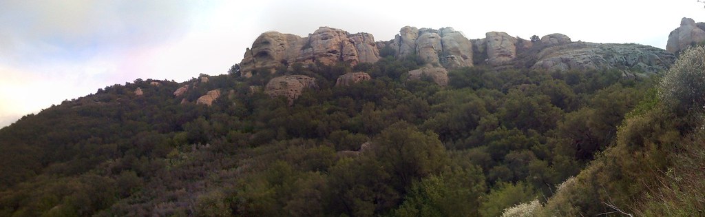 Photo: IrishFireside, CC BY 2.0 (via Flickr)
Treasure Towers
~2 min drive
11 sport climbing routes at Treasure Towers in California.
Photo: IrishFireside, CC BY 2.0 (via Flickr)The Alcove
~2 min drive
Alcove, California climbing area with 9 routes on 7 difficulty grades.
Photo: IrishFireside, CC BY 2.0 (via Flickr)Kamikaze Cave
~2 min drive
Kamikaze Cave in California has 8 sport climbing routes.
Photo: IrishFireside, CC BY 2.0 (via Flickr)Left Flank
~2 min drive
Left Flank in California has 7 sport climbing routes across 6 grades.
Photo: IrishFireside, CC BY 2.0 (via Flickr)Test Site
~2 min drive
12-route climbing crag in California with sport and trad options.
 Photo: Churnice, CC BY-SA 3.0 (via Wikimedia Commons)
The Grotto
~2 min drive
22-route sport climbing crag in California with 11 difficulty grades


