Piute Lake Campground
Campground
Campground · 3.0 mi from the trail
Closure in the area
There's a closure order in Stanislaus National Forest. It doesn't name Willow Meadow, so check the source for the area it covers (2 listed).
Stanislaus National Forest extends seasonal MVUM closure for two high elevation roads
Agency closure covering Stanislaus National Forest · USFS · Stanislaus National Forest
Extension of Seasonal Road Closures
Agency closure covering Stanislaus National Forest · USFS · Stanislaus National Forest
As of · Source: USFS · Stanislaus National Forest. Agencies don't list every closure — check before you go.
Willow Meadow is an easy hike of about 1.4 miles in the Emigrant Wilderness, part of the Summit Ranger District of Stanislaus National Forest in California. The Forest Service manages the land, and the trail is a short out-and-back with a one-way climb of about 150 feet, from a low point of roughly 8,600 feet to a high of about 8,765 feet. Summer is the most comfortable time to go. Typical averages from a nearby weather station at a similar elevation show July highs around 71°F with lows near 38°F, while winter highs stay in the low 40s. The trail is on natural surface, and horses are allowed. Bikes are not. Burst Rock, a mountain biking spot, is about half a mile away, and Chewing Gum Lake Trail is about 1.3 miles off. Climbers can head to Below the Fun House, about 3.1 miles away, and Herring Creek campground is about 6.7 miles away.
Piute Lake Campground
Campground
Places © OpenStreetMap contributors
More in Bear ValleyBest months: June–September. Best months have typical highs of 55–85 °F, lows of 30 °F or warmer (32 °F where the station doesn't record snow), at most one snowy day and no more than 12 wet days.
Jan
41° / 13°
Feb
38° / 12°
Mar
42° / 15°
Apr
45° / 22°
May
54° / 27°
Jun
65° / 33°
Jul
71° / 38°
Aug
70° / 36°
Sep
65° / 32°
Oct
57° / 26°
Nov
47° / 20°
Dec
40° / 12°
Typical high / low (°F) and days with rain or snow, 1991–2020. Measured at Tuolumne Meadows Rs, CA, 34.5 mi away at 8,694 ft. This station doesn't record snowfall. Source: NOAA NCEI U.S. Climate Normals 1991–2020.
 Photo: travisreitter, CC BY-SA 2.0 (via Flickr)
Lake Valley Trail
~4 min drive
6.2-mile out-and-back hike in California with 2,128 ft elevation gain and loss.
 Photo: Tom Hilton, CC BY 2.0 (via Flickr)
Wire Lakes
~5 min drive
Easy alpine lake hike with minimal elevation gain near Wire Lakes.
 Photo: farktronix, CC BY 2.0 (via Flickr)
Relief Valley
~10 min drive
19.56-mile out-and-back trail in California with 1,932 ft elevation gain.
HIKE
Crabtree Trail
~5 min drive
25.38-mile out-and-back trail in California with 4,258 ft elevation gain.
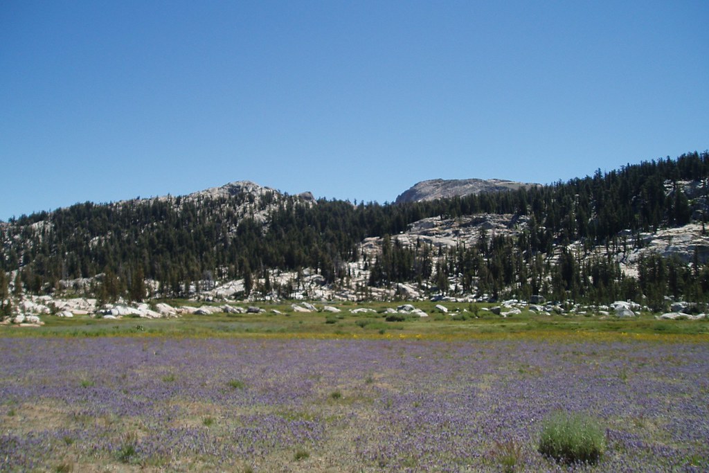 Photo: Tom Hilton, CC BY 2.0 (via Flickr)
Whitesides Meadow
~4 min drive
Whitesides Meadow is a 3.24-mile out-and-back trail in California with 451 feet of elevation gain.
Photo: Tom Hilton, CC BY 2.0 (via Flickr)Long Lake Trail
~6 min drive
1.94-mile out-and-back hike to Long Lake in California with 486 ft elevation gain
 Photo: farktronix, CC BY 2.0 (via Flickr)
Kennedy Lake
~13 min drive
9.06-mile out-and-back trail to Kennedy Lake in California with 1,157 ft elevation gain.
HIKE
Bell Meadow
~8 min drive
Bell Meadow is a 33.12-mile out-and-back trail in California with 2,992 feet of elevation gain.
 Photo: btwashburn, CC BY 2.0 (via Flickr)
LAKE VALLEY
~6 min drive
5.66-mile out-and-back trail in California with 1,388 ft gain and loss.
 Photo: TyB, CC BY 2.0 (via Flickr)
Pine Valley
~9 min drive
1.78-mile out-and-back trail in California with 68 ft of elevation gain.


