Yaqui Pass Primitive Campground
Campground
Campground · 0.2 mi from the trail
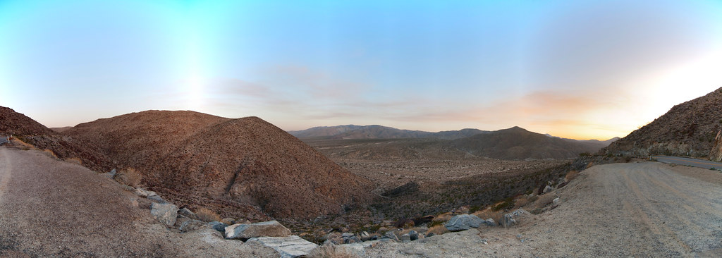 Photo: RuggyBearLA, CC BY-SA 2.0 (via Flickr)
William L. Kenyon Overlook Trail is an easy hike in California's desert country, a short outing that fits easily into a day spent exploring the trails and climbing in this corner of the state. The trail is about 0.75 miles long, and it is a steady climb up to a high point of 1,801 feet, with a total gain of 329 feet over the round trip. The trail runs out and back, and the steepest stretch comes early, at about 0.15 miles from the start, with a grade of about 7%. The nearest town is Desert Lodge, about 4.6 miles away, which makes the trail a convenient addition to a visit to the surrounding area. Winter and early spring are the most comfortable times to go. Typical averages from the Borrego Desert Park weather station, about 8 miles away and roughly 1,000 feet below the trail, show January highs around 70°F with lows near 45°F, while summer highs there climb past 100°F. The trip takes about half an hour, so it works well as a quick stop before or after other outings. Nearby, the Cactus Loop Trail and Yaqui Well Nature Trail are both within about a mile and a half, and the Narrows Earth Trail lies about 3 miles away. For climbers, Glorietta Canyon is about 3.3 miles off.
Yaqui Pass Primitive Campground
Campground
Warlock Mine
Attraction
Places © OpenStreetMap contributors
More in JulianNot on Roamze yet. Their page has how to reach them.
 Yaqui Well Nature TrailHikingPhoto: npdoty, CC BY 2.0 (via Flickr)1.5 mi
 Granitica HillRock climbingPhoto: RuggyBearLA, CC BY-SA 2.0 (via Flickr)7.3 mi
 Sandbag Deluxe CircuitRock climbingPhoto: RuggyBearLA, CC BY-SA 2.0 (via Flickr)7.4 mi
Source: Roamze catalog (indexable pages within 10 miles, PostGIS distance)
Yaqui Well Nature TrailHiking · ~3 min drivePhoto: npdoty, CC BY 2.0 (via Flickr) Whale Peak TrailHiking · ~12 min drivePhoto: GSEC, CC BY 2.0 (via Flickr)
 Pacific Crest National Scenic Trail #2000Hiking · ~13 min drivePhoto: lhogue46, CC BY 2.0 (via Flickr)
 California Riding and Hiking TrailHiking · ~14 min drivePhoto: BOB PERRY, CC BY 3.0 (via Wikimedia Commons)
 Visitor Center/Hellhole TrailHiking · ~13 min drivePhoto: Chris Hunkeler, CC BY-SA 2.0 (via Flickr)
 Hellhole Canyon TrailHiking · ~13 min drivePhoto: Chris Hunkeler, CC BY-SA 2.0 (via Flickr)
 Wilson TrailHiking · ~14 min drivePhoto: RuggyBearLA, CC BY 2.0 (via Flickr)
 Culp Valley TrailHiking · ~14 min drivePhoto: RuggyBearLA, CC BY-SA 2.0 (via Flickr)
 California Riding & Hiking TrailHiking · ~14 min drivePhoto: RuggyBearLA, CC BY-SA 2.0 (via Flickr)California Riding & Hiking TrailHiking · ~14 min drivePhoto: RuggyBearLA, CC BY-SA 2.0 (via Flickr)
Also worth it near here
Best months: November–April. Best months have typical highs of 55–85 °F, lows of 30 °F or warmer (32 °F where the station doesn't record snow), at most one snowy day and no more than 12 wet days.
Jan
70° / 45°
4 wet
Feb
72° / 47°
4 wet
Mar
79° / 52°
3 wet
Apr
85° / 56°
1 wet
May
93° / 62°
1 wet
Jun
103° / 69°
0 wet
Jul
107° / 77°
1 wet
Aug
107° / 78°
1 wet
Sep
101° / 72°
1 wet
Oct
90° / 62°
1 wet
Nov
78° / 52°
1 wet
Dec
68° / 45°
3 wet
Typical high / low (°F) and days with rain or snow, 1991–2020. Measured at Borrego Desert Park, CA, 8.1 mi away at 810 ft. The station sits about 1,000 ft lower than this place, so expect it a little cooler here. Source: NOAA NCEI U.S. Climate Normals 1991–2020.
Map and trail data © OpenStreetMap contributors

