Tamarisk Grove Campground
Campground
Campground · < 0.1 mi from the trail
Clear today
Weather is good · OpenWeather · checked 6 h ago
Cactus Loop Trail is a short, easy loop in California's desert country, about 5.7 miles from the town of Desert Lodge. The trail is 0.67 miles long, and it rises from 1,409 feet to 1,626 feet before returning to nearly the same level. The climb is front-loaded, with the steepest stretch at about 0.2 miles in, where the grade reaches 18 percent. The total gain is 228 feet, and the total loss is 219 feet, so the trail is roughly balanced. Spring and fall are the most comfortable times to go. Typical averages from a nearby weather station at Borrego Desert Park show March highs around 79°F and November highs around 78°F, while July and August average about 107°F. That station sits well below the trail, so temperatures on the loop run cooler. The Yaqui Well Nature Trail starts just 0.1 mile away, and the William L. Kenyon Overlook Trail is about 1.4 miles off. Climbers can head to Glorietta Canyon, about 3.2 miles away, and the Pacific Crest National Scenic Trail #2000 lies about 6.2 miles from the loop.
Tamarisk Grove Campground
Campground
Warlock Mine
Attraction
Places © OpenStreetMap contributors
More in JulianNot on Roamze yet. Their page has how to reach them.
 Yaqui Well Nature TrailHikingPhoto: npdoty, CC BY 2.0 (via Flickr)0.1 mi
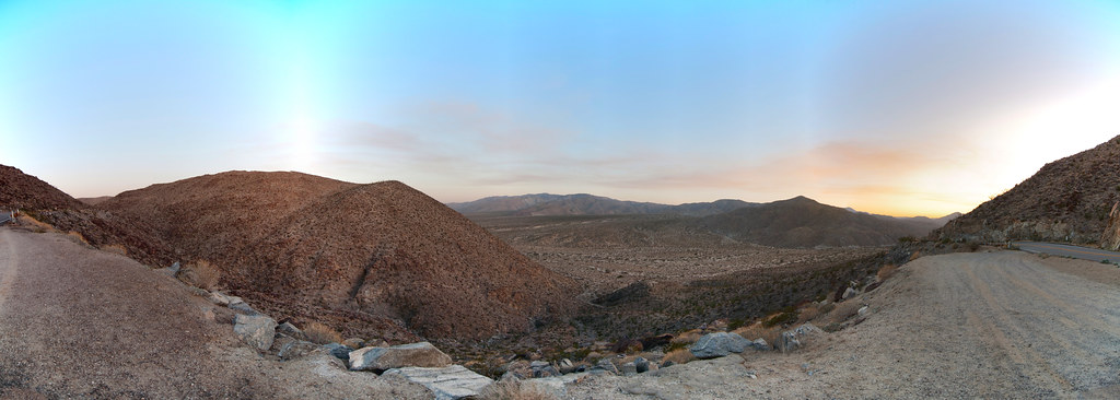 William L. Kenyon Overlook TrailHikingPhoto: RuggyBearLA, CC BY-SA 2.0 (via Flickr)1.4 mi
 Pacific Crest National Scenic Trail #2000HikingPhoto: lhogue46, CC BY 2.0 (via Flickr)6.2 mi
 Granitica HillRock climbingPhoto: RuggyBearLA, CC BY-SA 2.0 (via Flickr)6.7 mi
Source: Roamze catalog (indexable pages within 10 miles, PostGIS distance)
Yaqui Well Nature TrailHiking · Next doorPhoto: npdoty, CC BY 2.0 (via Flickr)Pacific Crest National Scenic Trail #2000Hiking · ~11 min drivePhoto: lhogue46, CC BY 2.0 (via Flickr) Whale Peak TrailHiking · ~12 min drivePhoto: GSEC, CC BY 2.0 (via Flickr)
 California Riding and Hiking TrailHiking · ~12 min drivePhoto: BOB PERRY, CC BY 3.0 (via Wikimedia Commons)William L. Kenyon Overlook TrailHiking · ~2 min drivePhoto: RuggyBearLA, CC BY-SA 2.0 (via Flickr)
 Hellhole Canyon TrailHiking · ~13 min drivePhoto: Chris Hunkeler, CC BY-SA 2.0 (via Flickr)
 Wilson TrailHiking · ~13 min drivePhoto: RuggyBearLA, CC BY 2.0 (via Flickr)
 Culp Valley TrailHiking · ~13 min drivePhoto: RuggyBearLA, CC BY-SA 2.0 (via Flickr)
 California Riding & Hiking TrailHiking · ~13 min drivePhoto: RuggyBearLA, CC BY-SA 2.0 (via Flickr)California Riding & Hiking TrailHiking · ~13 min drivePhoto: RuggyBearLA, CC BY-SA 2.0 (via Flickr)
Best months: November–April. Best months have typical highs of 55–85 °F, lows of 30 °F or warmer (32 °F where the station doesn't record snow), at most one snowy day and no more than 12 wet days.
Jan
70° / 45°
4 wet
Feb
72° / 47°
4 wet
Mar
79° / 52°
3 wet
Apr
85° / 56°
1 wet
May
93° / 62°
1 wet
Jun
103° / 69°
0 wet
Jul
107° / 77°
1 wet
Aug
107° / 78°
1 wet
Sep
101° / 72°
1 wet
Oct
90° / 62°
1 wet
Nov
78° / 52°
1 wet
Dec
68° / 45°
3 wet
Typical high / low (°F) and days with rain or snow, 1991–2020. Measured at Borrego Desert Park, CA, 8.2 mi away at 810 ft. The station sits about 800 ft lower than this place, so expect it a little cooler here. Source: NOAA NCEI U.S. Climate Normals 1991–2020.
Map and trail data © OpenStreetMap contributors
