Granitica Hill
Granitica Hill in California has 12 climbing routes across 5 grades.
 Photo: RuggyBearLA, CC BY-SA 2.0 (via Flickr)
- 12 routes
- V0 – V2
- Bouldering · Sport
Best time to visit Granitica Hill
Best months: February–June and October–November. Best months have typical highs of 55–85 °F, lows of 30 °F or warmer (32 °F where the station doesn't record snow), at most one snowy day and no more than 12 wet days.
Jan
60° / 31°
7 wet
Feb
61° / 32°
8 wet
Mar
65° / 35°
8 wet
Apr
69° / 38°
5 wet
May
75° / 43°
3 wet
Jun
85° / 46°
1 wet
Jul
92° / 53°
1 wet
Aug
93° / 54°
1 wet
Sep
89° / 49°
2 wet
Oct
79° / 40°
3 wet
Nov
68° / 34°
5 wet
Dec
60° / 30°
7 wet
Typical high / low (°F) and days with rain or snow, 1991–2020. Measured at Henshaw Dam, CA, 18 mi away at 2,700 ft. This station doesn't record snowfall. Source: NOAA NCEI U.S. Climate Normals 1991–2020.
Granitica Hill is a climbing area in Anza-Borrego Desert State Park in California, managed by State Park and Recreation. It sits among a cluster of bouldering spots, with Culp Valley and Windy Boulders South both about 0.2 miles away and "B" Boulder at the same distance. The area is a bouldering destination, with 10 boulder problems and two sport routes among its 12 routes. The boulders run from V0 to V2 on the V scale, and the sport routes are rated around 5.11+. Some of the named boulders include Crystal Myth at V0, Left Crack at V1 and Nuthatch at V2. Spring and fall are the most comfortable times to visit. Typical averages from a nearby weather station at Henshaw Dam show May highs around 75°F and October highs around 79°F, while July and August average in the low 90s. The Culp Valley Trail is about 0.8 miles away, and the California Riding & Hiking Trail and Peña Springs Trail are each about a mile off.
Routes (12)
Crystalline Boulder(2)
Grand Granitica(2)
Hilltop warmup(1)
Nuthatch boulder(2)
Sliced Loaf(3)
Tall Arete, The(2)
Keep exploring — more climbs worth the drive
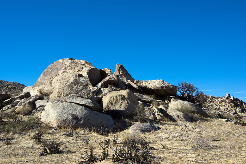 Photo: RuggyBearLA, CC BY-SA 2.0 (via Flickr)
Culp Valley
~0 min drive
Culp Valley in California has 17 climbing routes with 12 difficulty grades, featuring bouldering pads and sport climbing.
 Photo: RuggyBearLA, CC BY-SA 2.0 (via Flickr)
Windy Boulders South
~0 min drive
Windy Boulders South in California has 8 bouldering routes with 6 difficulty grades.
Photo: RuggyBearLA, CC BY-SA 2.0 (via Flickr)Windy Boulders North
~0 min drive
15 bouldering routes at Windy Boulders North in California.
Photo: RuggyBearLA, CC BY-SA 2.0 (via Flickr)Windy Boulders
~1 min drive
Windy Boulders in California has 1 bouldering route rated 5.11a.
Photo: RuggyBearLA, CC BY-SA 2.0 (via Flickr)Wolf Area
~1 min drive
Wolf Area in California has 11 bouldering routes across 7 grades.
 Photo: RuggyBearLA, CC BY-SA 2.0 (via Flickr)
Hilltop Boulders
~1 min drive
Hilltop Boulders in California has 9 bouldering routes across 6 grades.
Photo: RuggyBearLA, CC BY-SA 2.0 (via Flickr)Vector Boulder
~1 min drive
Vector Boulder in California offers 11 bouldering routes across 7 difficulty grades.
Photo: RuggyBearLA, CC BY-SA 2.0 (via Flickr)Cottonwood Area
~1 min drive
Cottonwood Area in California has 8 bouldering routes across 5 difficulty grades.
 Photo: RuggyBearLA, CC BY-SA 2.0 (via Flickr)
Sandbag Deluxe Circuit
~1 min drive
Sandbag Deluxe Circuit in California has 17 bouldering routes across 5 grades.
Photo: RuggyBearLA, CC BY-SA 2.0 (via Flickr)Marvel at the View area
~1 min drive
3 bouldering routes in California, grades range from moderate to advanced.


