West Parks
- 1.8 mi
- round trip
- 612 ft
- climb
- 7,233 ft
- high point
- Out and back
- route
Is West Parks open right now?
Closure in the area
There's a closure order in Shasta-Trinity National Forest. It doesn't name West Parks, so check the source for the area it covers (2 listed).
Mud and Ash Creek Area and Road Closure
Agency closure covering Shasta-Trinity National Forest · Order 14-26-13 · USFS · Shasta-Trinity National Forest
Road Closure on Wild Mad Road
Agency closure covering Shasta-Trinity National Forest · Order 14-25-09 · USFS · Shasta-Trinity National Forest
Trout Creek Bridge Closure Order
Agency alert covering Shasta-Trinity National Forest · Order 14-26-02 · USFS · Shasta-Trinity National Forest
South Fork Suspension Bridge Closure
Agency alert covering Shasta-Trinity National Forest · Order 14-25-30 · USFS · Shasta-Trinity National Forest
Ah-Di-Na Area Closure
Agency alert covering Shasta-Trinity National Forest · Order 14-25-10 · USFS · Shasta-Trinity National Forest
As of · Source: USFS · Shasta-Trinity National Forest. Agencies don't list every closure — check before you go.
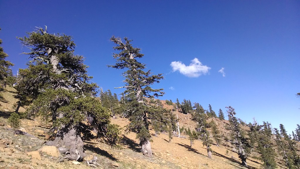
West Parks is an easy, out-and-back hike of about 1.8 miles in the Mt. Shasta Ranger District of Shasta-Trinity National Forest in California. The trail rises from a low point of about 6,600 feet to a high of about 7,230 feet, with a total elevation gain of about 612 feet. The Forest Service manages the land, and the route is open year-round. The trail is natural-surfaced and allows bikes, so it works for hikers and riders alike. The climb is gentle, and the route is short enough to fit into a day of exploring the surrounding area. Caldwell Lakes lies about a mile away, and Eddy Creek is roughly 2.6 miles off. For an overnight stay, Kangaroo campground is about 6 miles away, and Toad Lake Campground is about 7.7 miles away.
- Caldwell LakesHiking0.9 mi
 Eddy CreekHikingPhoto: theforestprimeval, CC BY-SA 2.0 (via Flickr)2.6 mi
- KangarooCamping6.2 mi
- Parks CreekCanoeing6.8 mi
- Toad Lake CgCamping7.7 mi
- Plasma WallRock climbing7.9 mi
- The RoomRock climbing8 mi
- East Fork Scott RiverCanoeing9.1 mi
Source: Roamze catalog (indexable pages within 10 miles, PostGIS distance)
 Houston CreekHiking · ~5 min drivePhoto: theforestprimeval, CC BY-SA 2.0 (via Flickr)
 Pacific Crest TrailHiking · ~6 min drivePhoto: theforestprimeval, CC BY-SA 2.0 (via Flickr)
 Kangaroo LakeHiking · ~11 min drivePhoto: Curt Kline, CC BY 3.0 (via Wikimedia Commons)
 Toad LakeHiking · ~12 min drivePhoto: theforestprimeval, CC BY-SA 2.0 (via Flickr)
- Fen Nature Trail (Sisson)Hiking · ~11 min drivePhoto: Curt Kline, CC BY 3.0 (via Wikimedia Commons)
- Pacific Crest National Scenic Trail #2000Hiking · ~13 min drivePhoto: Curt Kline, CC BY 3.0 (via Wikimedia Commons)
- Sisson Callahan TrailHiking · ~12 min drivePhoto: theforestprimeval, CC BY-SA 2.0 (via Flickr)
- Sisson Callahan TrailHiking · ~7 min drive
- Caldwell LakesHiking · ~2 min drive
 Pacific Crest TrailHiking · ~21 min drivePhoto: randomduck, CC BY-SA 2.0 (via Flickr)

