Turner Mountain
- 6.4 mi
- round trip
- 3,060 ft
- climb
- 6,876 ft
- high point
- Out and back
- route
- May–Oct
- best months
Is TURNER MOUNTAIN open right now?
Closure in the area
There's a closure order in Lassen National Forest. It doesn't name TURNER MOUNTAIN, so check the source for the area it covers (3 listed).
Harmful Algal Blooms
Agency closure covering Lassen National Forest · USFS · Lassen National Forest
Forest Road Closure Order
Agency closure covering Lassen National Forest · Order 06-26-01 · USFS · Lassen National Forest
SAFETY ALERT - South Antelope Bridge out, Do Not Cross
Agency closure covering Lassen National Forest · USFS · Lassen National Forest
As of · Source: USFS · Lassen National Forest. Agencies don't list every closure — check before you go.
Turner Mountain is a hard, out-and-back hike of about 12.8 miles in California's Lassen National Forest, on the Almanor Ranger District. The trail starts at roughly 5,637 feet and climbs to 6,876 feet, with a total gain of about 3,060 feet for the round trip. The steepest stretch comes around mile 5.9, where the grade reaches 27 percent. Summer is the most comfortable time to go. Typical July averages from a nearby weather station at Manzanita Lake run to a high of 79°F and a low of 46°F, and that station sits about 1,100 feet lower than the mountain's summit, so temperatures on top run cooler. The trip takes about six hours. Battle Creek campground is 3.4 miles away, and Hole in the Ground is 5.2 miles off. Summit Lake and Heart Lake Trail are both within about 7 miles.
- Battle CreekCamping3.4 mi
- Hole in the GroundCamping5.2 mi
- SUMMIT LAKEHiking6 mi
- Heart Lake TrailHiking6.9 mi
- South Fork Antelope CreekCanoeing7.1 mi
- South Fork Battle CreekCanoeing7.7 mi
- Lassen TrailHiking7.7 mi
- The MillRock climbing8.7 mi
Source: Roamze catalog (indexable pages within 10 miles, PostGIS distance)
 Mill CreekHiking · ~15 min drivePhoto: g.bertschinger, CC BY-SA 2.0 (via Flickr)
- MILL CREEKHiking · ~16 min drivePhoto: g.bertschinger, CC BY-SA 2.0 (via Flickr)
- Boat Gunwale Tie IshiHiking · ~16 min drivePhoto: g.bertschinger, CC BY-SA 2.0 (via Flickr)
 SPENCER MEADOW LOOPHiking · ~18 min drivePhoto: Pacific Southwest Region 5, Public domain (via Wikimedia Commons)
- Brokeoff Volcano VistaHiking · ~23 min drive
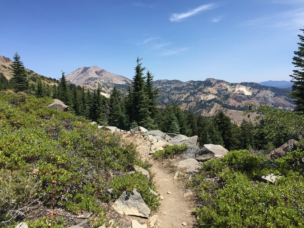 HEART LAKE NRTHiking · ~17 min drivePhoto: ray_explores, CC BY 2.0 (via Flickr)
- Heart Lake TrailHiking · ~12 min drive
- Spencer Meadow TrailHiking · ~17 min drivePhoto: Pacific Southwest Region 5, Public domain (via Wikimedia Commons)
- Spencer Meadow Loop TrailHiking · ~18 min drivePhoto: Pacific Southwest Region 5, Public domain (via Wikimedia Commons)
 Bumpass Hell TrailHiking · ~23 min drivePhoto: Seth Tisue, CC BY-SA 2.0 (via Flickr)
Best time to visit TURNER MOUNTAIN
Best months: May–October. Best months have typical highs of 55–85 °F, lows of 30 °F or warmer (32 °F where the station doesn't record snow), at most one snowy day and no more than 12 wet days.
Jan
41° / 22°
Feb
42° / 22°
Mar
46° / 24°
Apr
50° / 27°
May
61° / 35°
Jun
70° / 41°
Jul
79° / 46°
Aug
78° / 45°
Sep
72° / 41°
Oct
59° / 33°
Nov
47° / 26°
Dec
39° / 22°
Typical high / low (°F) and days with rain or snow, 1991–2020. Measured at Manzanita Lake, CA, 16.7 mi away at 5,750 ft. The station sits about 1,100 ft lower than this place, so expect it a little cooler here. This station doesn't record snowfall. Source: NOAA NCEI U.S. Climate Normals 1991–2020.

Route details
- Distance
- 6.4 mi round trip
- Climbing
- About 3,060 ft
- Summit
- 6,896 ft
- Difficulty
- Hard
- Time
- About 3 hours
Questions about this route
How long is the TURNER MOUNTAIN on Turner Mountain?
About 6.4 mi round trip.
How much elevation gain is on the TURNER MOUNTAIN?
About 3,060 ft of climbing round trip.
How hard is the TURNER MOUNTAIN?
It is rated hard.
How long does the TURNER MOUNTAIN take?
About 3 hours round trip.
Conditions and forecast on Turner Mountain
Daily highs and lows, wind and the chance of precipitation at the summit and route start for the next 7 days, from the Open-Meteo model.
