Free — you'll pick up right here.
Watch this trail
Sign up to watch it — saving subscribes you to gate, closure and report changes.
California
Bumpass Hell Trail
1.0 mi
Distance
674 ft
Gain
32 min
Time
No verdict for this trail
We won't guess. Here is exactly what we do and don't know.
What we do know
Inside Lassen Volcanic National Park
National Park unit boundary is mapped — agency alerts for it feed this page automatically.
Boundary data
What's missing
No access route mapped
We don't yet know which road reaches this trailhead, so we can't tell you if it's gated.
Nobody's filed a report here yet — be the first.
Why you'll love it
Here's your day, mapped
Bumpass Hell Trail
AI-suggested draft · review before you go
Meals
Gear for the day
Elevation & route
- Distance
- 1.0 mi
- Elevation gain
- 674 ft
- Elevation loss
- 674 ft
- Highest point
- 8,398 ft
- Lowest point
- 8,180 ft
Photos
Directions & GPX
Permits & access
- Managing agency
- National Park Service
About this trail
Bumpass Hell Trail is a 2.02-mile out-and-back route in California with 674 feet of elevation gain and loss. The trail reaches a maximum elevation of 8,398 feet.
Add to a trip & share
Keep exploring — more trails worth the drive
Brokeoff Volcano Vista
~0 min drive
This small parking area is perched above Little Hot Springs Valley in the shadow of Lassen Peak. Parking is limited and fills quickly in the summer due to the popularity of the Bumpass Hell Trail. The trailhead is located at the northeast end of the parking area, near the…
Lassen Peak Scenic Vista
~1 min drive
Lassen Peak is a monument to the area’s natural history and humankind’s adventurous spirit. At 10,457 feet high, it’s one of the world’s largest plug dome volcanoes. Its 1914-1917 eruptions were a driving force behind the establishment of Lassen Volcanic National Park. The…
Kings Creek Meadow Viewpoint
~4 min drive
Outstanding views of Lassen Peak are visible from highway turnouts near Kings Creek Upper Meadow. This meadow is frequently photographed in its vibrant seasonal colors from the snowy white of spring to the golden hues of fall. Non-native trout species including brown and…
 Photo: inkknife_2000 (7.5 million views +), CC BY-SA 2.0 (via Wikimedia Commons)
Pacific Crest Trail
~10 min drive
28.18-mile out-and-back trail in California with 4,049 ft elevation gain
 Photo: inkknife_2000 (7.5 million views +), CC BY-SA 2.0 (via Wikimedia Commons)
Bear Lakes Trail
~10 min drive
10.3-mile out-and-back hike in California with 1,675 ft elevation gain
Manzanita Lake Day Use Area
~9 min drive
The Manzanita Lake boat launch, trailhead, and picnic area are located on the southeast shore of Manzanita Lake. Get here by following the Manzanita Lake Campground Road off of Lassen Volcanic National Park Highway in the Manzanita Lake Area. Boat Launch At the south end of…
 Photo: CC BY 2.5 (via Wikimedia Commons)
Bumpass Hell Trail
~2 min drive
3.46-mile out-and-back hike in California with 2,409 ft elevation gain and loss.
Devastated Area
~7 min drive
Discover the story behind Lassen Peak's 1915-1916 eruption. Waysides along the half-mile accessible loop describe how the eastern slope of Lassen Peak came to be known as the Devastated Area. More than a hundred years later, forests cover much of this once barren area.…
 Photo: Pacific Southwest Region 5, Public domain (via Wikimedia Commons)
SPENCER MEADOW LOOP
~11 min drive
9.16-mile out-and-back out-and-back in California with 3,218 ft elevation gain
Drakesbad Guest Ranch
~10 min drive
Drakesbad Guest Ranch is a secluded lodge nestled in Warner Valley, in the southeast corner of Lassen Volcanic National Park. The ranch includes a lodge, dining hall, and bungalow units. Initially homesteaded by Edward Drake in the 1880s, Drakesbad Guest Ranch continues to…
Also worth it near here
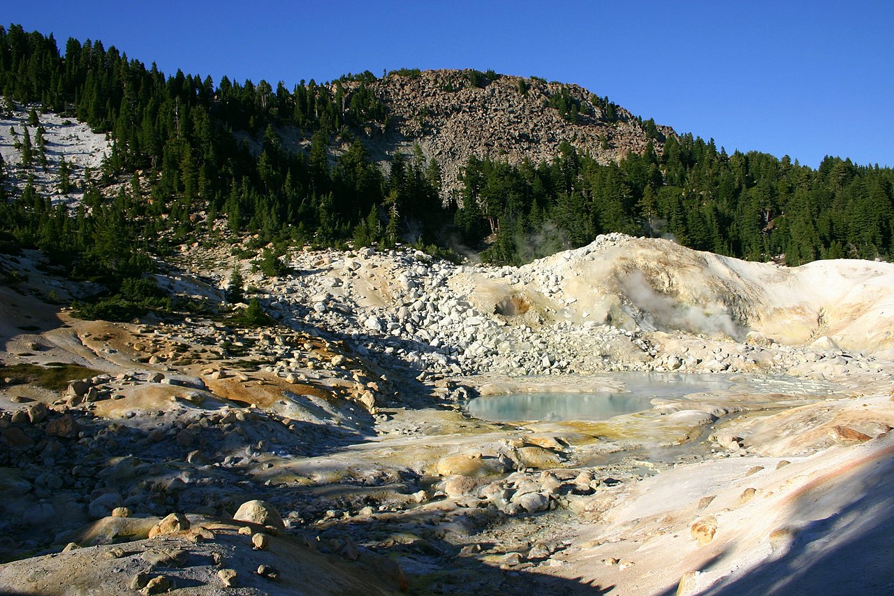 Photo: Genista Kai Schreiber, CC BY-SA 2.0 (via Wikimedia Commons)
Bumpass Mountain
~2 min drive
 Photo: T1madpaintballer at English Wikipedia, Public domain (via Wikimedia Commons)
Bumpass Hell
~2 min drive
 Photo: Daniel Schwen, CC BY-SA 2.5 (via Wikimedia Commons)
First and Second Terrace
~2 min drive
Soda Lake
~2 min drive
Mill Creek Falls
~3 min drive
Map and trail data © OpenStreetMap contributors
