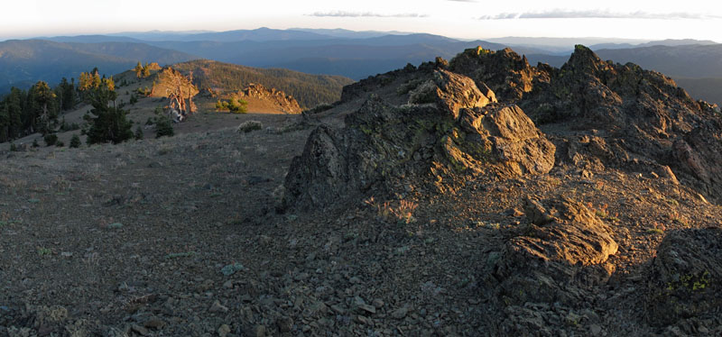
Syd Cabin Ridge
- 9.0 mi
- round trip
- 2,629 ft
- climb
- 5,719 ft
- high point
- Out and back
- route
Caution at last check
Agency alerts are in effect for this area; weather is marginal · USFS, OpenWeather · checked 20 h ago
Is Syd Cabin Ridge open right now?
Closure in the area
There's a closure order in Shasta-Trinity National Forest. It doesn't name Syd Cabin Ridge, so check the source for the area it covers (2 listed).
Mud and Ash Creek Area and Road Closure
Agency closure covering Shasta-Trinity National Forest · Order 14-26-13 · USFS · Shasta-Trinity National Forest
Road Closure on Wild Mad Road
Agency closure covering Shasta-Trinity National Forest · Order 14-25-09 · USFS · Shasta-Trinity National Forest
Trout Creek Bridge Closure Order
Agency alert covering Shasta-Trinity National Forest · Order 14-26-02 · USFS · Shasta-Trinity National Forest
South Fork Suspension Bridge Closure
Agency alert covering Shasta-Trinity National Forest · Order 14-25-30 · USFS · Shasta-Trinity National Forest
Ah-Di-Na Area Closure
Agency alert covering Shasta-Trinity National Forest · Order 14-25-10 · USFS · Shasta-Trinity National Forest
As of · Source: USFS · Shasta-Trinity National Forest. Agencies don't list every closure — check before you go.
Syd Cabin Ridge is a hard hike in California's Yolla Bolly-Middle Eel Wilderness, part of the Yolla Bolla Ranger District of Shasta-Trinity National Forest. The trail is an out-and-back route of about 9 miles, with a total elevation gain of roughly 2,600 feet, taking you from a low point of about 3,070 feet to a high of about 5,720 feet. The trail is on natural surface and allows horses, so plan for that if you're riding. Bikes are not allowed. The route stays open year-round, and the trailhead is about a tenth of a mile from the Humboldt Trail and the Tomhead Saddle Campground, both of which are listed as nearby stops. Lazyman Butte and the Cottonwood Trail lie about 2.8 and 3 miles away. Paddlers can find Buck Creek roughly 5.3 miles off.
- Humboldt TrailHiking0.1 mi
- Tomhead Saddle Cg-FCamping0.1 mi
- Lazyman ButteHiking2.8 mi
- Cottonwood TrailHiking3 mi
- Buck CreekCanoeing5.3 mi
- South Fork Cottonwood CreekCanoeing6.6 mi
- Rat Trap Gap (trailhead)Camping6.8 mi
- Cold ForkCanoeing6.8 mi
Source: Roamze catalog (indexable pages within 10 miles, PostGIS distance)
 Pettijohn TrailHiking · ~16 min drivePhoto: John Game, CC BY 2.0 (via Flickr)
- Black Rock MtnHiking · ~16 min drivePhoto: John Game, CC BY 2.0 (via Flickr)
- Humboldt TrailHiking · Next door
- Scorpion Camp TrailHiking · ~5 min drive
- North Yolla BollyHiking · ~16 min drivePhoto: John Game, CC BY 2.0 (via Flickr)
- Black Rock LakeHiking · ~16 min drivePhoto: John Game, CC BY 2.0 (via Flickr)
- Cottonwood TrailHiking · ~9 min drive
- Barker Camp TieHiking · ~11 min drive
- Lazyman ButteHiking · ~5 min drive
- Cottonwood TrailHiking · ~5 min drive