Humboldt Trail
- 14.5 mi
- round trip
- 5,813 ft
- climb
- 6,426 ft
- high point
- Out and back
- route
Is Humboldt Trail open right now?
Closure in the area
There's a closure order in Shasta-Trinity National Forest. It doesn't name Humboldt Trail, so check the source for the area it covers (2 listed).
Mud and Ash Creek Area and Road Closure
Agency closure covering Shasta-Trinity National Forest · Order 14-26-13 · USFS · Shasta-Trinity National Forest
Road Closure on Wild Mad Road
Agency closure covering Shasta-Trinity National Forest · Order 14-25-09 · USFS · Shasta-Trinity National Forest
Trout Creek Bridge Closure Order
Agency alert covering Shasta-Trinity National Forest · Order 14-26-02 · USFS · Shasta-Trinity National Forest
South Fork Suspension Bridge Closure
Agency alert covering Shasta-Trinity National Forest · Order 14-25-30 · USFS · Shasta-Trinity National Forest
Ah-Di-Na Area Closure
Agency alert covering Shasta-Trinity National Forest · Order 14-25-10 · USFS · Shasta-Trinity National Forest
As of · Source: USFS · Shasta-Trinity National Forest. Agencies don't list every closure — check before you go.
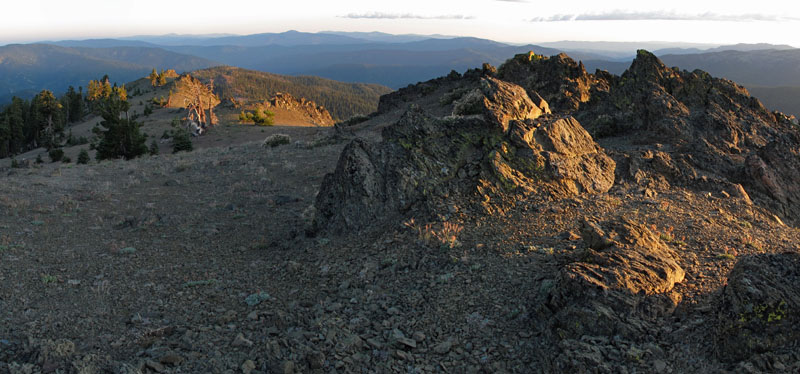
Humboldt Trail is an expert-level hike in California's Yolla Bolly-Middle Eel Wilderness, part of the Yolla Bolla Ranger District of Shasta-Trinity National Forest. The Forest Service manages the land. The trail is out and back, about 29 miles long, with a one-way gain of 2,624 feet. The route starts at roughly 5,700 feet and climbs to about 6,400 feet, with the steepest stretch at around 23% grade near mile 7. That makes for a long, sustained climb, and the total round-trip gain is about 5,800 feet. Syd Cabin Ridge and Tomhead Saddle Campground sit right next to the trail, both within about a tenth of a mile. Lazyman Butte and Cottonwood Trail lie a little over 3 miles away.
- Syd Cabin RidgeHiking0.1 mi
- Tomhead Saddle Cg-FCamping0.1 mi
- Lazyman ButteHiking2.8 mi
- Cottonwood TrailHiking3.1 mi
- Buck CreekCanoeing5.3 mi
- South Fork Cottonwood CreekCanoeing6.6 mi
- Rat Trap Gap (trailhead)Camping6.7 mi
- Cold ForkCanoeing6.8 mi
Source: Roamze catalog (indexable pages within 10 miles, PostGIS distance)
 Pettijohn TrailHiking · ~15 min drivePhoto: John Game, CC BY 2.0 (via Flickr)
- Black Rock MtnHiking · ~15 min drivePhoto: John Game, CC BY 2.0 (via Flickr)
- Scorpion Camp TrailHiking · ~5 min drive
- Cottonwood TrailHiking · ~9 min drive
- North Yolla BollyHiking · ~15 min drivePhoto: John Game, CC BY 2.0 (via Flickr)
- Black Rock LakeHiking · ~16 min drivePhoto: John Game, CC BY 2.0 (via Flickr)
- Barker Camp TieHiking · ~11 min drive
- Ides Cove Loop TrailHiking · ~11 min drive
- Syd Cabin RidgeHiking · Next door
- Cottonwood TrailHiking · ~5 min drive
Map and trail data © OpenStreetMap contributors
