Loading…

Free — you'll pick up right here.
Watch this trail
Sign up to watch it — saving subscribes you to gate, closure and report changes.
California
2.4 mi
Distance
1,262 ft
Gain
Agency alerts are in effect for this area; weather is good
2 factors · 2 sources
Newest 21 h ago · oldest 11 d
caution: Agency alerts
9 active alerts in Klamath National Forest; most severe: Fire restrictions in effect on Klamath National Forest
USFS11 d ago
clear: Weather
Clouds, high 71°F / low 44°F, 0% precip — 95/100 for hike
OpenWeather21 h ago
Been out here in the last few days? One report keeps this current for everyone.
Why you'll love it
South Fork Ridge (Noland Gl.)
AI-suggested draft · review before you go
No permit or access details on file for this trail — check with the local land manager before you go.
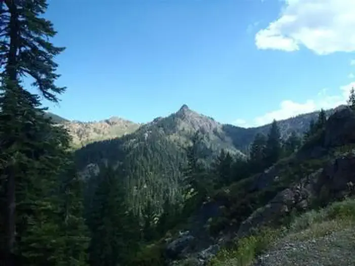
South Fork Ridge offers a steep and rewarding climb through the Noland Glacier area, gaining over 1,200 feet in just 2.4 miles. This challenging ascent rewards hikers with alpine views and access to high-elevation terrain in the Sierra Nevada region. The trail's significant elevation gain per mile makes it a strenuous workout best suited for experienced hikers.
South Fork Lakes
~1 min drive
Moderate 6-mile alpine lake hike with 2,421 ft elevation gain.
Hidden Lake
~2 min drive
Steady 1.75-mile climb to a scenic alpine lake with 854 ft elevation gain.
Trail Gulch
~4 min drive
Moderate 5.6-mile gulch hike with 1,931 ft elevation gain.
Middle Boulder
~6 min drive
Moderate 8.4-mile alpine trail with 2,415 ft elevation gain and scenic high-country views.
Slide Creek
~3 min drive
Easy waterfall hike along Slide Creek with minimal elevation gain.
Saloon Creek
~6 min drive
Moderate 5.4-mile creek-side hike with 1,796 ft elevation gain.
Granite Creek
~7 min drive
Moderate 9.2-mile Sierra foothills hike with 2,825 ft gain and granite creek views.
Fox Creek Lake
~4 min drive
Easy 2-mile hike to a scenic mountain lake with minimal elevation gain.
Milk Ranch
~6 min drive
Steady 4.77-mile climb with 1,946 ft gain through California foothills.
Chipmunk Meadow
~8 min drive
Moderate 10.65-mile alpine trail with 2,062 ft gain through forest and meadows.