Barton Flats
Campground
Campground · 0.2 mi from the trail
Closure in the area
There's a closure order in Mountaintop Ranger District. It doesn't name SANTA ANA RIVER TRAIL C SPUR, so check the source for the area it covers.
Radford Fire Closure Area
Agency closure covering Mountaintop Ranger District · Order 05-12-52-24-06 · USFS · Mountaintop Ranger District
Safety Alert - Falling Rocks at Bonita Falls
Agency alert covering San Bernardino National Forest · USFS · San Bernardino National Forest
Fire Restrictions
Agency alert covering San Bernardino National Forest · Order 05-12-00-26-05 · USFS · San Bernardino National Forest
As of · Source: USFS · Mountaintop Ranger District. Agencies don't list every closure — check before you go.
The Santa Ana River Trail C Spur is an easy, out-and-back hike of about 2 miles in the Mountaintop Ranger District of San Bernardino National Forest, managed by the Forest Service. The trail starts at roughly 6,390 feet and climbs to about 6,424 feet, with a total gain of 784 feet over the round trip. The steepest stretch comes at about 0.4 miles in, where the grade reaches 10 percent. The most comfortable months for a visit are late spring and early fall. Typical averages from the nearby Big Bear Lake weather station show May highs around 66°F and September highs around 73°F, with only a couple of wet days in each month. Winter is much colder, with highs in the mid-40s and lows near 24°F. Barton Flats campground sits just 0.2 miles away, and the Santa Ana River Trail D Spur is 0.3 miles off. Rio Monte is 0.6 miles away, and the Lobo Group campground is 0.8 miles away.
Barton Flats
Campground
 If it rainsBeyond My Ken, CC BY-SA 4.0 · Wikimedia Commons
Deep Creek Hot Springs
Hot spring
Natural hot springs located in San Bernardino National Forest, California, United States
Places © OpenStreetMap contributors, Places © Overture Maps Foundation · Photos: Beyond My Ken, CC BY-SA 4.0 (commons)
More in Lucerne Valley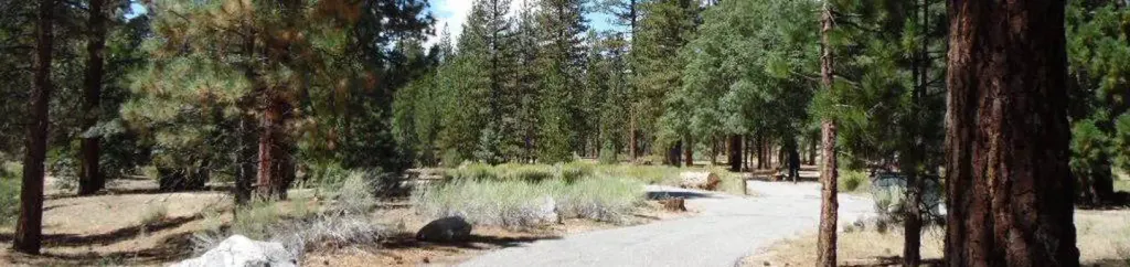 Barton FlatsCampingPhoto: Recreation.gov (RIDB) / public domain0.2 mi
 Santa Ana River Trail D SpurHikingPhoto: inkknife_2000 (7.5 million views +), CC BY-SA 2.0 (via Wikimedia Commons)0.3 mi
 San GorgonioSaltwater fishing0.4 miRio MonteHikingPhoto: inkknife_2000 (7.5 million views +), CC BY-SA 2.0 (via Wikimedia Commons)0.6 mi
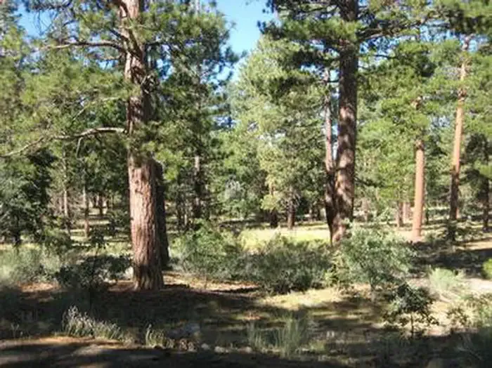 Lobo GroupCampingPhoto: Recreation.gov (RIDB) / public domain0.8 mi
Source: Roamze catalog (indexable pages within 10 miles, PostGIS distance)
Santa Ana River Trail D SpurHiking · Next doorPhoto: inkknife_2000 (7.5 million views +), CC BY-SA 2.0 (via Wikimedia Commons)Rio MonteHiking · Next doorPhoto: inkknife_2000 (7.5 million views +), CC BY-SA 2.0 (via Wikimedia Commons) FORSEE CREEKHiking · ~3 min drivePhoto: inkknife_2000 (7.5 million views +), CC BY-SA 2.0 (via Wikimedia Commons)
 Santa Ana River TrailHiking · ~5 min drivePhoto: inkknife_2000 (7.5 million views +), CC BY-SA 2.0 (via Wikimedia Commons)Jenks LakeHiking · ~1 min drivePhoto: inkknife_2000 (7.5 million views +), CC BY-SA 2.0 (via Wikimedia Commons)SANTA ANA RIVER TRAIL A SPURHiking · ~3 min drivePhoto: inkknife_2000 (7.5 million views +), CC BY-SA 2.0 (via Wikimedia Commons)
 Radford Truck TrailHiking · ~5 min drivePhoto: kallahar, CC BY 3.0 (via Wikimedia Commons)
 Jenks Lake TrailHiking · ~1 min drivePhoto: inkknife_2000 (7.5 million views +), CC BY-SA 2.0 (via Wikimedia Commons)
 South ForkHiking · ~3 min drivePhoto: simonov, CC BY-SA 2.0 (via Flickr)
Best months: May–October. Best months have typical highs of 55–85 °F, lows of 30 °F or warmer (32 °F where the station doesn't record snow), at most one snowy day and no more than 12 wet days.
Jan
46° / 24°
6 wet
Feb
46° / 24°
6 wet
Mar
51° / 27°
6 wet
Apr
57° / 31°
4 wet
May
66° / 37°
2 wet
Jun
75° / 43°
1 wet
Jul
80° / 50°
2 wet
Aug
79° / 49°
3 wet
Sep
73° / 44°
2 wet
Oct
63° / 35°
2 wet
Nov
53° / 28°
3 wet
Dec
46° / 24°
6 wet
Typical high / low (°F) and days with rain or snow, 1991–2020. Measured at Big Bear Lake, CA, 5.4 mi away at 6,753 ft. This station doesn't record snowfall. Source: NOAA NCEI U.S. Climate Normals 1991–2020.
