Phelan Loop
- 6.1 mi
- round trip
- 364 ft
- climb
- 4,803 ft
- high point
- Out and back
- route
- Apr–Oct
- best months
Is Phelan Loop open right now?
Alert in the area
The Forest Service lists 4 alerts for San Bernardino National Forest.
Safety Alert - Falling Rocks at Bonita Falls
Agency alert covering San Bernardino National Forest · USFS · San Bernardino National Forest
Upper Big Falls Area Closure
Agency alert covering Front Country Ranger District · Order 05-12-53-26-03 · USFS · Front Country Ranger District
Fire Restrictions
Agency alert covering San Bernardino National Forest · Order 05-12-00-26-05 · USFS · San Bernardino National Forest
Applewhite Picnic Area Closure
Agency alert covering Front Country Ranger District · Order 05-12-53-26-01 · USFS · Front Country Ranger District
As of · Source: USFS · San Bernardino National Forest. Agencies don't list every closure — check before you go.
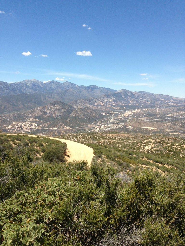
Phelan Loop is a 6.1-mile out-and-back hike in the Front Country Ranger District of San Bernardino National Forest in California, managed by the Forest Service. The trail rises from about 4,435 feet to a high point of 4,803 feet, with a total elevation gain of 364 feet. It is an accessible trail, and its natural surface makes it a straightforward route for a day on foot. The most comfortable months for a visit are typically late spring and early fall. Typical averages from a nearby weather station in Wrightwood show May highs around 69°F and September highs around 75°F, while winter highs sit in the upper 40s. That station sits about 1,200 feet higher than the trail's low point, so temperatures on the loop run warmer than those figures. Several other trails lie within a few miles, including Manzanita Wash Loop at 1.6 miles and Pinon Pine Trail at 2.6 miles. For an overnight stay, Guffy campground is about 7 miles away, and Mount San Antonio (Mt. Baldy) offers climbing roughly 8.7 miles off.
- Manzanita Wash LoopHiking1.6 mi
- Pinon Pine TrailHiking2.6 mi
 Baldy Mesa Ridge TrailHikingPhoto: Chanilim714, CC BY-SA 3.0 (via Wikimedia Commons)4.1 mi
- GuffyCamping7 mi
- LupineCamping8 mi
- Blue RidgeCamping8.5 mi
- Mount San Antonio (Mt. Baldy)Rock climbing8.7 mi
- Other RoutesRock climbing8.8 mi
Source: Roamze catalog (indexable pages within 10 miles, PostGIS distance)
- Baldy Mesa Ridge TrailHiking · ~7 min drivePhoto: Chanilim714, CC BY-SA 3.0 (via Wikimedia Commons)
 Mormon Rocks Interpretive Tr.Hiking · ~8 min drivePhoto: Hear2heaL, CC BY-SA 3.0 (via Wikimedia Commons)
 Devils Backbone TrailHiking · ~14 min drivePhoto: inkknife_2000 (7.5 million views +), CC BY-SA 2.0 (via Wikimedia Commons)
 North Devils BackboneHiking · ~11 min drivePhoto: On^ste82, CC BY 3.0 (via Wikimedia Commons)
 Summit TrailHiking · ~13 min drivePhoto: InSapphoWeTrust from Los Angeles, California, USA, CC BY-SA 2.0 (via Wikimedia Commons)
 Cleghorn Ridge TrailHiking · ~14 min drivePhoto: GSEC, CC BY 2.0 (via Flickr)
- Three T'sHiking · ~15 min drivePhoto: inkknife_2000 (7.5 million views +), CC BY-SA 2.0 (via Wikimedia Commons)
 Cleghorn Ridge TrailHiking · ~13 min drivePhoto: Stiggs13, CC BY 2.0 (via Flickr)
 Three Ts TrailHiking · ~14 min drivePhoto: inkknife_2000 (7.5 million views +), CC BY-SA 2.0 (via Wikimedia Commons)
 Middlefork - WildernessHiking · ~15 min drivePhoto: joedecruyenaere on Flickr, CC BY-SA 2.0 (via Wikimedia Commons)
Also worth it near here
- Rim of the World Scenic BywayScenic drive · ~8 min drive
- PCT Wright Mt to Inspiration PMountain biking · ~13 min drivePhoto: On^ste82, CC BY 3.0 (via Wikimedia Commons)
 Mountain HighDownhill skiing · ~14 min drivePhoto: Mtf612 at English Wikipedia, Public domain (via Wikimedia Commons)
- Table Mountain (angeles)Camping · ~15 min drive
Best time to visit Phelan Loop
Best months: April–October. Best months have typical highs of 55–85 °F, lows of 30 °F or warmer (32 °F where the station doesn't record snow), at most one snowy day and no more than 12 wet days.
Jan
48° / 26°
5 wet
Feb
48° / 25°
8 wet
Mar
54° / 29°
6 wet
Apr
60° / 32°
4 wet
May
69° / 39°
2 wet
Jun
78° / 44°
1 wet
Jul
83° / 53°
2 wet
Aug
82° / 51°
2 wet
Sep
75° / 46°
2 wet
Oct
64° / 37°
3 wet
Nov
55° / 29°
4 wet
Dec
47° / 25°
5 wet
Typical high / low (°F) and days with rain or snow, 1991–2020. Measured at Wrightwood, CA, 5.7 mi away at 6,000 ft. The station sits about 1,200 ft higher than this place, so expect it a little warmer here. This station doesn't record snowfall. Source: NOAA NCEI U.S. Climate Normals 1991–2020.
