Oregon Redwoods - Barrier Free
- 1.1 mi
- round trip
- 49 ft
- climb
- 1,127 ft
- high point
- Out and back
- route
- May–Oct
- best months
Is Oregon Redwoods - Barrier Free open right now?
Closure in the area
There's a closure order in Gold Beach Ranger District. It doesn't name Oregon Redwoods - Barrier Free, so check the source for the area it covers.
Moon Complex Fire Closure
Agency closure covering Gold Beach Ranger District · Order 06-10-28-26-05 · USFS · Gold Beach Ranger District
As of · Source: USFS · Gold Beach Ranger District. Agencies don't list every closure — check before you go.
The Oregon Redwoods - Barrier Free trail is an accessible, easy walk on gravel, about a mile long, in the Gold Beach Ranger District of the Rogue River-Siskiyou National Forests in southwest Oregon. The Forest Service manages the land, and the trail is open from June through October. The route is an out-and-back, with a high point of about 1,127 feet and a low of about 1,045 feet, so the climb is a small one of about 49 feet. Bikes and horses are not allowed on this trail. Summer is the most comfortable time to go. Typical averages from a nearby weather station in Brookings, which sits well below the trail, show July and August highs around 67 to 69°F with only four wet days a month. Winter brings highs in the mid-50s and rain on most days. Nearby, the Oregon Redwoods - Hiking trail is about 0.3 miles away. The Winchuck River, Ludlum Campground and Ludlum House are all within about 3 miles.
Local outfitters
- Turtle Rock RV Resort30 mi away
- John Carl Guide Service38 mi away
Not on Roamze yet. Their page has how to reach them.
 Oregon Redwoods - HikingHikingPhoto: Forest Service Pacific Northwest Region, Public Domain Mark (via Flickr)0.3 mi
 Winchuck RiverCanoeingPhoto: United States Forest Service, Public domain (via Wikimedia Commons)1 mi
- Ludlum CampgroundCamping2.8 mi
- Ludlum HouseCamping2.8 mi
- Bear CreekCanoeing3.2 mi
- Rowdy CreekCanoeing5.1 mi
- Japanese Bombing SiteHiking5.2 mi
 Riverview Nature TrailHikingPhoto: Rick Obst, CC BY 2.0 (via Flickr)7.5 mi
Source: Roamze catalog (indexable pages within 10 miles, PostGIS distance)
- Riverview Nature TrailHiking · ~13 min drivePhoto: Rick Obst, CC BY 2.0 (via Flickr)
 SourdoughHiking · ~15 min drivePhoto: Northwest Rafting Company, CC BY 2.0 (via Flickr)
 North Fork Smith RiverHiking · ~19 min drivePhoto: Northwest Rafting Company, CC BY 2.0 (via Flickr)
- Lieffer Loop TrailHiking · ~23 min drive
 Red MountainHiking · ~23 min drivePhoto: U.S. Forest Service- Pacific Northwest Region, Public domain (via Wikimedia Commons)
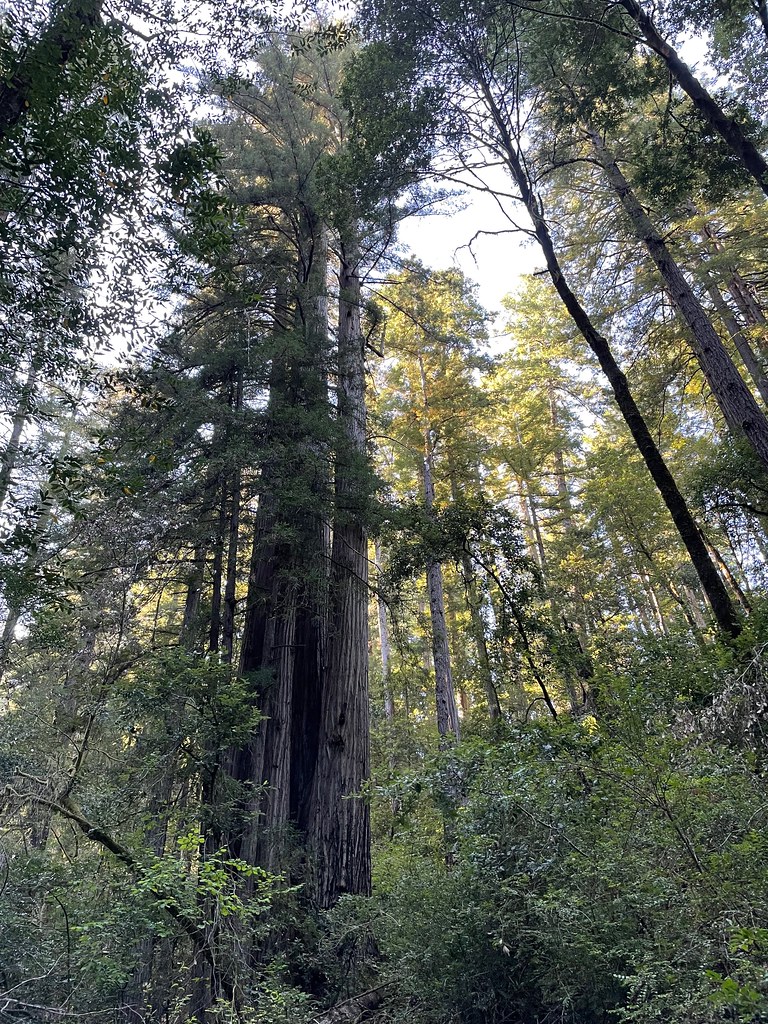 Redwood NatureHiking · ~14 min drivePhoto: bsterling, CC BY-SA 2.0 (via Flickr)
 Hatton TrailHiking · ~24 min drivePhoto: Ken Lund, CC BY-SA 2.0 (via Flickr)
 Chetco DivideHiking · ~24 min drivePhoto: Forest Service Pacific Northwest Region, Public Domain Mark (via Flickr)
 Ellsworth Loop TrailHiking · ~23 min drivePhoto: Ken Lund, CC BY-SA 2.0 (via Flickr)
- Vulcan PeakHiking · ~24 min drivePhoto: Forest Service Pacific Northwest Region, Public Domain Mark (via Flickr)
Also worth it near here
- Winchuck RiverCanoeing · ~2 min drivePhoto: United States Forest Service, Public domain (via Wikimedia Commons)
- Clifford Kamph Memorial ParkBeach · ~6 min drive
 Mount EmilySummit · ~11 min drivePhoto: Visitor7, CC BY-SA 3.0 (via Wikimedia Commons)
 Alfred A. LoebCamping · ~13 min drivePhoto: Rick Obst — CC BY 2.0 (via Flickr)
Best time to visit Oregon Redwoods - Barrier Free
Best months: May–October. Best months have typical highs of 55–85 °F, lows of 30 °F or warmer (32 °F where the station doesn't record snow), at most one snowy day and no more than 12 wet days.
Jan
56° / 42°
19 wet
Feb
57° / 43°
17 wet
Mar
58° / 43°
17 wet
Apr
59° / 44°
15 wet
May
63° / 47°
11 wet
Jun
68° / 50°
6 wet
Jul
69° / 52°
4 wet
Aug
67° / 53°
4 wet
Sep
68° / 51°
5 wet
Oct
65° / 48°
10 wet
Nov
58° / 45°
18 wet
Dec
57° / 42°
19 wet
Typical high / low (°F) and days with rain or snow, 1991–2020. Measured at Brookings 2 Se, OR, 5.3 mi away at 50 ft. The station sits about 1,100 ft lower than this place, so expect it a little cooler here. This station doesn't record snowfall. Source: NOAA NCEI U.S. Climate Normals 1991–2020.
Closures we've recorded since August 2026
Stage 2 Public Use Fire Restrictions (Forest-wide)
Rogue River-Siskiyou National Forests · Order dated September 4, 2026; seen Sep 3, 2026 → lifted Oct 28, 2026 · Forest Service
Stage 3 Public Use Fire Restrictions (Forest-wide)
Rogue River-Siskiyou National Forests · Order dated July 17, 2026; seen Aug 23, 2026 → lifted Sep 3, 2026 · Forest Service
