Lieffer Loop Trail
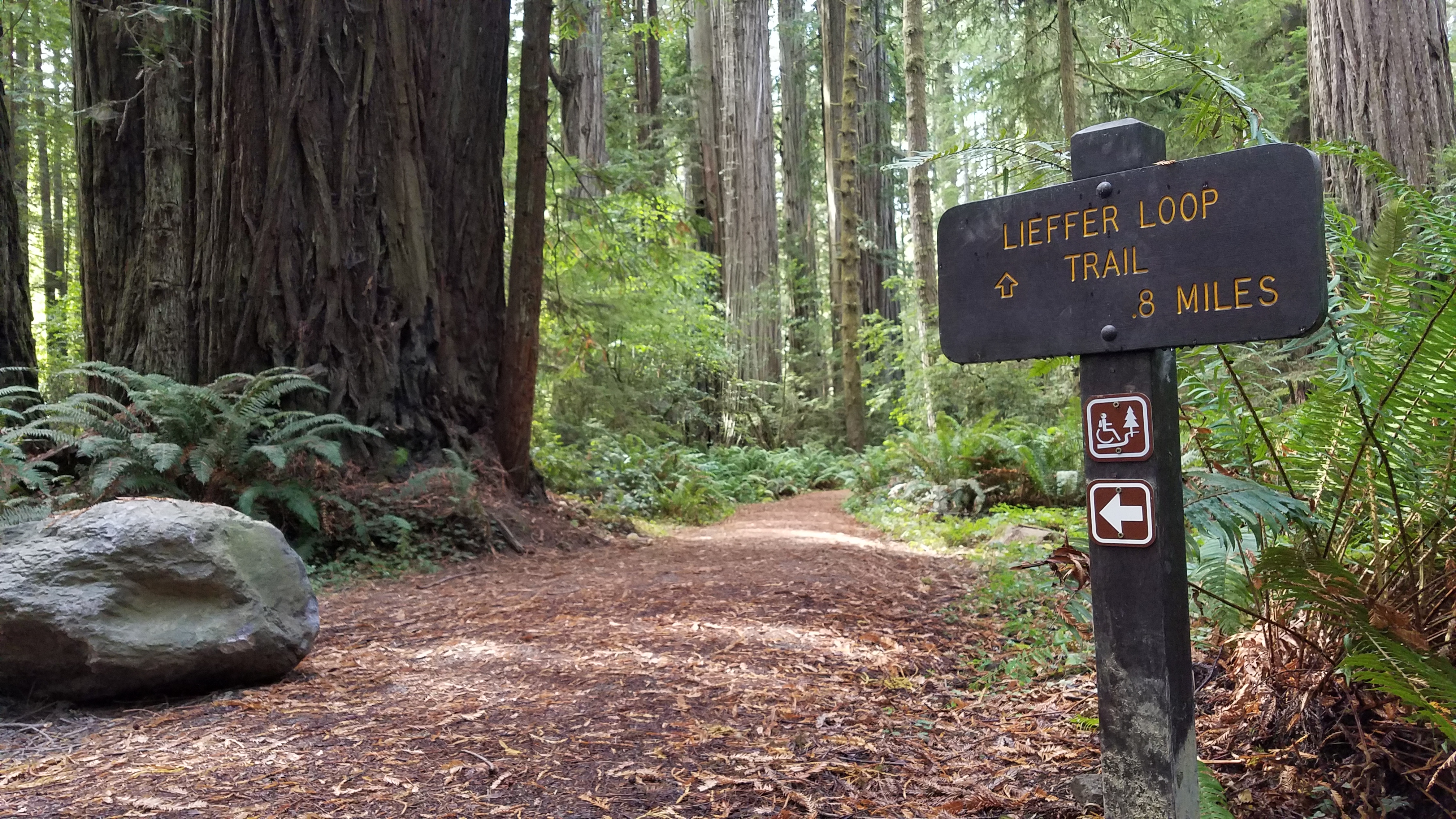 Photo: NPS Photo / B. Marciniec.
- Loop
- route
- May–Oct
- best months
Clear at last check
Weather is good · OpenWeather · checked 17 h ago
Is Lieffer Loop Trail open right now?
Closure in the area
There's a closure order in Redwood National Park. It doesn't name Lieffer Loop Trail, so check the source for the area it covers.
Closure: Lady Bird Johnson Grove Parking Lot
Park closure covering Redwood National Park · NPS · Redwood National Park
Prescribed Fire in the Bald Hills Area
Park alert covering Redwood National Park · NPS · Redwood National Park
Delays along Highway 101
Park alert covering Redwood National Park · NPS · Redwood National Park
As of · Source: NPS · Redwood National Park. Agencies don't list every closure — check before you go.
The Lieffer Loop trail offers a walk for those searching for a shorter trail with elevation changes of 150 feet. A section of the Lieffer Trail is wheelchair accessible. Found in Jedediah Smith Redwoods State Park, this 1.5-mile trail is far enough away from Highway 199 that the sounds of vehicle traffic are unheard. Hikers will pass living redwoods with scars and large hollows created by fires of the past. Ferns, nurse logs, berry bushes, and a variety of forest features are found here. Benches can be found along the trail that allow hikers to rest and marvel the beauty and resiliency of the forest. Two trailhead along Walker Road give you access to the Lieffer Loop. You can access both the trailheads by taking the Walker Road turnoff on HWY 199 - this is a sharp turn to the north. One trailhead is about 0.5 miles from the intersection of Highway 199. The other trailhead is located 0.75 miles (1/2 km) farther. The 0.75 mile section between the two trailheads is wheelchair accessible. Be sure to note which trailhead your vehicle is parked at, so you will end your hike at the correct location. There is no suitable parking anywhere here for recreational vehicles, camper vans, or vehicles with trailers. Safety Tips • We recommend you purchase and use a good map and trail guide for your adventures in Redwood National and State Parks. Don’t rely on online maps when you are here. • To protect the habitats, leave no trace also means staying on the developed trail. Please don’t go off-trail and make any new trails. These forests grow by the inch, and will die by your foot. • To protect the wildlife (and you and other visitors), pets are not allowed on park trails. • Cell coverage is very limited and cannot be relied on in an emergency. Have a plan for checking in and checking out with a friend when you are here.
Local outfitters
- Turtle Rock RV Resort42 mi away
Not on Roamze yet. Their page has how to reach them.
Best time to go · May–Oct
Best time to visit Lieffer Loop Trail
Best months: May–October. Best months have typical highs of 55–85 °F, lows of 30 °F or warmer (32 °F where the station doesn't record snow), at most one snowy day and no more than 12 wet days.
Jan
54° / 40°
16 wet
Feb
55° / 40°
14 wet
Mar
56° / 41°
16 wet
Apr
58° / 43°
13 wet
May
61° / 46°
9 wet
Jun
63° / 48°
5 wet
Jul
65° / 51°
3 wet
Aug
66° / 52°
3 wet
Sep
66° / 48°
4 wet
Oct
62° / 46°
9 wet
Nov
57° / 42°
15 wet
Dec
53° / 39°
17 wet
Typical high / low (°F) and days with rain or snow, 1991–2020. Measured at Crescent City 3 Nnw, CA, 5.5 mi away at 43 ft. Source: NOAA NCEI U.S. Climate Normals 1991–2020.
Keep exploring — more trails worth the drive
 Photo: Ken Lund, CC BY-SA 2.0 (via Flickr)
Ellsworth Loop Trail
Next door
0.51-mile loop trail in California with 95 ft elevation gain.
 Photo: Ken Lund, CC BY-SA 2.0 (via Flickr)
Hatton Trail
~1 min drive
2.38-mile out-and-back trail in California with 1,892 ft elevation gain
 Photo: Ken Lund, CC BY-SA 2.0 (via Flickr)
Craigs Creek Trail
~6 min drive
7.45-mile out-and-back hike in California with 2,304 ft elevation gain.
HIKE
Simpson-Reed Grove
Next door
A Beautiful and Flat Trail In The North If you are driving on HWY199 between Crescent City and Hiouchi, this easy and level walk is a good option for those short on time, or energy. The loop trail is 0.8 mile (1/2 km) long. Be aware that there is no parking for recreational…
 Photo: Tori Sloane, CC BY-SA 3.0 (via Wikimedia Commons)
Mill Creek Trail
~4 min drive
3.8-mile out-and-back hike in California with 1,149 ft of elevation gain.
HIKE
Hiouchi Trail
~3 min drive
2.26-mile out-and-back hike in California with 2,534 ft gain
Photo: Ken Lund, CC BY-SA 2.0 (via Flickr)Hatton Trail
Next door
0.84-mile out-and-back trail in California with 320 ft elevation gain.
 Photo: Šarūnas Burdulis from USA, CC BY-SA 2.0 (via Wikimedia Commons)
Boy Scout Tree Trail
~5 min drive
2.14-mile out-and-back trail in California with 1,258 ft gain and 427 ft max elevation.
 Photo: Ken Lund, CC BY-SA 2.0 (via Flickr)
Adams Trail
~1 min drive
0.76-mile out-and-back trail in California with 42 ft of elevation gain.
 Photo: Tori Sloane, CC BY-SA 3.0 (via Wikimedia Commons)
Mill Creek Horse Trail (North)
~7 min drive
6.22-mile out-and-back trail in California with 1,771 ft elevation gain and loss.

