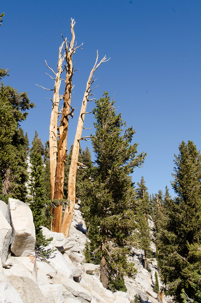
Muir Lake
 Photo: Matt Lavin, CC BY-SA 2.0 (via Flickr)
- 1.2 mi
- round trip
- 134 ft
- climb
- 11,157 ft
- high point
- Out and back
- route
Is Muir Lake open right now?
Alert in the area
The Forest Service lists 3 alerts for Inyo National Forest.
Help Halt Golden Mussel Invasion
Agency alert covering Inyo National Forest · USFS · Inyo National Forest
Ansel Adams and John Muir Wilderness Campfire Restrictions
Agency alert covering Inyo National Forest · Order 05-04-50-25-04 · USFS · Inyo National Forest
Golden Trout and Hoover Wilderness Campfire Restrictions
Agency alert covering Inyo National Forest · Order 05-04-50-25-05 · USFS · Inyo National Forest
As of · Source: USFS · Inyo National Forest. Agencies don't list every closure — check before you go.
Muir Lake is a short, easy hike in California's John Muir Wilderness, within the Mt. Whitney Ranger District of Inyo National Forest. The trail is about 1.2 miles long, with a one-way elevation gain of 134 feet, and it is an out-and-back route that starts and ends at roughly the same point. The trail is natural-surface and not accessible. Horses are allowed, but bikes are not. The Forest Service manages the land, and the trail is open year-round. The hike sits close to several other destinations. Cottonwood Lakes, a mountain biking area, is about 0.1 mile away, and the Cottonwood Lakes Cutoff #1 and #2 hikes are within a mile. Lone Pine Area, a climbing area, is about 1.9 miles off.
Local outfitters
- Big Willi Mountaineering Company11 mi away
- Glacier Lodge45 mi away
Not on Roamze yet. Their page has how to reach them.
 Cottonwood LakesMountain bikingPhoto: Marty B, CC BY-SA 4.0 (via Wikimedia Commons)0.1 mi
- Cottonwood Lakes Cutoff #1HikingPhoto: Matt Lavin, CC BY-SA 2.0 (via Flickr)0.3 mi
 Cottonwood Lakes Cutoff #2HikingPhoto: Matt Lavin, CC BY-SA 2.0 (via Flickr)0.6 mi
 Lone Pine AreaRock climbingPhoto: Jesse Wagstaff, CC BY 2.0 (via Flickr)1.9 mi
- Cottonwood Lakes Walk In CampgroundCamping3.3 mi
- Cottonwood Pass Walk In CampgroundCamping3.7 mi
 Lone Pine PeakRock climbingPhoto: jfdervin, CC BY-SA 2.0 (via Flickr)4.9 mi
 Whitney & Surrounding PeaksRock climbingPhoto: GSEC, CC BY 2.0 (via Flickr)6.4 mi
Source: Roamze catalog (indexable pages within 10 miles, PostGIS distance)
- Cottonwood Lakes Cutoff #1Hiking · Next doorPhoto: Matt Lavin, CC BY-SA 2.0 (via Flickr)
- South Fork Cottonwood CreekHiking · ~2 min drivePhoto: Jesse Wagstaff, CC BY 2.0 (via Flickr)
 Little Cottonwood CreekHiking · ~3 min drivePhoto: kalestews, CC BY 2.0 (via Flickr)
 Cottonwood Pass TrailHiking · ~5 min drivePhoto: danhurt, CC BY-SA 2.0 (via Flickr)
- Cottonwood Lakes Cutoff #2Hiking · ~1 min drivePhoto: Matt Lavin, CC BY-SA 2.0 (via Flickr)
 Mulkey Pass TrailHiking · ~7 min drivePhoto: danhurt, CC BY-SA 2.0 (via Flickr)
 Soldier LakeHiking · ~7 min drivePhoto: NPS staff, Public domain (via Wikimedia Commons)
- Mount NewcombHiking · ~6 min drivePhoto: danhurt, CC BY-SA 2.0 (via Flickr)
 Cirque LakeHiking · ~1 min drivePhoto: Jesse Wagstaff, CC BY 2.0 (via Flickr)
 Cottonwood PassHiking · ~7 min drivePhoto: Jesse Wagstaff, CC BY 2.0 (via Flickr)
Also worth it near here
- Cottonwood LakesMountain biking · Next doorPhoto: Marty B, CC BY-SA 4.0 (via Wikimedia Commons)
- High LakeLake fishing · ~3 min drive
 Mount LangleySummit · ~5 min drivePhoto: Timwryan (talk · contribs), CC BY-SA 4.0 (via Wikimedia Commons)
- Lone Pine PeakRock climbing · ~8 min drivePhoto: jfdervin, CC BY-SA 2.0 (via Flickr)
