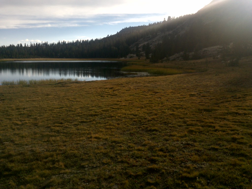
Hobbler Lake
 Photo: Kurt Minard, CC BY-SA 3.0 (via Wikimedia Commons)
- 3.5 mi
- round trip
- 293 ft
- climb
- 9,016 ft
- high point
- Out and back
- route
- May–Sep
- best months
Is Hobbler Lake open right now?
Closure in the area
There's a closure order in Sierra National Forest. It doesn't name Hobbler Lake, so check the source for the area it covers (3 listed).
Safety Tips for Burned Areas: Garnet Fire Area
Agency closure covering Sierra National Forest · USFS · Sierra National Forest
Wilderness Food and Refuse Storage
Agency closure covering Sierra National Forest · Order 05-15-00-26-03 · USFS · Sierra National Forest
Food and Refuse Storage
Agency closure covering Sierra National Forest · Order 05-15-00-26-02 · USFS · Sierra National Forest
Forest Order removes Fish Camp, Soda Springs, and Little Jackass from closure list
Agency alert covering Sierra National Forest · Order 05-15-00-26-11 · USFS · Sierra National Forest
Ansel Adams and John Muir Wilderness Campfire Restrictions
Agency alert covering Sierra National Forest · Order 05-15-00-26-09 · USFS · Sierra National Forest
As of · Source: USFS · Sierra National Forest. Agencies don't list every closure — check before you go.
Hobbler Lake is a 3.5-mile out-and-back hike in California's John Muir Wilderness, within the High Sierra Ranger District of Sierra National Forest. The trail rises about 290 feet from a low point of 8,724 feet to a high of 9,016 feet, and it is rated moderate. The Forest Service manages the land, and the route is natural-surfaced, with horses allowed and bikes not. Summer is the most comfortable time to go. Typical averages from a nearby weather station at Mammoth Lakes show July highs around 78°F with lows near 49°F, while winter highs sit around 41°F. That station sits roughly 1,200 feet lower than the trail's high point, so temperatures on the hike run cooler. The trip is open year-round. Voyager Rock campground is about 1.6 miles away, and the Blackcap Trail starts about 0.6 miles off. Climbers can head to Dusy Dome, about 2.6 miles away, and paddlers to Post Corral Creek, about 2.4 miles away.
 Blackcap TrailHikingPhoto: Kurt Minard, CC BY-SA 3.0 (via Wikimedia Commons)0.6 mi
- Voyager RockCamping1.6 mi
- FrazierHikingPhoto: Kurt Minard, CC BY-SA 3.0 (via Wikimedia Commons)1.8 mi
- Frazier TrailHiking2.1 mi
- Post Corral CreekCanoeing2.4 mi
- Dusy DomeRock climbing2.6 mi
- Spring DomeRock climbing2.7 mi
- Helms CreekCanoeing3.2 mi
Source: Roamze catalog (indexable pages within 10 miles, PostGIS distance)
- Blackcap TrailHiking · Next doorPhoto: Kurt Minard, CC BY-SA 3.0 (via Wikimedia Commons)
 Hell for Sure TrailHiking · ~4 min drivePhoto: jason.c.hansen, CC BY 2.0 (via Flickr)
 Burnt CorralHiking · ~8 min drivePhoto: Tom Hilton, CC BY 2.0 (via Flickr)
 Rae LakeHiking · ~10 min drivePhoto: jason.c.hansen, CC BY 2.0 (via Flickr)
- Dinkey Lakes TrailHiking · ~6 min drive
 Hot Springs Pass TrailHiking · ~12 min drivePhoto: Tom Hilton, CC BY 2.0 (via Flickr)
 Reddys HoleHiking · ~8 min drivePhoto: Tom Hilton, CC BY 2.0 (via Flickr)
- Hell for SureHiking · ~10 min drivePhoto: jason.c.hansen, CC BY 2.0 (via Flickr)
- FrazierHiking · ~3 min drivePhoto: Kurt Minard, CC BY-SA 3.0 (via Wikimedia Commons)
- Hot Springs PassHiking · ~13 min drivePhoto: Tom Hilton, CC BY 2.0 (via Flickr)
Best time to visit Hobbler Lake
Best months: May–September. Best months have typical highs of 55–85 °F, lows of 30 °F or warmer (32 °F where the station doesn't record snow), at most one snowy day and no more than 12 wet days.
Jan
41° / 17°
Feb
41° / 18°
Mar
45° / 22°
Apr
51° / 27°
May
60° / 35°
Jun
70° / 42°
Jul
78° / 49°
Aug
77° / 47°
Sep
71° / 40°
Oct
61° / 30°
Nov
49° / 23°
Dec
41° / 17°
Typical high / low (°F) and days with rain or snow, 1991–2020. Measured at Mammoth Lakes Rs, CA, 36.2 mi away at 7,804 ft. The station sits about 1,200 ft lower than this place, so expect it a little cooler here. This station doesn't record snowfall. Source: NOAA NCEI U.S. Climate Normals 1991–2020.
