Rae Lake
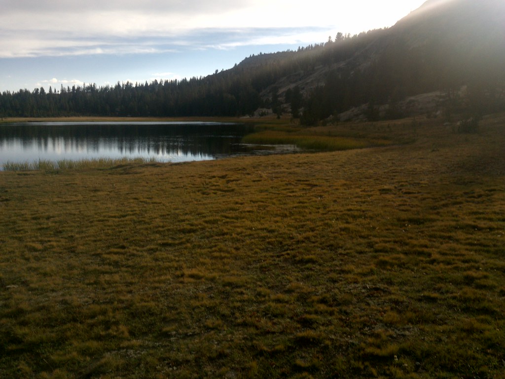 Photo: jason.c.hansen, CC BY 2.0 (via Flickr)
- 0.5 mi
- round trip
- 35 ft
- climb
- 9,931 ft
- high point
- Out and back
- route
Is Rae Lake open right now?
Closure in the area
There's a closure order in Sierra National Forest. It doesn't name Rae Lake, so check the source for the area it covers (3 listed).
Safety Tips for Burned Areas: Garnet Fire Area
Agency closure covering Sierra National Forest · USFS · Sierra National Forest
Wilderness Food and Refuse Storage
Agency closure covering Sierra National Forest · Order 05-15-00-26-03 · USFS · Sierra National Forest
Food and Refuse Storage
Agency closure covering Sierra National Forest · Order 05-15-00-26-02 · USFS · Sierra National Forest
Forest Order removes Fish Camp, Soda Springs, and Little Jackass from closure list
Agency alert covering Sierra National Forest · Order 05-15-00-26-11 · USFS · Sierra National Forest
Ansel Adams and John Muir Wilderness Campfire Restrictions
Agency alert covering Sierra National Forest · Order 05-15-00-26-09 · USFS · Sierra National Forest
As of · Source: USFS · Sierra National Forest. Agencies don't list every closure — check before you go.
Rae Lake is a short, easy hike in California's John Muir Wilderness, within the High Sierra Ranger District of Sierra National Forest. The trail is about half a mile long, with a total elevation gain of about 35 feet, and it makes an out-and-back trip from the low point at 9,865 feet to the high point at 9,931 feet. The Forest Service manages the land, and the route is natural-surfaced, so it works well for horses and is not accessible. The trail is open year-round, and it is not a place for bikes. The surrounding wilderness makes it a compact outing rather than a long day on foot, and the climb is gentle enough to fit easily into a longer trip in the area. Several other destinations sit close by. Mosquito Pass is about 0.2 miles away, and Hell for Sure is about 0.3 miles away. Dale Lake is about 0.6 miles off, and Voyager Rock campground is about 7 miles away.
Local outfitters
- Bishop Pack Outfitters14 mi away
- Rainbow Pack Outfitters16 mi away
Not on Roamze yet. Their page has how to reach them.
Keep exploring — more trails worth the drive
Photo: jason.c.hansen, CC BY 2.0 (via Flickr)Mosquito Pass
Next door
5.16-mile out-and-back trail in California with 878 ft elevation gain.
Photo: jason.c.hansen, CC BY 2.0 (via Flickr)Hell for Sure
Next door
2.00-mile out-and-back trail in California with 357 ft of elevation gain.
 Photo: TyB, CC BY 2.0 (via Flickr)
Piute Canyon
~9 min drive
22.46-mile out-and-back trail in California with 3,685 ft elevation gain.
 Photo: Kurt Minard, CC BY-SA 3.0 (via Wikimedia Commons)
Blackcap Trail
~10 min drive
25.84-mile out-and-back hike in California with 3,103 ft elevation gain and loss.
 Photo: jason.c.hansen, CC BY 2.0 (via Flickr)
Hell for Sure Pass
~4 min drive
3.70-mile out-and-back trail in California's National Park Service area, 1,869 ft gain.
Photo: jason.c.hansen, CC BY 2.0 (via Flickr)Dale Lake
~1 min drive
Dale Lake is a 1.16-mile out-and-back trail in California with 273 feet of elevation gain.
Photo: TyB, CC BY 2.0 (via Flickr)PCT: Sonora Pass - Carson Pass - Nevada
~9 min drive
86.33-mile point-to-point PCT section from Sonora Pass to Nevada with 16,969 ft gain
 Photo: TyB, CC BY 2.0 (via Flickr)
Lamarck Col
~13 min drive
3.54-mile out-and-back trail in California with 2,252 ft gain and 12,924 ft max elevation.
 Photo: jason.c.hansen, CC BY 2.0 (via Flickr)
Hell for Sure Trail
~6 min drive
9.22-mile out-and-back hike in California with 2,032 ft elevation gain and loss.
 Photo: TyB, CC BY 2.0 (via Flickr)
Evolution Creek Alternate Crossing
~8 min drive
1.14-mile out-and-back trail at Evolution Creek Alternate Crossing in California.

