Grouse Lake
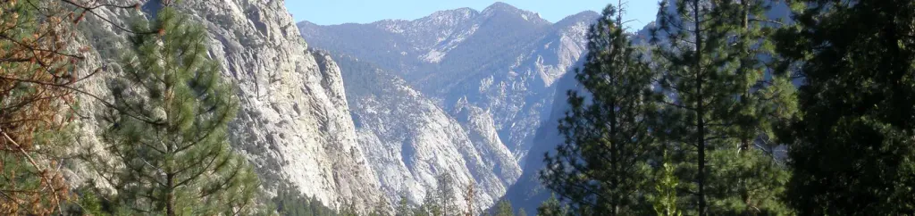
 Photo: Tom Hilton, CC BY 2.0 (via Flickr)
- 0.6 mi
- round trip
- 194 ft
- climb
- 10,458 ft
- high point
- Out and back
- route
Is Grouse Lake open right now?
No closures listed
The National Park Service lists no closures for Kings Canyon National Park.
As of · Source: NPS · Kings Canyon National Park. Agencies don't list every closure — check before you go.
Grouse Lake is a short, easy hike in Kings Canyon National Park, part of the Sequoia-Kings Canyon Wilderness in California. The National Park Service manages the land. The trail is about 1.3 miles out and back, with a low point around 10,239 feet and a high of about 10,458 feet, a climb of roughly 200 feet one way. The route sits within the wilderness, so the surrounding area falls under the same protections and rules as the rest of the Sequoia-Kings Canyon Wilderness. Granite Basin and the Grouse Lake Trail both start within about a tenth of a mile, so it pairs easily with those outings. Farther afield, the Upper Copper Creek Switchbacks lie about 1.5 miles away, and Canyon View Group Sites offers camping about 5.8 miles off.
Local outfitters
- Glacier Lodge21 mi away
- Rainbow Pack Outfitters23 mi away
Not on Roamze yet. Their page has how to reach them.
- Granite BasinHikingPhoto: Tom Hilton, CC BY 2.0 (via Flickr)0.1 mi
- Grouse Lake TrailHikingPhoto: Tom Hilton, CC BY 2.0 (via Flickr)0.1 mi
 Upper Copper Creek SwitchbacksHikingPhoto: Tom Hilton, CC BY 2.0 (via Flickr)1.5 mi
- Northwest LotRock climbing3.6 mi
 North BeachRock climbingPhoto: Tom Hilton, CC BY 2.0 (via Flickr)3.6 mi
 Canyon View Group SitesCampingPhoto: Recreation.gov (RIDB) / public domain5.8 mi
 South Fork Kings RiverCanoeingPhoto: Daniel Mayer (mav), CC BY-SA 3.0 (via Wikimedia Commons)5.8 mi
- Sentinel CampgroundSaltwater fishing5.9 mi
Source: Roamze catalog (indexable pages within 10 miles, PostGIS distance)
- Granite BasinHiking · Next doorPhoto: Tom Hilton, CC BY 2.0 (via Flickr)
- Upper Copper Creek SwitchbacksHiking · ~3 min drivePhoto: Tom Hilton, CC BY 2.0 (via Flickr)
- Copper CreekHiking · ~6 min drive
 Lower Copper Creek SwitchbacksHiking · ~6 min drivePhoto: lewinb, CC BY-SA 2.0 (via Flickr)
 Gardiner Basin TrailHiking · ~12 min drivePhoto: Kurt Minard, CC BY-SA 3.0 (via Wikimedia Commons)
- Grouse Lake TrailHiking · Next doorPhoto: Tom Hilton, CC BY 2.0 (via Flickr)
 Granite LakeHiking · ~3 min drivePhoto: Tom Hilton, CC BY 2.0 (via Wikimedia Commons)
- Mist FallsHiking · ~6 min drive
- Don Cecil TrailheadHiking · ~10 min drive
 Cedar Grove Roads End - Sand Flats StockHiking · ~6 min drivePhoto: Melofors, CC BY-SA 4.0 (via Wikimedia Commons)

