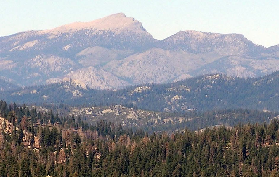
Deer Mountain
- 3.1 mi
- round trip
- 375 ft
- climb
- 7,897 ft
- high point
- Out and back
- route
- Jun–Oct
- best months
Is Deer Mountain open right now?
Closure in the area
There's a closure order in Sequoia National Forest. It doesn't name Deer Mountain, so check the source for the area it covers (2 listed).
Tule River Glass Container Prohibition Area
Agency closure covering Sequoia National Forest · Order 0513-26-02 · USFS · Sequoia National Forest
Trail of 100 Giants Boardwalk and Area Closure
Agency closure covering Sequoia National Forest · Order 0513-26-03 · USFS · Sequoia National Forest
PUBLIC NUDITY PROHIBITION - Sequoia National Forest
Agency alert covering Sequoia National Forest · Order 0513-26-06 · USFS · Sequoia National Forest
Chico Flat Dispersed Camping Area Prohibition 26-27
Agency alert covering Sequoia National Forest · Order 0513-26-09 · USFS · Sequoia National Forest
Wildlife Alert - BEARS
Agency alert covering Sequoia National Forest · USFS · Sequoia National Forest
As of · Source: USFS · Sequoia National Forest. Agencies don't list every closure — check before you go.
Deer Mountain is a 3.08-mile out-and-back hike in the South Sierra Wilderness, part of the Kern River Ranger District of Sequoia National Forest. The Forest Service manages the land, and the trail is rated moderate. The route rises about 375 feet from a low point of 7,625 feet to a high of 7,897 feet, with the Pacific Crest Trail passing within 0.2 miles of the start. Summer is the most comfortable time to go. Typical averages from the Lodgepole weather station, about 45 miles away at 6,735 feet, show July and August highs around 76°F with only two wet days a month. That station sits well below the trail, so temperatures on the mountain run cooler. The Deer Mountain Trail lies about 1.9 miles away, and Honey Bee and Lost Meadow are within 3 miles. For an overnight base, Kennedy Meadows Campground is about 9 miles off.
Local outfitters
- Big Willi Mountaineering Company29 mi away
Not on Roamze yet. Their page has how to reach them.
- Pacific Crest TrailHiking0.2 mi
- Deer Mountain TrailHiking1.9 mi
- Honey BeeHiking2.4 mi
- Lost MeadowHiking2.7 mi
- Kennedy Meadows CampgroundCamping8.8 mi
- Fish CreekCamping9.4 mi
- Fish Creek RockRock climbing9.6 mi
- Troy Meadow CampgroundCamping10 mi
Source: Roamze catalog (indexable pages within 10 miles, PostGIS distance)
 Albanita TrailHiking · ~10 min drivePhoto: Moo.The.Cow, CC BY 2.0 (via Flickr)
- Jackass Peak TrailHiking · ~10 min drivePhoto: Moo.The.Cow, CC BY 2.0 (via Flickr)
 Blackrock Mountain TrailHiking · ~10 min drivePhoto: Moo.The.Cow, CC BY 2.0 (via Flickr)
- Deer Mountain TrailHiking · ~3 min drive
 Soda CreekHiking · ~10 min drivePhoto: Paul Mono, CC BY-SA 3.0 (via Wikimedia Commons)
- Honey BeeHiking · ~4 min drive
- Pacific Crest TrailHiking · Next door
- Olancha Pass - PCT SouthHiking · ~5 min drive
- Fish CreekHiking · ~13 min drivePhoto: Moo.The.Cow, CC BY 2.0 (via Flickr)
- Beck MeadowHiking · ~5 min drive
Also worth it near here
Best time to visit Deer Mountain
Best months: June–October. Best months have typical highs of 55–85 °F, lows of 30 °F or warmer (32 °F where the station doesn't record snow), at most one snowy day and no more than 12 wet days.
Jan
39° / 17°
9 wet · 8 snow
Feb
41° / 18°
10 wet · 8 snow
Mar
45° / 22°
10 wet · 8 snow
Apr
50° / 26°
8 wet · 5 snow
May
58° / 33°
5 wet · 2 snow
Jun
68° / 40°
3 wet
Jul
76° / 46°
2 wet
Aug
76° / 44°
2 wet
Sep
70° / 39°
2 wet
Oct
59° / 31°
4 wet · 1 snow
Nov
47° / 23°
6 wet · 4 snow
Dec
37° / 17°
8 wet · 6 snow
Typical high / low (°F) and days with rain or snow, 1991–2020. Measured at Lodgepole, CA, 44.7 mi away at 6,735 ft. The station sits about 1,200 ft lower than this place, so expect it a little cooler here. Source: NOAA NCEI U.S. Climate Normals 1991–2020.