Cooskie Creek Route
- 0.7 mi
- round trip
- 475 ft
- climb
- 2,366 ft
- high point
- Out and back
- route
Cooskie Creek Route is a short, easy out-and-back hike in California's King Range Wilderness, on land managed by the Bureau of Land Management's Arcata Field Office. The route is about 1.5 miles long, with a total elevation gain of 475 feet, and it starts and ends at roughly 2,348 feet. The high point is 2,366 feet, and the steepest stretch comes early on, at about 0.16 miles from the start, where the grade reaches 16 percent. The hike is a quick outing, estimated to take about half an hour. It's a back-loaded climb, so the ascent is steeper at the beginning than at the end. The route is short enough to fit into a day spent exploring the surrounding trails. Nearby, Kinsey Ridge Trail lies about 2.5 miles away, and Miller Loop is about 4.9 miles off. For an overnight stay, Honeydew Campground is about 7.1 miles away, and the Lost Coast Trail is about 7.6 miles away.
- Kinsey Ridge TrailHiking2.5 mi
- Miller LoopHiking4.9 mi
- Rattlesnake Ridge TrailHiking5.8 mi
- Honeydew CampgroundCamping7.1 mi
 Lightning TrailHikingPhoto: MARELBU, CC BY 3.0 (via Wikimedia Commons)7.4 mi
- Maple Camp TrailHikingPhoto: MARELBU, CC BY 3.0 (via Wikimedia Commons)7.5 mi
 Lost Coast TrailHikingPhoto: J Doll, CC BY 3.0 (via Wikimedia Commons)7.6 mi
 Mattole CampgroundCampingPhoto: Tony Webster — CC BY-SA 2.0 (via Flickr)8.1 mi
Source: Roamze catalog (indexable pages within 10 miles, PostGIS distance)
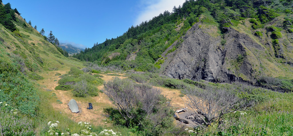 Cooskie Creek RouteHiking · ~4 min drivePhoto: Scrubhiker (USCdyer), CC BY 2.0 (via Flickr)
 Cooskie Creek RouteHiking · ~8 min drivePhoto: J Doll, CC BY 3.0 (via Wikimedia Commons)
- Lightning TrailHiking · ~13 min drivePhoto: MARELBU, CC BY 3.0 (via Wikimedia Commons)
- Maple Camp TrailHiking · ~13 min drivePhoto: MARELBU, CC BY 3.0 (via Wikimedia Commons)
 Thorton TrailHiking · ~27 min drivePhoto: Cal Fire Battalion Chief Kurt Dernedde, California Department of Forestry and Fire Protection, http://www.fire.ca.gov/, Public domain (via Wikimedia Commons)
 Johnson Camp TrailHiking · ~28 min drivePhoto: California Department of Parks and Recreation, Public domain (via Wikimedia Commons)
- Lost Coast TrailHiking · ~13 min drivePhoto: J Doll, CC BY 3.0 (via Wikimedia Commons)
- Bull Creek Trail SouthHiking · ~27 min drivePhoto: Cal Fire Battalion Chief Kurt Dernedde, California Department of Forestry and Fire Protection, http://www.fire.ca.gov/, Public domain (via Wikimedia Commons)
- Kinsey Ridge TrailHiking · ~4 min drive
 Bull Creek Trail NorthHiking · ~31 min drivePhoto: Federico Pizano, CC BY 3.0 (via Wikimedia Commons)
Map and trail data © OpenStreetMap contributors
