Cooskie Creek Route
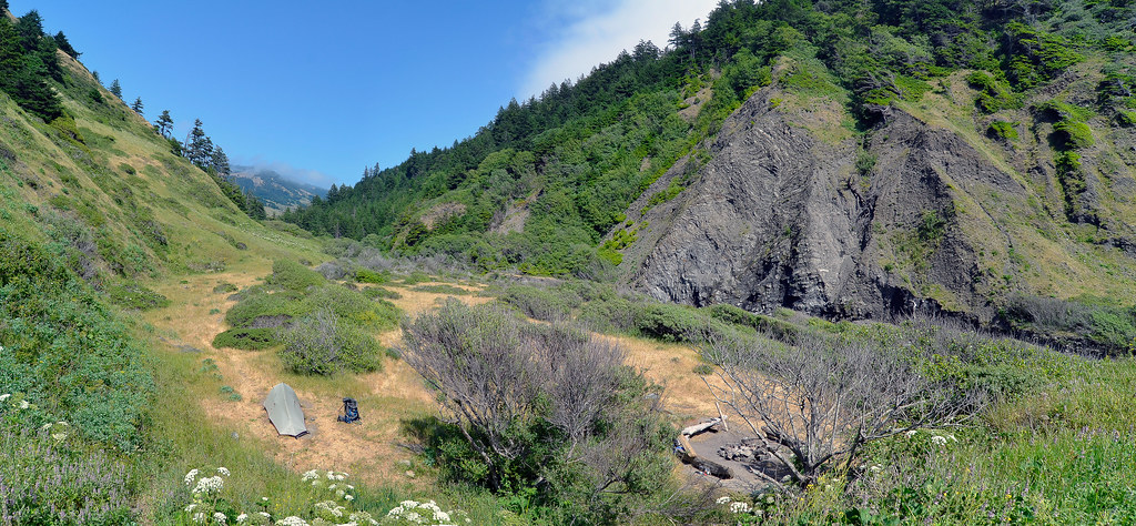 Photo: Scrubhiker (USCdyer), CC BY 2.0 (via Flickr)
- 5.9 mi
- round trip
- 4,645 ft
- climb
- 2,365 ft
- high point
- Out and back
- route
Cooskie Creek Route is a 5.9-mile hike in California's King Range Wilderness, managed by the Bureau of Land Management's Arcata Field Office. The route is an out-and-back that covers about 12 miles round trip, with a total climb of roughly 4,600 feet. It starts at an elevation of about 1,410 feet and reaches a high point of about 2,365 feet. The climb is steady, and the route is rated moderate. Because the trip is about 12 miles long with a total gain of nearly 4,600 feet, plan for a full day on foot. Nearby, Kinsey Ridge Trail is about 5 miles away and Lost Coast Trail about 5.3 miles. For an overnight base, Mattole Campground sits about 6 miles off, and Honeydew Campground is about 9 miles away.
- Kinsey Ridge TrailHiking4.9 mi
 Lost Coast TrailHikingPhoto: J Doll, CC BY 3.0 (via Wikimedia Commons)5.3 mi
 Mattole CampgroundCampingPhoto: Tony Webster — CC BY-SA 2.0 (via Flickr)6.1 mi
- Miller LoopHiking7.4 mi
- Rattlesnake Ridge TrailHiking8.2 mi
- Honeydew CampgroundCamping9.3 mi
 Lightning TrailHikingPhoto: MARELBU, CC BY 3.0 (via Wikimedia Commons)9.9 mi
- Maple Camp TrailHikingPhoto: MARELBU, CC BY 3.0 (via Wikimedia Commons)9.9 mi
Source: Roamze catalog (indexable pages within 10 miles, PostGIS distance)
 Cooskie Creek RouteHiking · ~4 min drivePhoto: J Doll, CC BY 3.0 (via Wikimedia Commons)
- Lost Coast TrailHiking · ~9 min drivePhoto: J Doll, CC BY 3.0 (via Wikimedia Commons)
- Maple Camp TrailHiking · ~17 min drivePhoto: MARELBU, CC BY 3.0 (via Wikimedia Commons)
 Thorton TrailHiking · ~30 min drivePhoto: Cal Fire Battalion Chief Kurt Dernedde, California Department of Forestry and Fire Protection, http://www.fire.ca.gov/, Public domain (via Wikimedia Commons)
 Johnson Camp TrailHiking · ~31 min drivePhoto: California Department of Parks and Recreation, Public domain (via Wikimedia Commons)
- Lightning TrailHiking · ~17 min drivePhoto: MARELBU, CC BY 3.0 (via Wikimedia Commons)
- Bull Creek Trail SouthHiking · ~30 min drivePhoto: Cal Fire Battalion Chief Kurt Dernedde, California Department of Forestry and Fire Protection, http://www.fire.ca.gov/, Public domain (via Wikimedia Commons)
- Kinsey Ridge TrailHiking · ~8 min drive
 Bull Creek Trail NorthHiking · ~35 min drivePhoto: Federico Pizano, CC BY 3.0 (via Wikimedia Commons)
 Baxter TrailHiking · ~29 min drivePhoto: Rainhead, CC BY-SA 2.0 (via Flickr)

Map and trail data © OpenStreetMap contributors
